Improving port operations in Brazil with real-time metocean monitoring
- User stories
Synopsis
Challenge
Maneuvering ships and meeting local safety standards in ports is aided by metocean data, which must be fed in real time to be of use.
Solution
Ports in Brazil have implemented a real-time metocean monitoring system, including a Nortek AWAC to measure currents and waves.
Benefit
Difficult maneuvers with large ships and timing of operational windows use this metocean data to make operations in the port safer and more efficient.
Metocean monitoring systems are gaining popularity since they can be used as a tool to provide operational support for maneuvering ships and to meet requirements established by state and local port authorities.
At the same time, they have also helped to meet demands associated with environmental monitoring projects and are currently used as an important source of data for application of the concept of Dynamic Under Keel Clearance (DUKC), whereby ports can increase their draft by up to several tens of centimeters without the need for dredging, solely by using data on waves, currents and level to their advantage.
Operational port monitoring systems supporting maritime operations
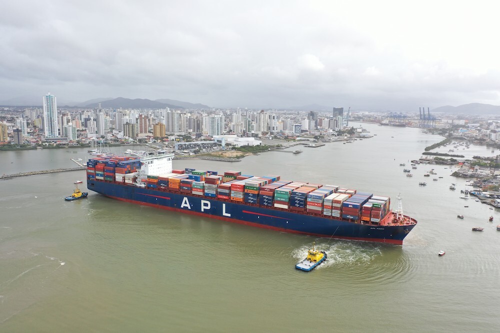
Increased ship size, greater demand for foreign trade based on the maritime sector, and the need to make operations safer and more efficient have created the need for systems to support the decision-making process, such as the operational monitoring systems mentioned herein.
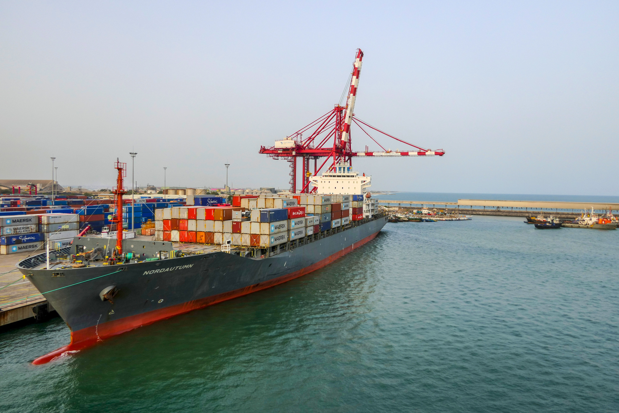
Ports throughout Brazil, such as the Port of Itajaí, have implemented a metocean operational monitoring system to improve the decision-making process.
“Having the same database for the Maritime Authority, Port Authority and the Maritime Piloting Service means that we have greater objectivity when it comes to making decisions,” says Joelcir Zatta, an engineer with the Works and Projects Management Board of the Port of Itajaí.
“The implementation of a system for monitoring waves and currents, along with other climate monitoring, offers a reliable method for controlling the parameters established by the Maritime Authority in the Procedures and Standards of the Port Authority of Santa Catarina – NPCP-SC and specific rulings of the Port Authority of the Superintendency of the Port of Itajaí,” he adds.
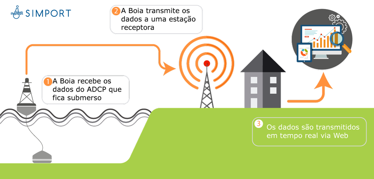
Setup and sensors for the real-time metocean monitoring system
These metocean monitoring systems can vary in their composition, but the essential parameters they need to measure to be efficient are: waves, sea currents, level and wind direction and velocity. Depending on the specific environmental requirements that a port is subject to or interested in with regard to the monitoring projects, new sensors (conductivity, dissolved oxygen, turbidimetry) can be installed at the same point and integrated into the system.
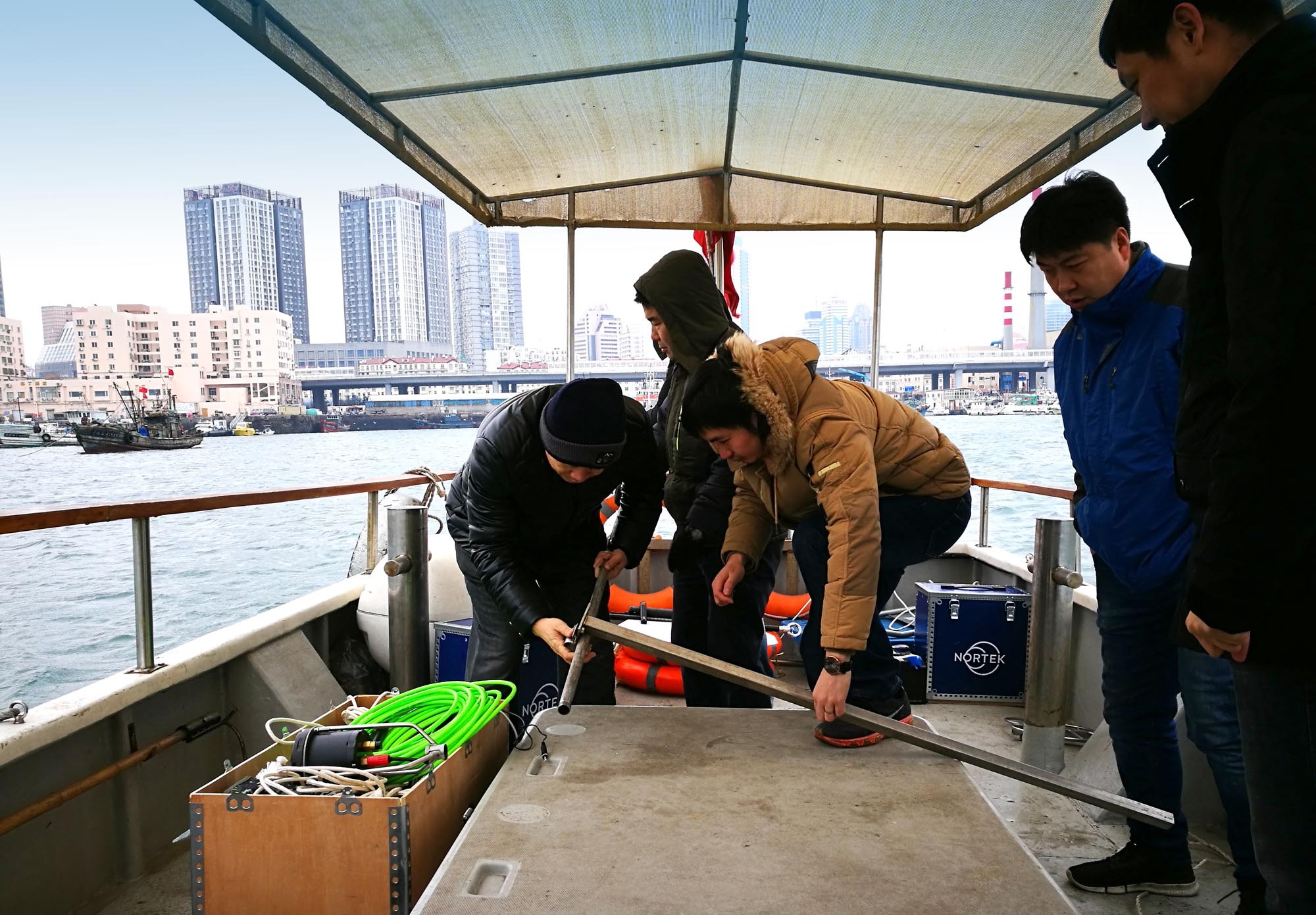
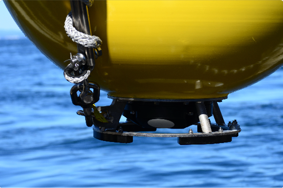
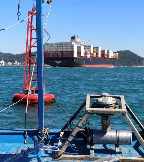
All of these sensors are held in a datalogger that is installed in a surface marker buoy and linked to a telemetry system, normally a GSM module (it can also be by radio or satellite) that transmits the data in real time to a server; the data is used as the entry parameters for the systems for managing and viewing the information.
SIMPORT (Acquaplan®) real-time metocean system
Raising the efficiency of port operations
There is also great potential for this same data to be assimilated in real time by a hydrodynamic model, optimizing the forecasts for oceanographic conditions for the area, given that the forecasting models depend on measured data for their calibration. In practical terms, this information could serve as the entry parameters for port operational window management applications, raising the efficiency of operations to new levels.
In order to facilitate the installation process, this package of accessories can be installed close to a port marker buoy, with the telemetry system fixed on top of it. This takes advantage of the fact that these buoys have good stability, an important factor for the integrity of the data cable in these types of systems with anchored equipment.
How have ports used real-time monitoring systems?
As an example, following the trend for ships of increased sizes, it has been possible to plan port maneuvers in greater detail. Having access to data on local hydrodynamic conditions provides an ideal basis for planning these maneuvers of larger ships operating in ports.
It is on the basis of precisely such a real-time monitoring system that the Port of Itajaí has been carrying out large-scale maneuvers in its new turning basin, which allows it to receive ships that are up to 350 m long and with capacity for up to 12,000 containers. When ships of this size are maneuvering in the turning basin, the connected navigation channel must be closed for other traffic.
“The Maritime Authority defines new parameters for the special maneuvers, because as a rule they are maneuvers which have never been performed before and the parameters are more restrictive. However, the fact that we have reliable data makes it safer in terms of maneuvering and decision-making,” says Joelcir Zatta on the use of metocean data in these special maneuvers.
Advantages of real-time monitoring systems for ports
In addition to contributing to safe maneuvering of the ship, information on water level, current, waves and wind, together with information on the cargo, size and movements of the ship, and the bathymetric and geometric data of the navigation channel and port area, can optimize the port’s draft by some tens of centimeters by means of reliable numerical calculations. This is achieved without the need for extra dredging, but by applying the data to the Dynamic Under Keel Clearance (DUKC) concept.
In Brazil, port legislation includes an incentive that offers rewards and bonuses to ports that comply with certain requirements regarding the Environmental Performance Index, or EPI. A real-time monitoring system is counted as a good practice in this Environmental Performance Index.
All of this impacts operational security: there has been a strong increase in ship handling operations, and meanwhile the port pilots are able to evaluate the hydrodynamic conditions in real time, which, linked to their local knowledge of the topographic features of the region, can bring greater safety to the maneuvers.
Finally, setting up a hydrodynamic database rich in information can support future studies of tidal forces and turbulence within the port area, optimizing calculations for mooring, maneuvers and the improvement of infrastructure by means of more precise dimensioning.
Solutions for measuring waves, currents and water level
There are different solutions on the market for measuring waves, currents and water level that can use surface buoys, radar or ADCP instruments anchored to the seabed. Each of these options has its advantages and disadvantages, and also its specific spatial and temporal scales for data collection.
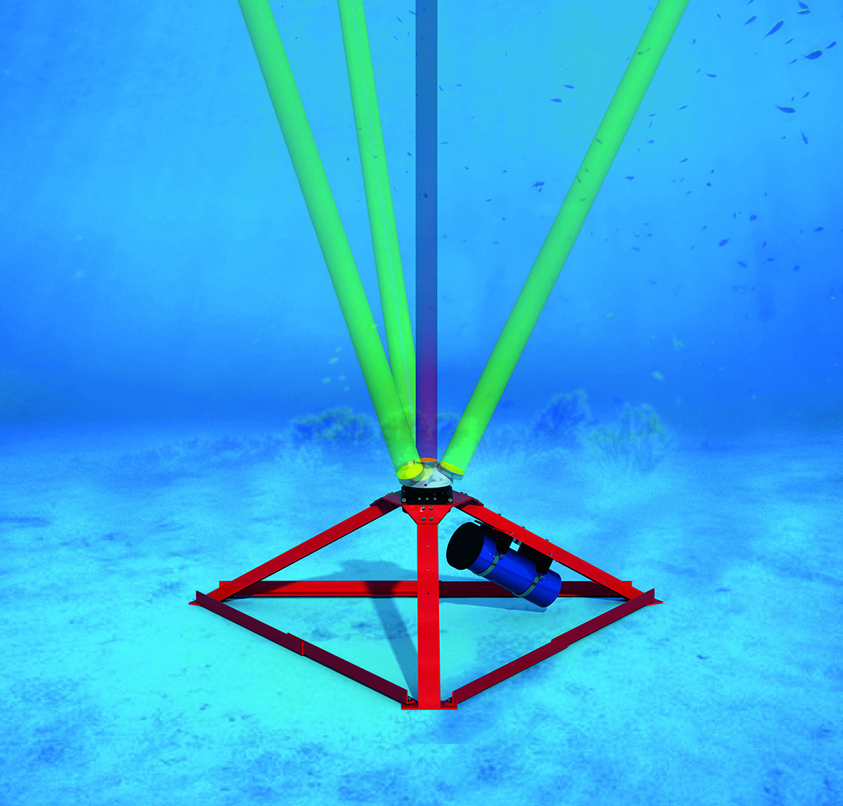
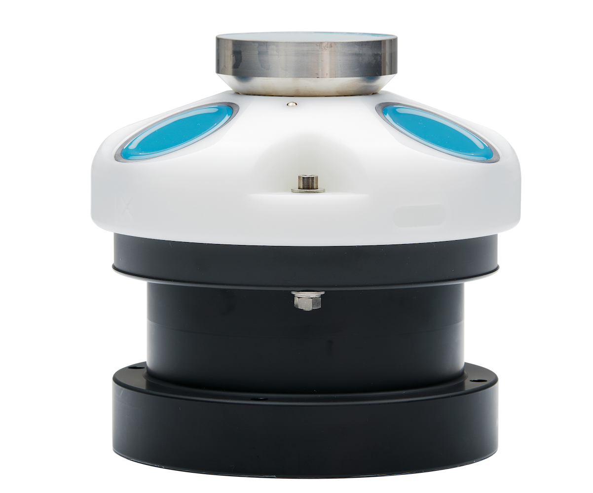
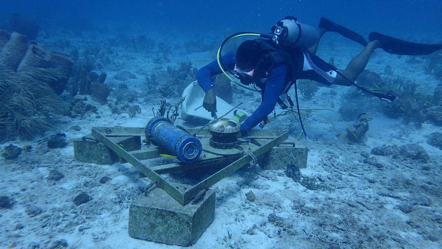
One solution which has been very well received by the community as it adds precision and versatility in data collection on these three parameters is the use of an AWAC 600 kHz ADCP anchored to the seabed, in its upward-facing configuration. This instrument uses acoustic pulses to measure water velocity, allowing the creation of water current profiles for the whole water column and calculation of wave parameters. This has been the solution chosen by ports around the world for collecting data with high stability, precise measurements and long-lasting operability.
The advantages of installing a sensor such as an ADCP on the seabed (as opposed to other places in the sea) for this type of system include protection against inevitable collisions with ships, reduced chances of vandalism, and a capacity for measurement of water (level). Additionally, installing an ADCP on the seabed means a lower initial investment in equipment and the benefit of precise measurement of wave parameters.
Appropriate ADCP anchoring techniques contribute to high levels of operability
Companies that have mastered ADCP anchoring techniques for port purposes have achieved high levels of operability and client satisfaction. Recently, the Brazilian service provision company Acquaplan completed more than five years of monitoring the Port of Itapoá, using an ADCP device anchored on the seabed to carry out its operations.
The future of environmental operational monitoring systems in ports
Port monitoring systems have indeed consolidated their place in the Brazilian market and have come to assist daily operations. The capacity to generate information from the collected data, and the way that this can assist in decision-making processes, has not yet been fully exploited.
Video of the SIMPORT real-time metocean system for oceanographic data