New to current measurement?
- Nortek Wiki
1. What do we mean by "currents"?
People have long tried to measure currents. It started with the measurement of boat speed through water. This is where the concept of “knots” came from. A more advanced level of sophistication in current measurement only became possible with the first use of propellers underwater, about a hundred years ago. Nowadays, the science has moved on dramatically: electronic sensors using acoustics make it much easier for researchers to measure flows in many different locations, from small streams to the deep ocean.
1.1 Currents in small streams
When studying streams, scientists and hydrologists are interested in measuring transport or discharge – the amount of water that passes through a given area. Discharge depends on rainfall, ice melting, terrain and so on, and fluctuates over time. Another aspect is investigating and monitoring fish habitats, particularly in streams whose water flow is too fast or that have too little water for fish to survive. Here the flow regime needs to be analyzed in order to create a proper habitat for vegetation and fish. Small instruments are needed to measure these small-scale currents.
1.2 Currents in lakes
Lakes range from small bodies of water, just a meter or so deep, to large ones, hundreds of meters in depth. While currents do occur in lakes due to the inflow and outflow of rivers and temperature effects, they are typically not very strong. However, lakes respond very promptly to changes in weather, and they function as large-scale laboratories to give us a better understanding of flow structures and mixing processes.
1.3 Currents in rivers
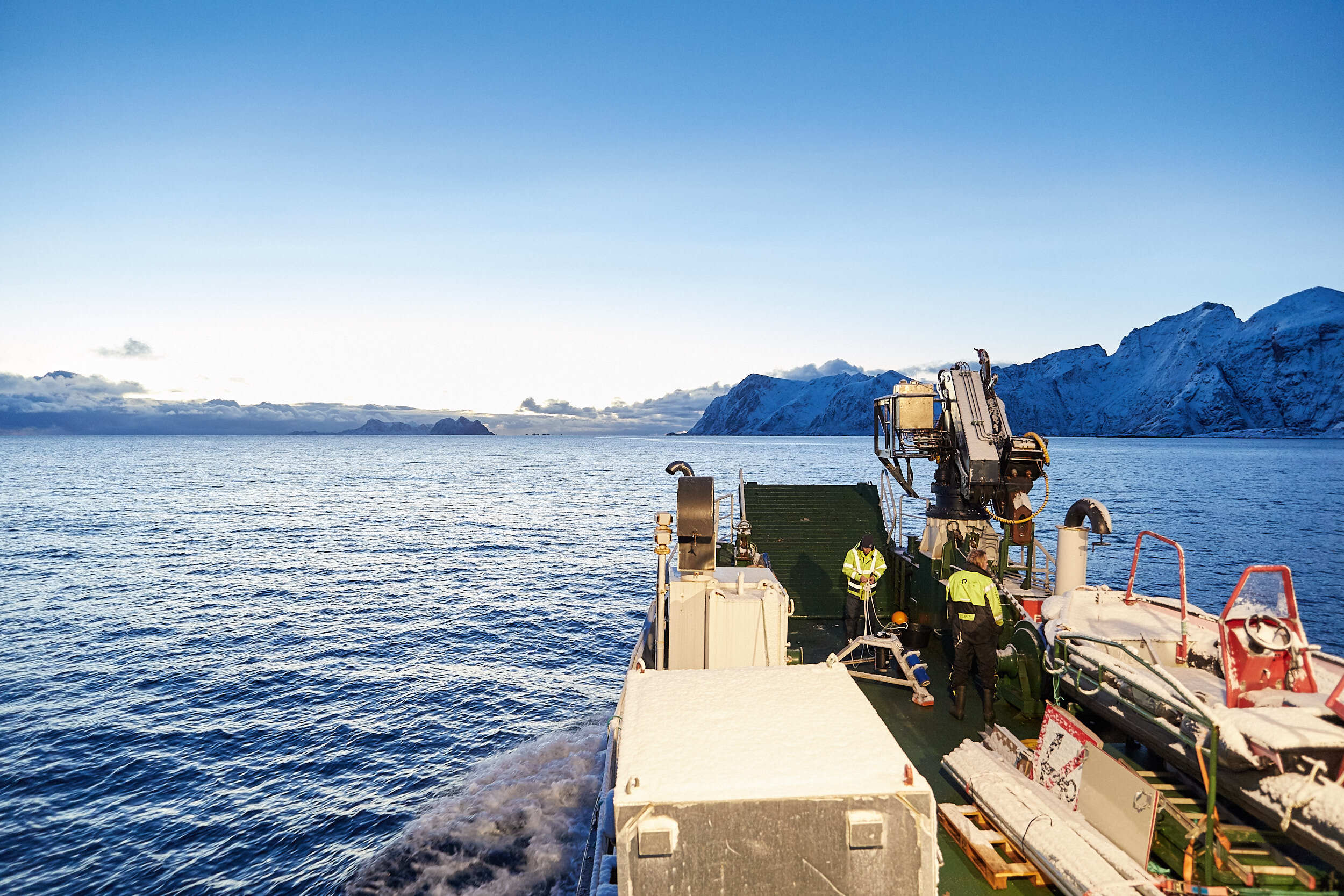
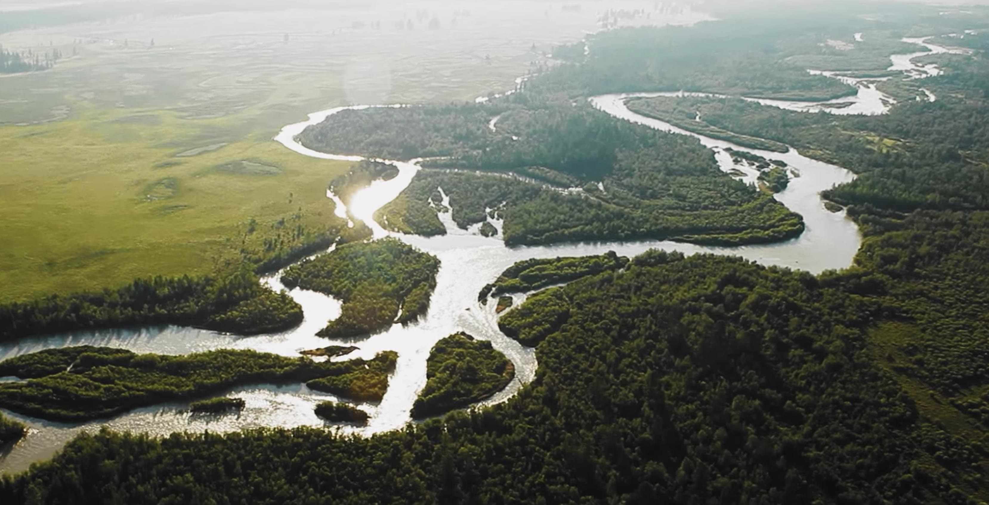
Larger rivers bring life to an area. They can be used for transport, for fishing and as a source of fresh water when clean enough. But they are difficult to control. Currents may be strong, even in normal conditions, but much faster during a flood – perhaps reaching more than 3 meters per second. At that speed, they can pick up anything in their path, causing a danger to life. Measuring these river currents helps to reduce risks to people and river traffic, and makes it possible to draw up plans to protect large urban areas from flooding.
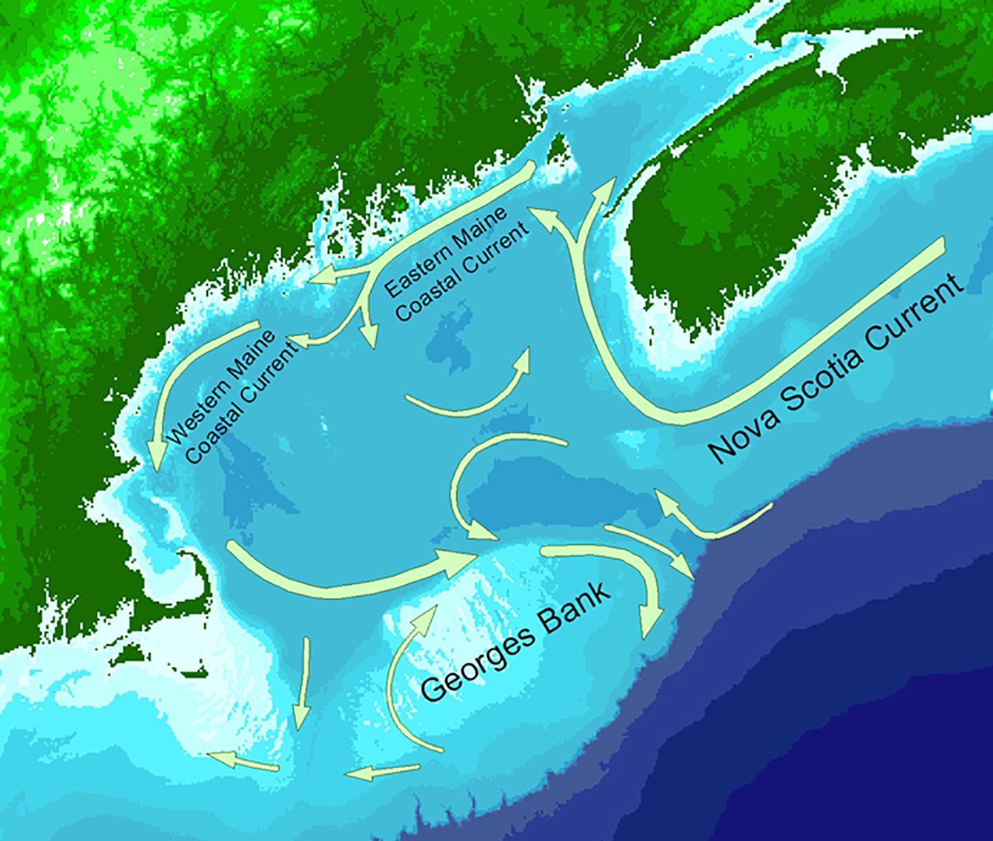
1.4 Coastal currents
Scientists model rivers and coasts using scale models in laboratories in order to understand the environment and to design ports and protective structures.
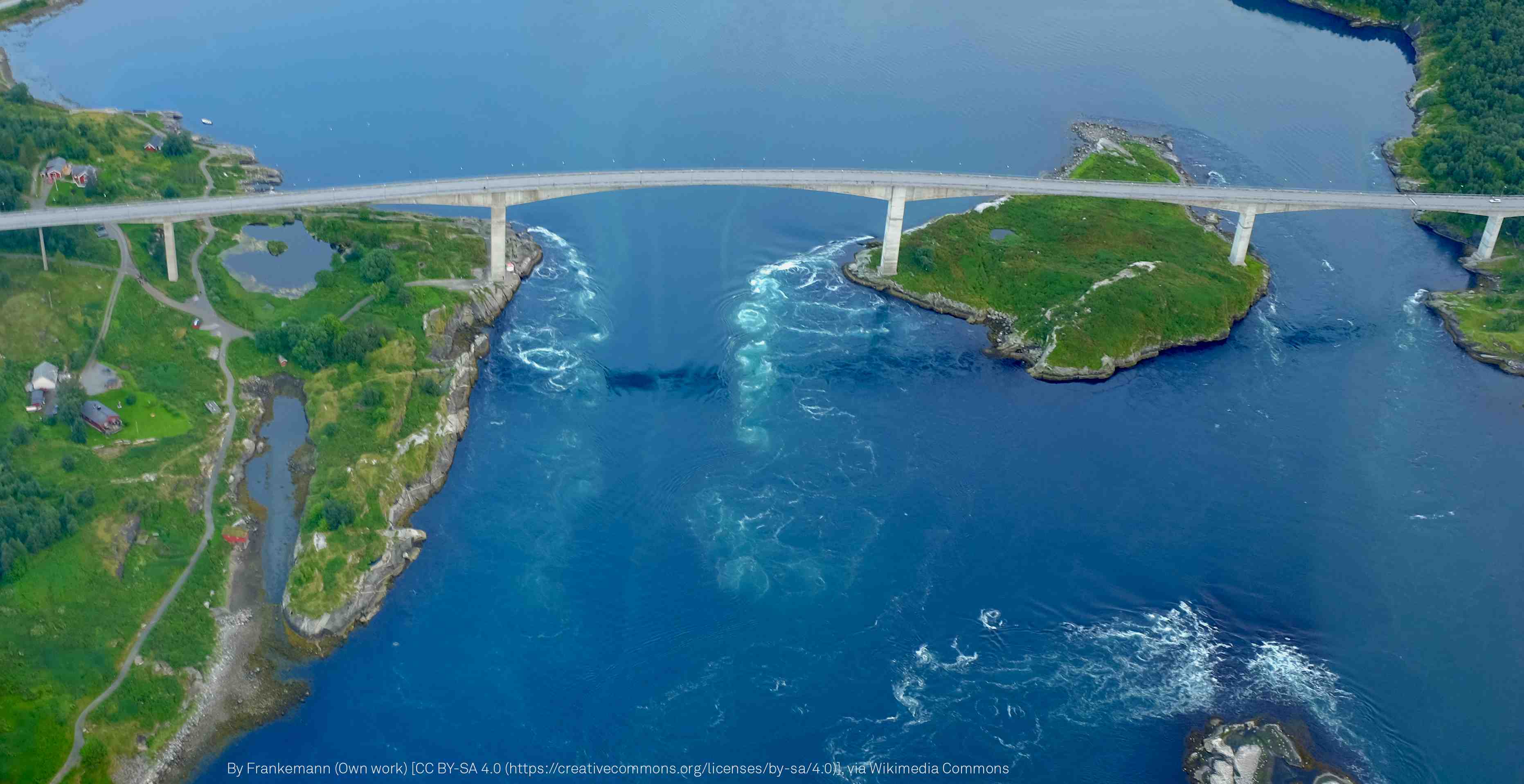
Coastal currents can be strong and dangerous. They are mainly driven by the tides, which means their behavior is predictable. Tidal currents are sometimes called tidal streams (as defined in the UK Hydrographic Survey Manual). Coastal estuaries will be filled during flood tides and emptied during ebb tides. All that water needs to pass through the many narrow inlets within a river estuary, where currents can reach speeds of several meters per second. Because of friction effects, tidal currents are not always in phase with the tidal elevation. This means that the strength and timing of the currents need to be measured and cannot simply be predicted from tide tables.
Coastal currents pose problems for ship navigation, so real-time information on currents helps captains maneuver safely into port. Coastal currents also bring fresh material into the estuary during flood and then remove debris and rubbish during ebb.
The composition of coastal currents is not always obvious. Salt sea water is heavier than fresh water coming from local rivers. Where the two meet in an estuary, they flow separately, with the heavier sea water flowing upriver during flood, below the lighter river water, which continues to flow downstream towards the sea. For that reason, you need to be careful if you plan to dive in!
You should also take care at the beach. Waves bring water towards the beach, but the water also needs to retreat back into the main body of the sea. Typically, that water goes to one side or the other, creating what is known as a rip current. These can be strong and dangerous, and they aren’t easy to spot, unless you know what to look for.
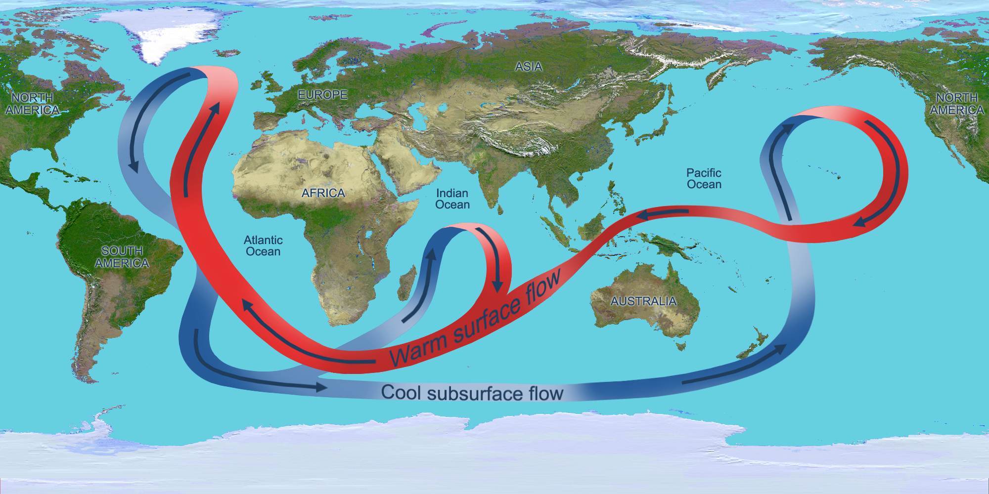
1.5 Ocean currents
The most powerful and largest-scale currents are those in the ocean. The NASA video “Perpetual Ocean” is a must-see for those who want to understand ocean currents better.
These currents also go deep down into the sea and help to form the so-called “global conveyor belt”, which is a pattern of strong currents around the world. Put simply, deep currents in the cold northern Atlantic Ocean around Greenland and the Arctic run south, rising as they warm up in the Indian and Pacific Oceans, before changing direction and heading back into the Atlantic Ocean. There, they track north, get cooler and sink once more, as they re-enter the Arctic region.
2. How are currents measured?
Water flows can be measured in many different ways, depending on how accurate you need to be and how interested you are in the variations over time and with depth. In the old days, people threw a leaf, or something else that floated, into the water and tracked how long it took to move over a certain distance. Later, mechanical propellers were used, which improved accuracy and enabled measurements at greater depths. This technology dominated for almost 100 years, until electronics made other measuring methods available. Starting around 1970 and for about 20 years, alternative methods such as electromagnetic current meters and acoustic travel time systems became common. These technologies responded faster to changes in the currents and gave us direct insight into the statistical nature of water flow.
Nowadays, propellers are still used for river measurements, but all other currents are usually measured with instruments based on the acoustic Doppler principle.
2.1 How do instruments using the Doppler principle work?
In water, it is much more common to use sound – or underwater acoustics – to make observations, rather than light. This is because light travels only short distances underwater.
Organic and inorganic material suspended in the water blocks and scatters light, making it effective only at very short ranges – typically only a few meters, even in “clear” ocean water. Sound, on the other hand, can travel great distances in water with minimal signal loss, making it an excellent choice as a carrier signal for observations underwater.
Acoustic Doppler devices use sound waves and the Doppler effect to measure velocity fluctuations underwater, and can do so several times per second. Currents can be measured not only close to the instrument itself, but also some distance away, as well as simultaneously at many points along the way.
This makes acoustic Doppler devices powerful tools for measuring currents not only on a very fine scale in streams and in the laboratory, but also on a large scale in big rivers, coastal seas and deep oceans.
2.2 What’s needed for high-quality measurement of currents?
All the instruments need to be robust and reliable, in order to withstand the journey to the measurement site and the rigors of use on location. The cost of carrying out such measurements is considerable, so you really don’t want the whole investment to go down the drain due to a failure of the current-measuring sensor.
Size matters – when smaller sensors are in use, other elements of the set-up, such as mounting structures or oceanographic moorings, need to be smaller too. That also makes the instrument easier to carry, of course.
The instruments’ power consumption should be low, as they will often rely on a battery or a solar panel for power, for example at remote sites, or where they are part of a set-up with an oceanographic buoy. Low power consumption means that a smaller power supply, easier to incorporate into equipment, can be used.
Design matters – as deployment costs are high, you will want to use the best possible combination of accessories, including mounting frames, cables and batteries.
When you arrive at a site to deploy an instrument, time is usually scarce. So it’s important that the instrument and associated software are easy to configure. Operation should be consistent and the status of the instrument should be clearly shown on your computer screen.
Since making measurements is a costly business, regardless of the equipment, it makes sense to use the best possible instrument for the job at hand. Choosing the right instrument, with access to a broad selection of acoustic frequencies, sound mechanical design and other specific features, makes deployment quick and easy and ensures better use of your limited battery power.
2.3 Choosing the right equipment for current measurement
There is a wide range of instruments available for current measurement, depending on the environment in which they are to be used.
As we have established, the instruments need to be robust and reliable, easy to use, have low power consumption, be compact and be the best instrument for the job.
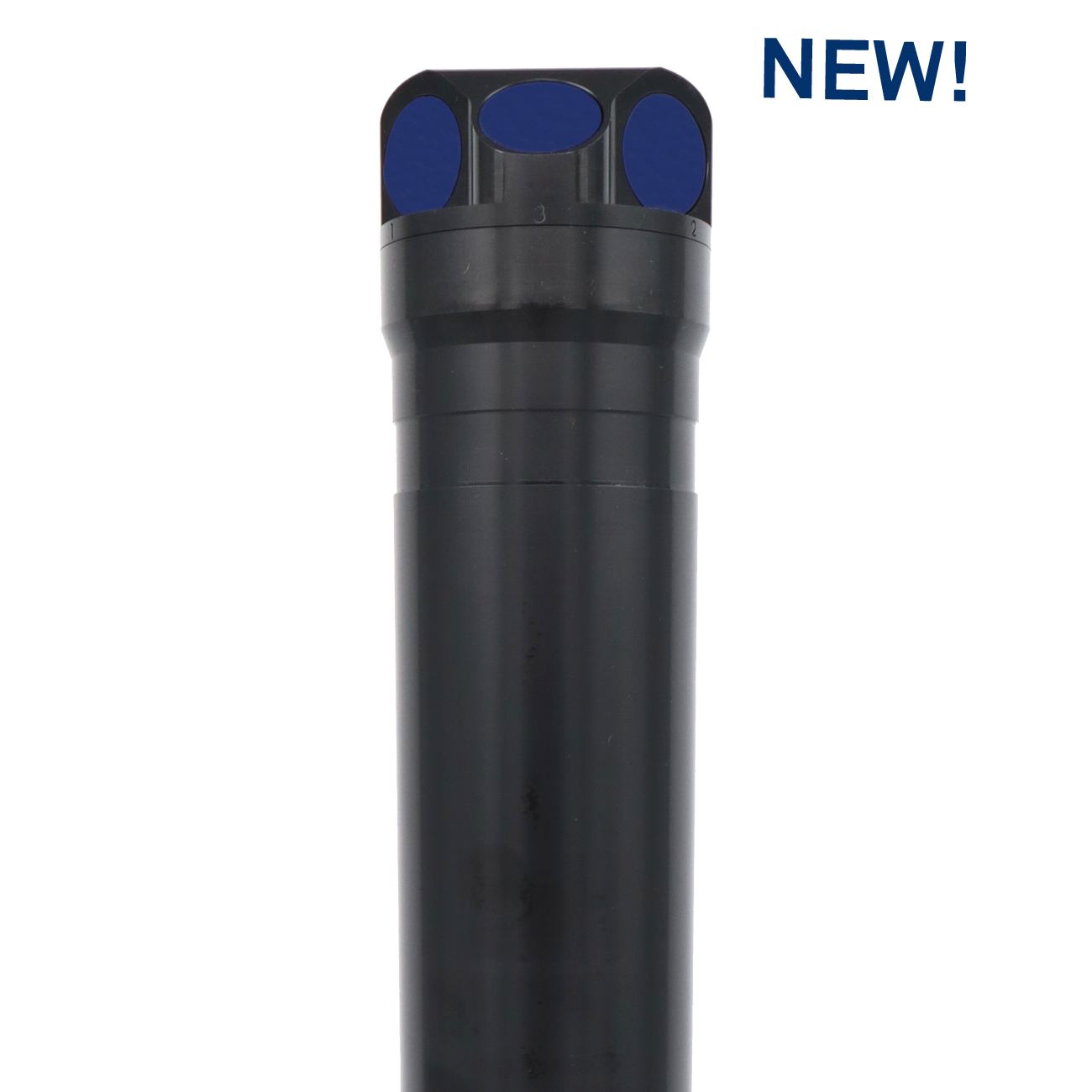
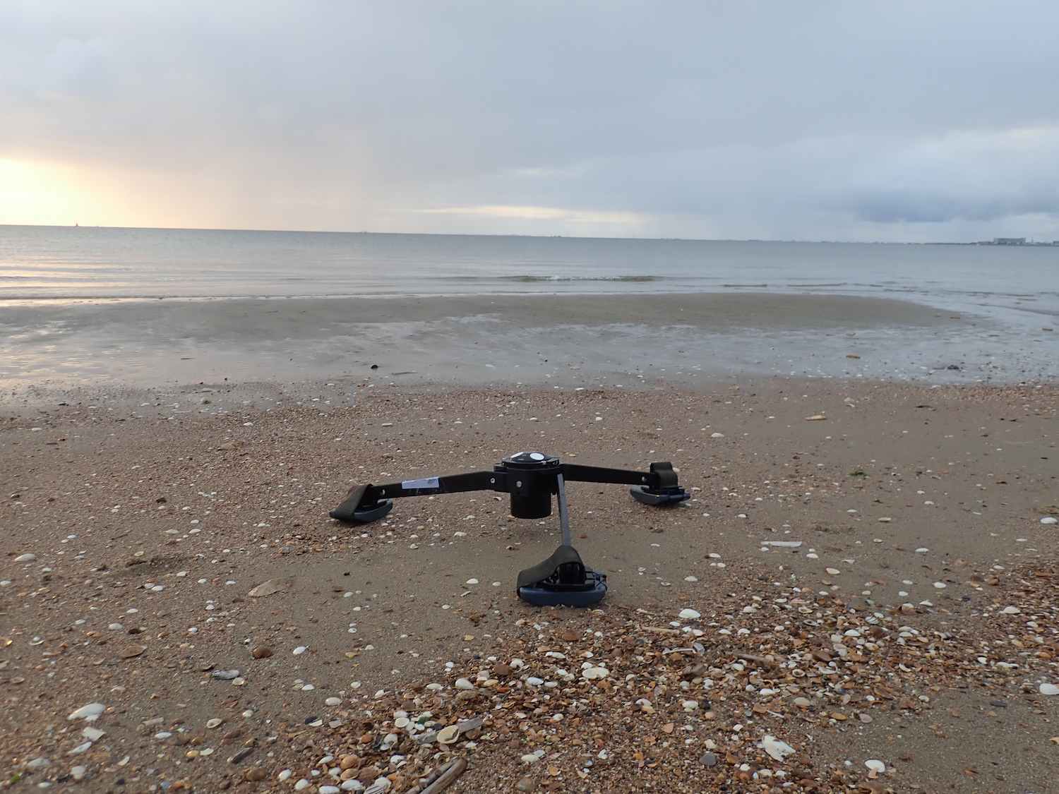
Velocimeters have a single acoustic transmitter and multiple acoustic receivers. These instruments can measure small-scale flows with an update rate of up to 200 Hz in some versions.
When things get a little larger, in lakes and estuaries, the Vector is a good choice for scientific studies. With internal memory and either internal or external batteries, it can work autonomously for several months. The Vector will give you very reliable data in a small measurement volume (i.e. the volume of water we average over) with a high update rate.
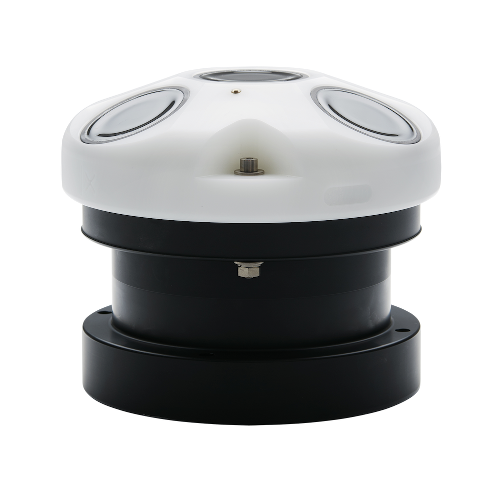
A current meter called the Aquadopp, with a single measurement cell, is also frequently used to study large-scale flows, as well as for scientific or operational purposes. The Aquadopp is small and can run for an extensive period on an internal battery. It is easy to mount on a structure or on a buoy; it is low cost and very robust.
The slightly bigger brother of the Aquadopp is the Aquadopp Profiler. This shares many features with the Aquadopp, but also measures currents in a profile, using a range of measurement cells that start close to the instrument and may extend to 10 m away for the high-frequency version, or up to around 80 m for the lowest-frequency version.
For coastal measurements, the Vector, Aquadopp or Aquadopp Profiler are the instruments of choice. If you are looking at waves, then the AWAC is the way to go: it is mounted below the sea surface and not only measures a current profile, like the Aquadopp Profiler, but also measures surface waves.
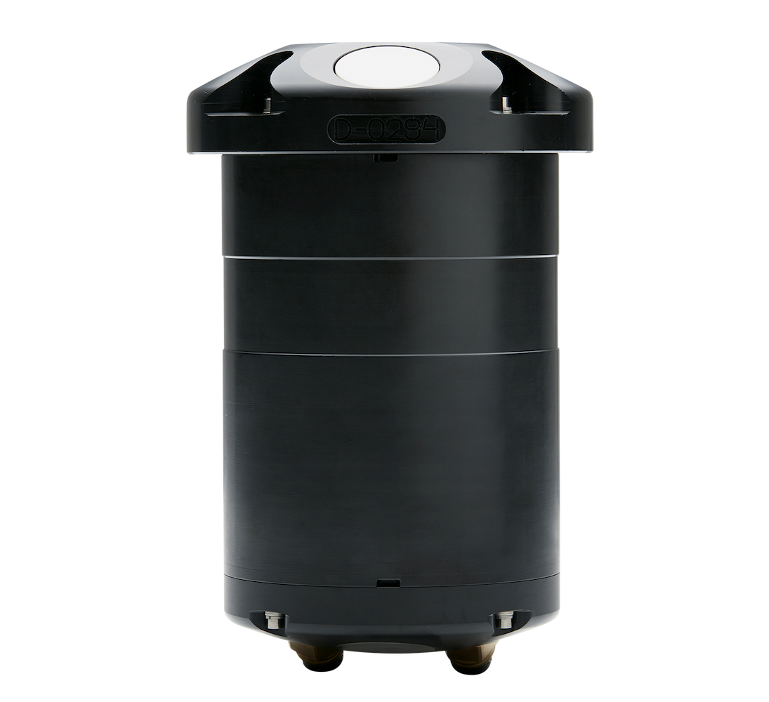
In the ocean, you can also use the deep-water versions of the Aquadopp, Aquadopp Profiler and Vector. Special titanium housings make sure that the instruments can survive the high water pressure. The internal electronics are adapted to an environment where return signals are weak.
ADCPs in the Signature series are now available in lower frequencies: the Signature55 enables you to measure current profiles up to a 1000 m range, while the Signature100 and Signature250 work with shorter, though still considerable, ranges.