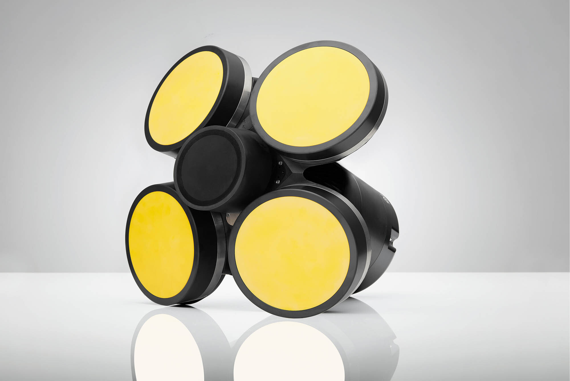
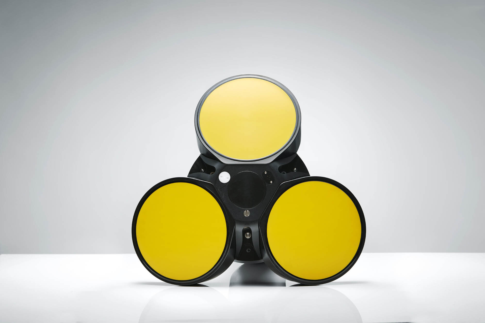
Overview
Until now, epipelagic and mesopelagic VM ADCP surveys could not deliver the resolution, precision or range to examine the ocean boundary layer in detail. The VM Ocean system with the Signature100 ADCP enables biomass studies in the upper-ocean boundary layer simultaneous to current measurements, with a combined ADCP and scientific echosounder. The innovative dual-frequency design of the Signature55 ADCP allows for both very long-range (up to 1000m) current profiles as well as higher-resolution measurements.
- Currents
- Echosounder
- Bottom track
Highlights
-
Comprehensive, easy-to-use system
-
Automated processing fir data viewing onboard
-
Instrument allows for flexible deployments, either vessel-mounted or standalone
-
Take both long-range and high-resolution measurements from one instrument with innovative dual-frequency transducers (Signature55)
-
Profile currents up to 300m and gather biomass information with scientific echosounder (Signature100)
Usage
-
Internal wave detection using echosounder (100 kHz)
-
Upper-ocean boundary-layer studies, profiling up to 300m (100 kHz)
-
Detection of krill or plankton in the water column (100 kHz)
-
Deep-water current profiles (up to 1000m), ocean discharge (55 kHz)
Setup
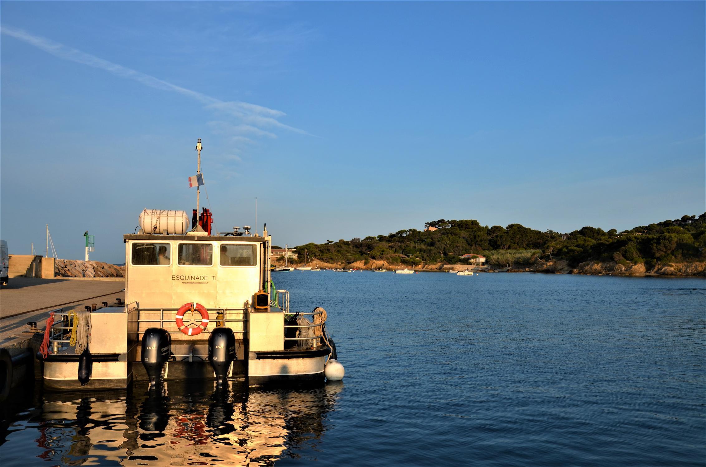
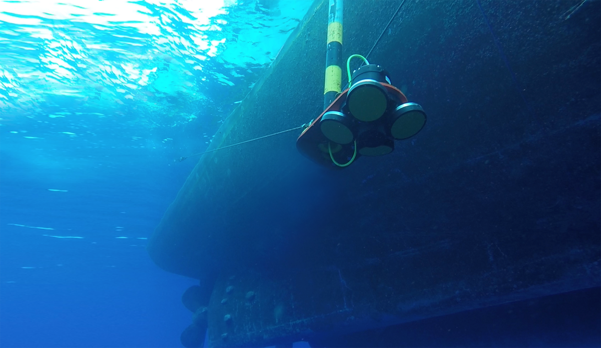
The 100 and 55 kHz units are typically mounted inside the hull or in a lowered structure attached to the hull, such as an instrument gondola. Nortek has a mounting guide available.
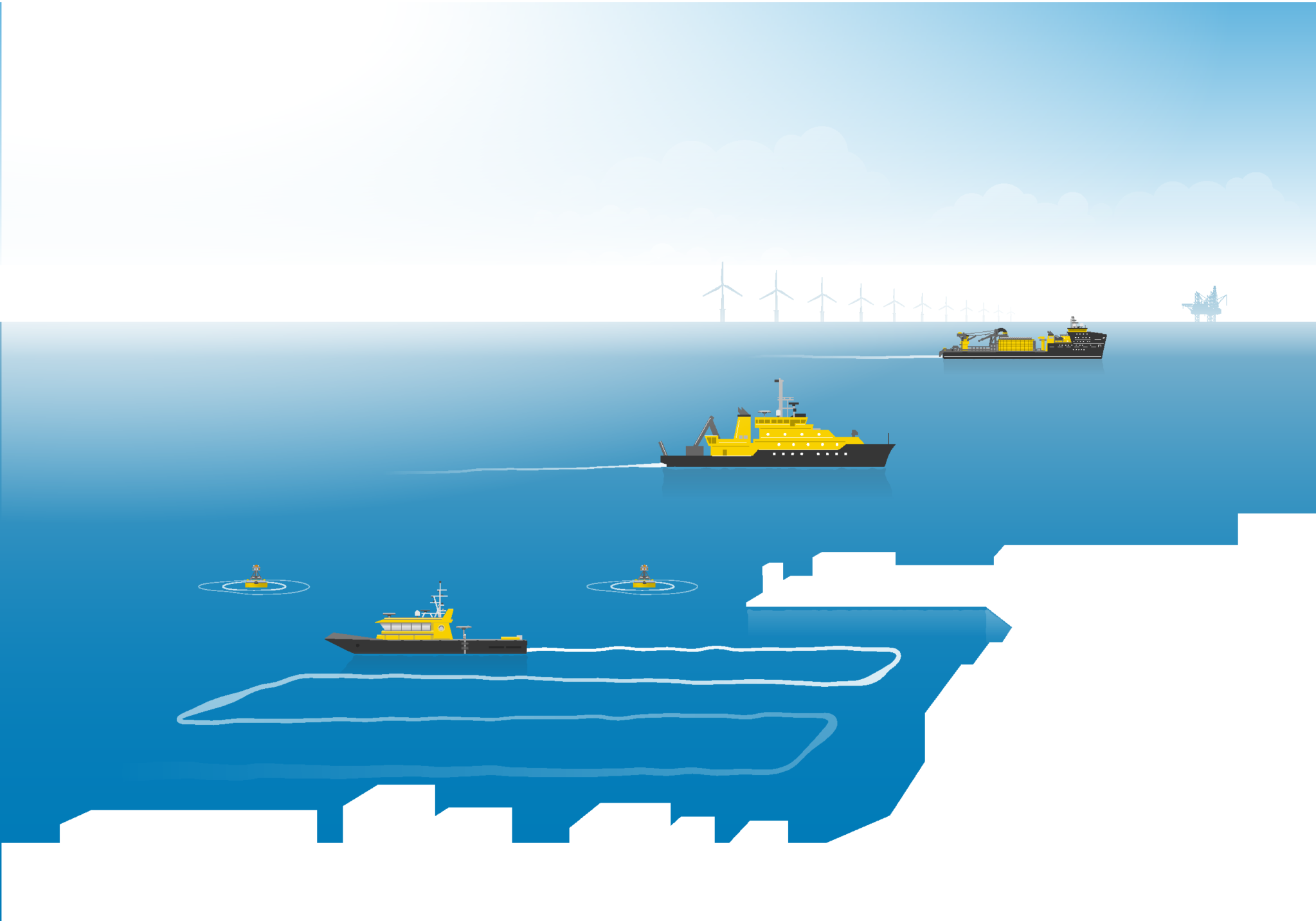
Deployment
View current velocity data in real time from the VM acquisition software while onboard the vessel. Gather long range current speed and direction information with the 55 kHz unit or use the 100 kHz unit for intermediate profiles and biomass estimates.
Data
Biomass estimates of fish and krill and detections of internal waves with the optional 100 kHz scientific echosounder can be further processed using Echoview software. Process and export current data subsets of interest using the VM review software once your survey has ended.
Profiling range** |
300-400 m |
Doppler processing |
Broadband & Narrowband |
Cell size |
3-16 m |
Max no. cells |
200 |
Min. blanking |
2 |
Minimum accuracy |
1% of the measured value ± 0.5 cm/s |
Velocity resolution |
0.1 cm/s |
Maximum sampling rate |
1 Hz (1/3 Hz with BT and echosounder) |
Velocity range (along beam) |
5 m/s |
No. of beams |
4 slanted at 20° |
** Depending on acoustic scattering condition. |
Profiling range** |
685/900-1000 m |
Doppler processing |
Broadband/Broadband & Narrowband |
Cell size |
5-20 m |
Max no. cells |
200 |
Min. blanking |
2 |
Minimum accuracy |
1% of the measured value ± 0.5 cm/s |
Velocity resolution |
0.1 cm/s |
Maximum sampling rate |
1 Hz |
Velocity range (along beam) |
5 m/s |
No. of beams |
3 slanted at 20° |
** Depending on acoustic scattering condition. |
Single ping std @ 3 m/s |
TBA |
Long-term accuracy |
TBA |
Minimum altitude |
5 m |
Maximum altitude |
540 m |
Velocity resolution |
0.01 mm/s |
Maximum sampling rate |
1/2 Hz (1/3 Hz with VP and echosounder) |
Single ping std @ 3 m/s |
TBA |
Long-term accuracy |
TBA |
Minimum altitude |
50 m |
Maximum altitude |
1000 m |
Velocity resolution |
0.01 mm/s |
Maximum sampling rate |
1/2 Hz |
Sampling |
Same as velocity for slanted beams |
Resolution/dynamic range |
0.5 dB/70 dB |
Dynamic range |
70 dB slanted beams |
Transducer acoustic frequency |
100 kHz |
No. of beams |
4 slanted at 20° |
Beam width |
6.1° |
Sampling |
Same as velocity |
Resolution/dynamic range |
0.5 dB/70 dB |
Dynamic range |
70 dB slanted beams |
Transducer acoustic frequency |
75 and 55 kHz |
No. of beams |
3 slanted at 20° |
Beam width |
4.5°-5.5° |
No. of beams |
1 vertical |
Transducer acoustic frequency |
70-120 kHz |
Sampling |
1 Hz (1/3 Hz with VP and BT) |
Transducer beam width |
15° @ 70 kHz, 8.7° @ 120 kHz |
Resolution |
0.375 –4 m |
Resolution/ dynamic range |
0.01 dB/130 dB |
Transmit pulse |
Monochromatic 70 kHz, 90 kHz and 120 kHz or frequency chirp (90 kHz, 50% BW) |
Transmit power |
7.5-120 W adjustable |
Chirp signal processing |
Pulse compression or binned frequency response |
No. of beams |
N/A |
Transducer acoustic frequency |
N/A |
Sampling |
N/A |
Transducer beam width |
N/A |
Resolution |
N/A |
Resolution/ dynamic range |
N/A |
Transmit pulse |
N/A |
Transmit power |
N/A |
Chirp signal processing |
N/A |
Temperature sensor range / accuracy |
-4 °C to 40 °C / 0.1 °C |
Pressure |
Piezo resistive |
Standard range |
0-1500 m (inquire for options) |
Accuracy/precision |
0.1% FS / Better than 0.002% of full scale |
Compass and tilt |
Solid-state magnetometer and accelerometer |
Data recording |
16 GB (inquire for options) |
Data cable |
10 m Ethernet cable. Other lenghts available |
IO |
Ethernet |
DC input |
24-48 V DC |
Temperature sensor range / accuracy |
-4 °C to 40 °C / 0.1 °C |
Pressure |
Piezo resistive |
Standard range |
0-1500 m (inquire for options) |
Accuracy/precision |
0.1% FS / Better than 0.002% of full scale |
Compass and tilt |
Solid-state magnetometer and accelerometer |
Data recording |
16 GB (inquire for options) |
Data cable |
30 m Ethernet cable (inquire for options) |
IO |
Ethernet |
DC input |
48 V DC |
Maximum diameter |
455 mm |
Maximum length without room for internal batteries |
392 mm |
Weight in air |
29 Kg (5 beams) |
Maximum diameter |
650 mm |
Maximum length without room for internal batteries |
314 mm |
Weight in air |
57 Kg |
Operating temperature |
-4 °C to 40 °C |
Storage temperature |
-20 °C to 60 °C |
Vibration |
IEC 60068-1/IEC60068-2-64 |
EMC approval |
IEC 61000 |
Depth rating |
1500 m – Bottom track is limited to surface vessels |
Connectors |
Straight fitted MCBH6F (Ethernet) |
Housing |
Small instrument housing |
Material |
POM with titanium fasteners |
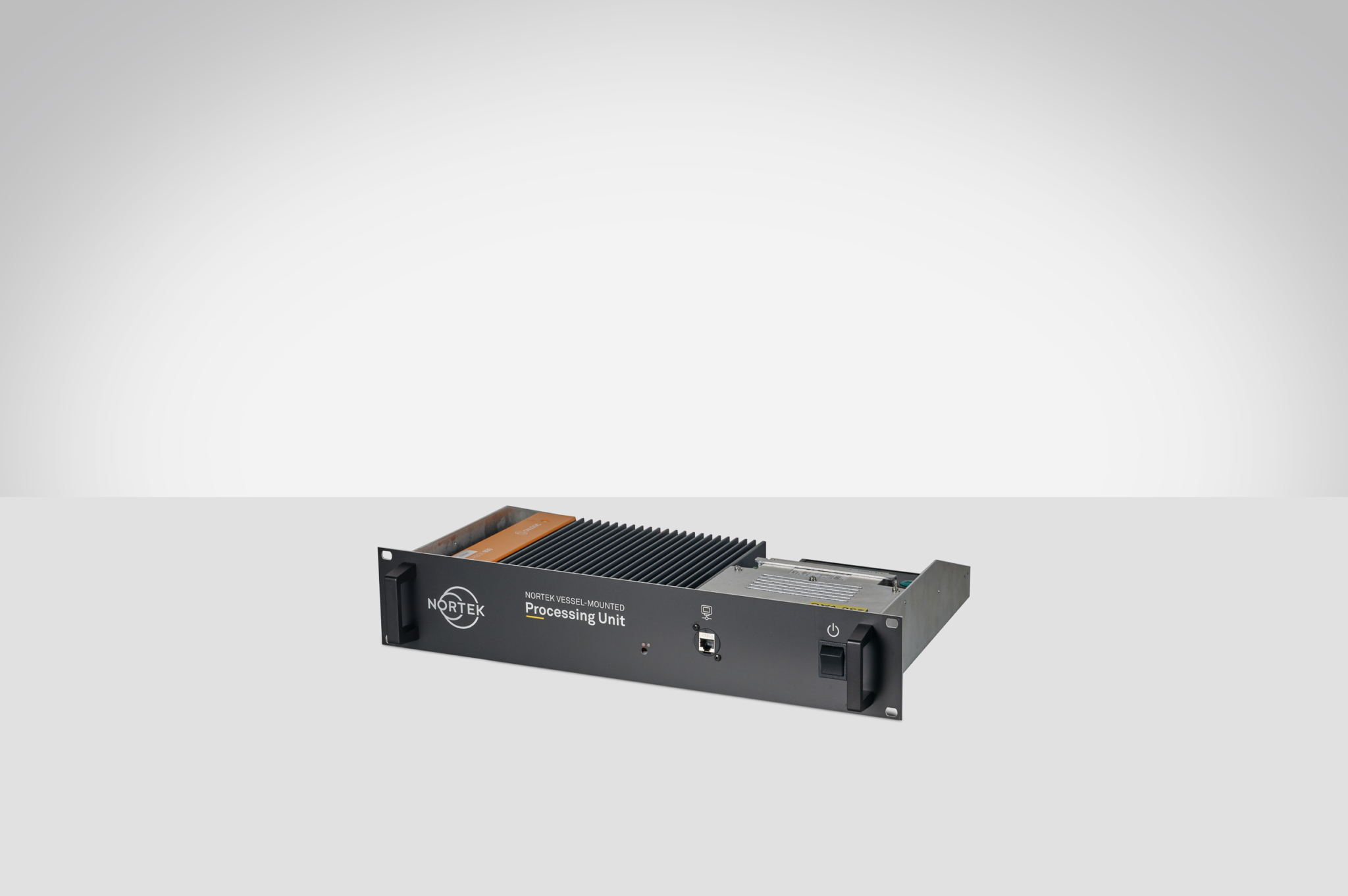
Processor/memory |
Intel i5/8 GB |
Hard disk |
SSD, 256 GB |
Operating system |
Windows® 10 |
Housing |
19" rack-mountable 2 HE |
Dimensions |
482x87x400 mm |
Input |
110-240 V AC, 100 W Max |
Total weight |
7 kg |
Connections* |
Power, Signature ADCP, 2x DisplayPort, 1x LAN, 2x USB, 4x RS232|RS422|RS485 configurable port* |
* Processing unit requires heading and GNSS input over Serial or Ethernet |
Acquisition |
Signature VM - binary, GNSS compass - binary |
Timing |
< 0.6 s, IEEE1588/PTP for absolute time stamping (GNSS/Signature VM) |
Configuration |
Signature VM (partly) GNSS Advanced navigation |
Display |
Vessel track in map, Bottom-track velocity, Bottom-track depth, Velocity magnitude and direction, Echo amplitude (slanted beams), Echo correlation (slanted beams), corrected relative volume backscatter (100) |
Status |
Signature VM + AN_GNSS compass |
Output |
Online: NMEA data formats. Offline: CSV, ASCII VMT, MATLAB, MATLAB VMT, MATLAB QRev, KML |
Accelerometer dynamic |
± 2 g |
Gyro dynamic range |
± 250°/sec |
Magnetometer dynamic range |
± 1.3 Gauss |
Pitch and roll range/resolution |
± 90° (pitch), ± 180° (roll)/0.01° |
Pitch and roll accuracy |
± 2° (dynamic)3), ± 0.5° (static, ± 30°) |
Heading range / resolution |
360°, all axes/0.01° |
Heading accuracy |
± 3° (dynamic)3), ± 2° (static, tilt < 20°) |
Sampling rate |
Same as measurement rate |
Signature100 VM Ocean
Signature55 VM Ocean
4-beam head (100)
5-beam head (adds 95 kHz center transducer for echo sounder)(100)
3 beam head (55)
Short, no room for battery (requires external battery canister for bottom-mount use)
16 GB SD card data logger
64 GB SD card data logger
128 GB SD card data logger
256 GB SD card data logger
Pressure sensor, 0-1500 m, accuracy 0,1% of FS (standard)
Pressure sensor, 0-100 m, accuracy 0,1% of FS (option)
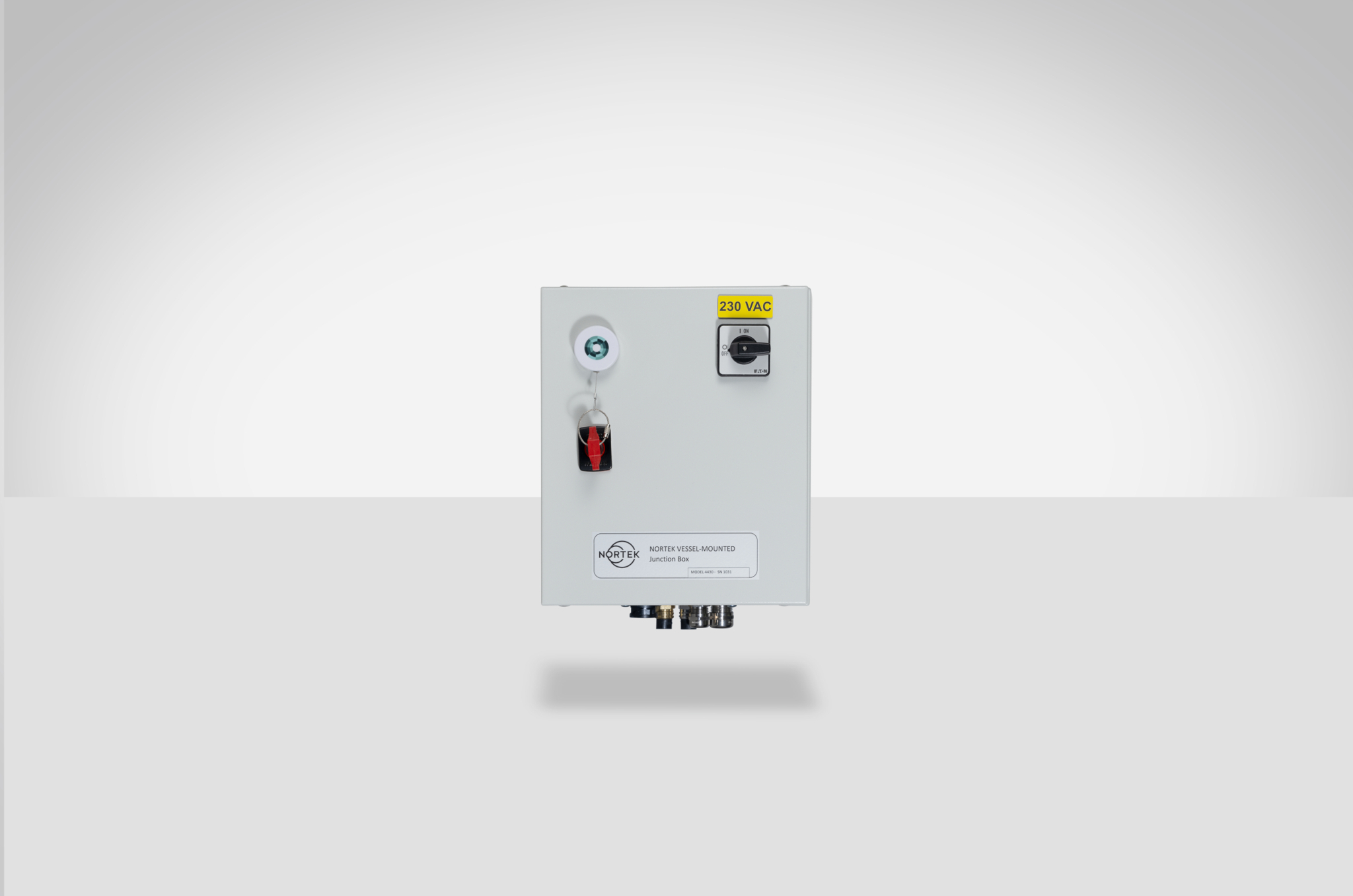
AD2CP: 20 m Ethernet cable towards the junction box with MCIL6MP on both ends
Vessel-mounted over the side
Vessel hull-mounted
Unmanned Surface Vehicle (USV) mounted (please inquire)
Compass and tilt sensor
AHRS (option)
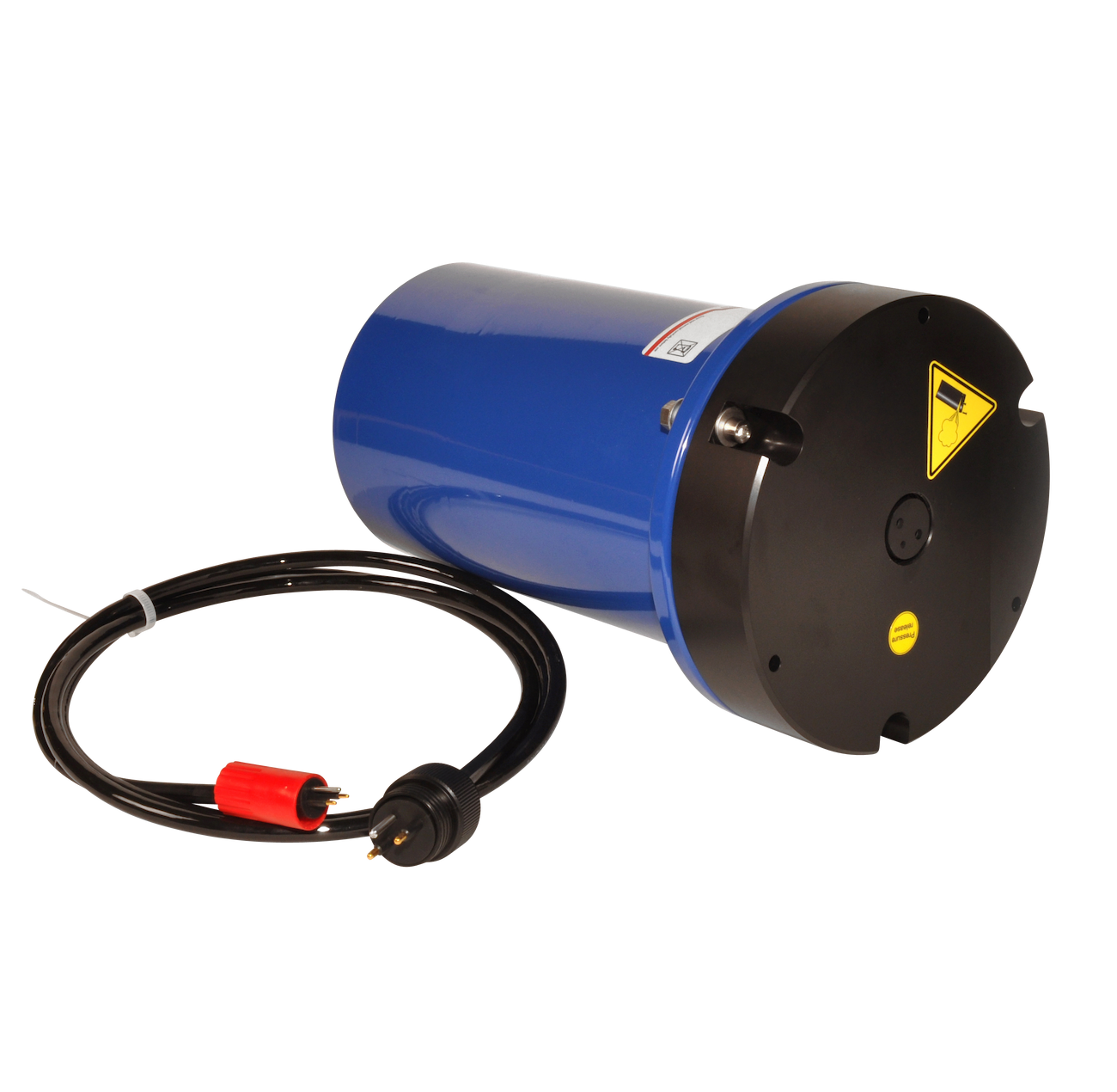
Battery canister, aluminium for 36*D pack w/cable to Signature / Gen 2 AWAC, 8-pin Inline (500m rating)
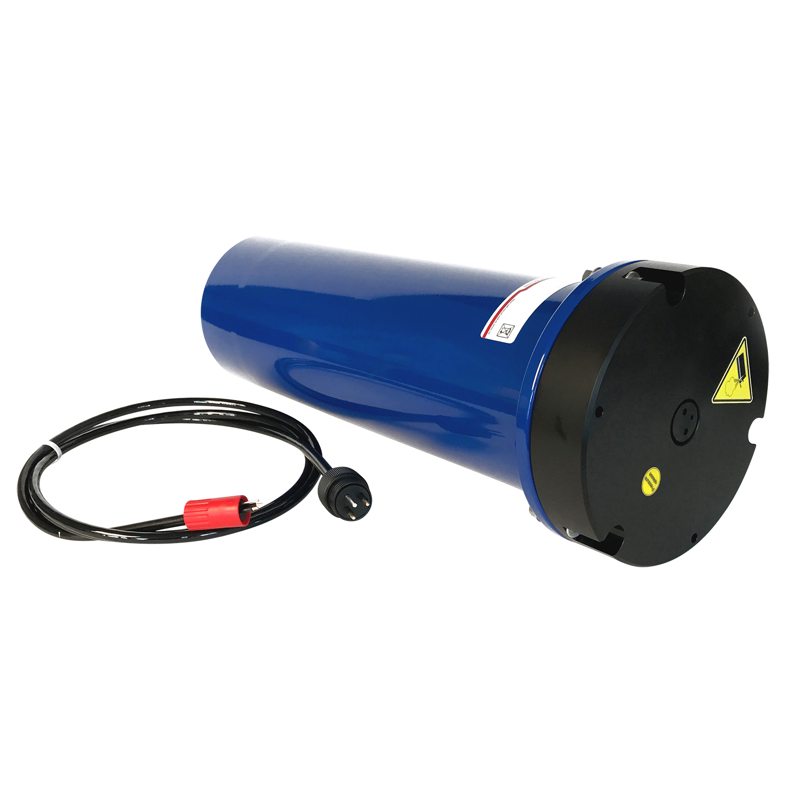
Battery canister, aluminium for 2*36*D pack w/cable to Signature / Gen 2 AWAC, 8-pin Inline (500m rating)
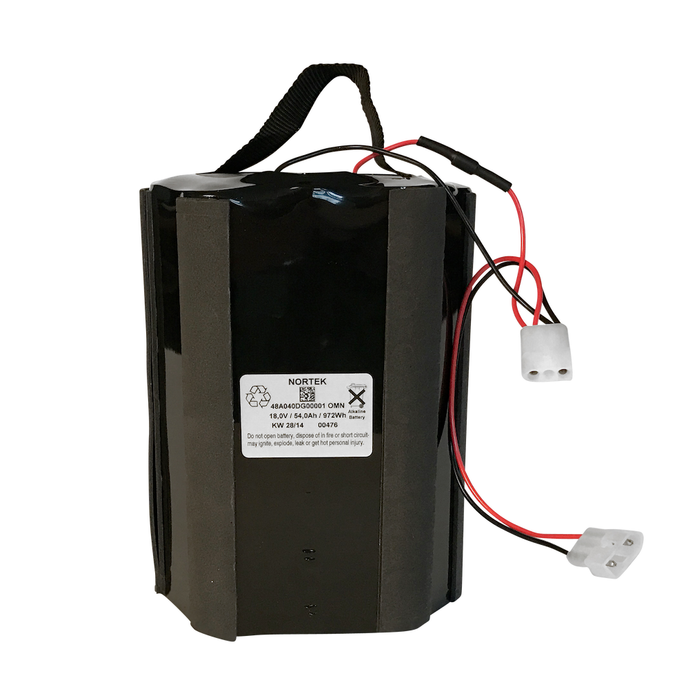
Battery, 18 V - 540 Wh, alkaline
The standard battery for Signature & Generation 2 AWAC instruments.
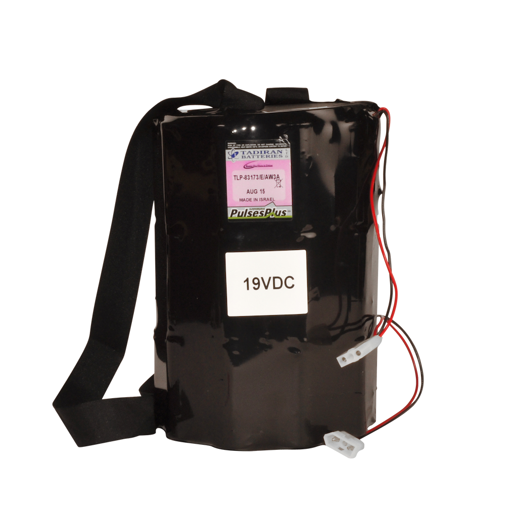
Battery, 19 V - 1800 Wh, lithium
An optional high-capacity lithium battery for Signature & Generation 2 AWAC instruments.

Battery pack, 5-pack, 18 V - 540 Wh, alkaline
The standard battery for Signature & Generation 2 AWAC instruments.
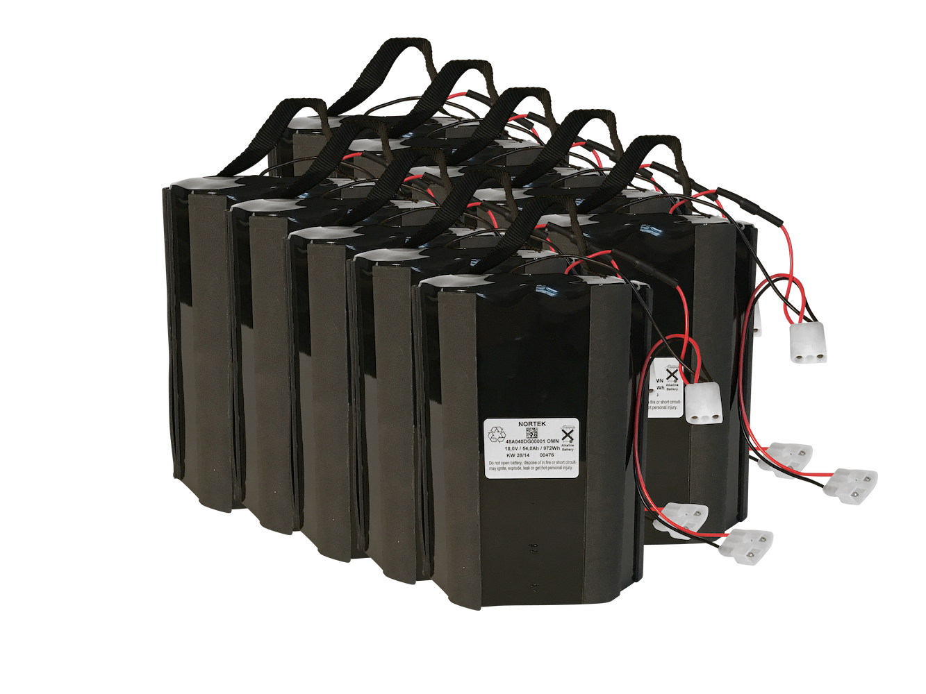
Battery pack, 10-pack, 18 V - 540 Wh, alkaline
The standard battery for Signature & Generation 2 AWAC instruments.