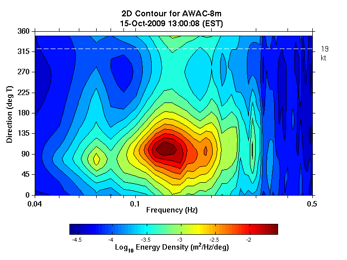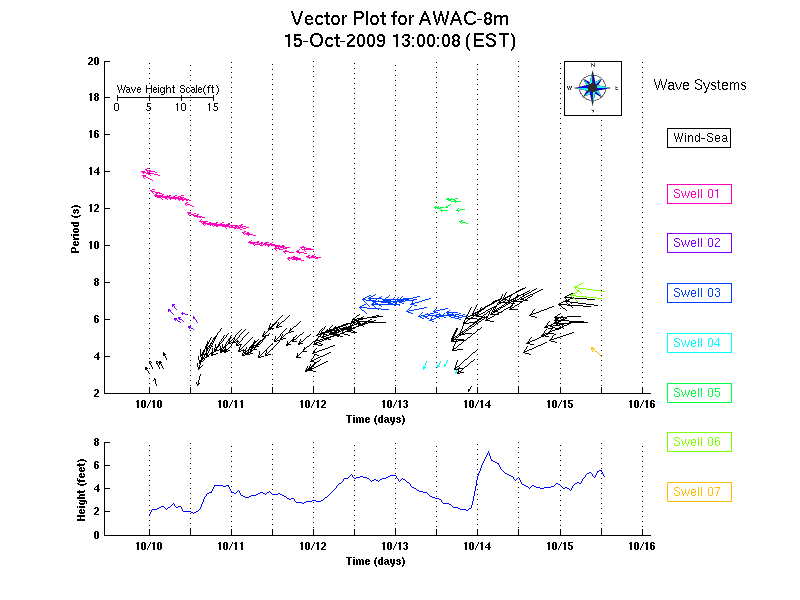
Real-time AWAC wave data used at Duck Field Research Facility
- User stories
A significant challenge to numerical wave modeling is capturing the dynamics of wave transformation in coastal waters. To collect essential data sets and evaluate numerical wave model performance, the US Army Corps of Engineers developed a real-time cross-shore wave and current array across the energetic shelf environment in Duck.
95 km array
The array consists of four AWAC wave and current profilers at 5–11 m depths, a pier-based meteorological station at 8 m depth, and two directional Waverider buoys at 17 m and 26 m depths. National Data Buoy Center (NDBC) station 44014 adds winds and directional waves at 48 m depth. With these sensors, the array spans 95 km and captures all phases of wave transformation from the outer continental shelf to within the surf zone.