Improving navigational safety at US port with current and wave monitoring
- User stories
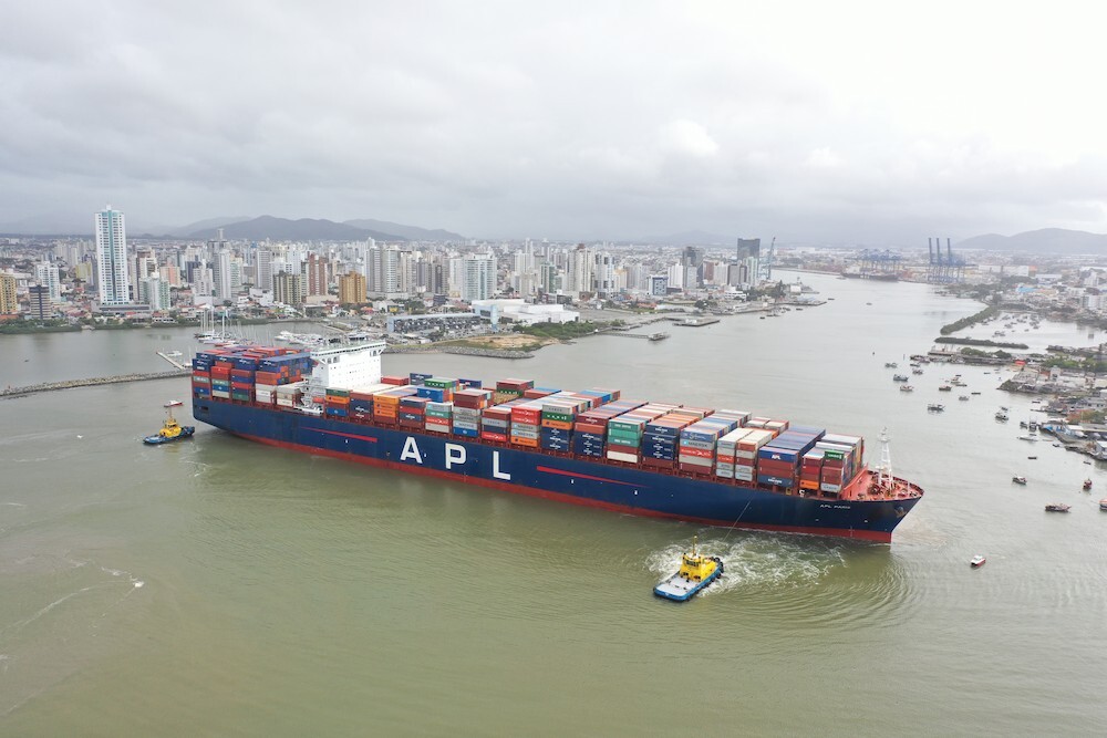
The Port of Morgan City plays an important role in supporting the oil and gas industry in the Gulf of Mexico, with the Atchafalaya River Channel serving as the link between the port and the Gulf of Mexico. Some time back, the Port of Morgan City became involved with the supply and shipping of international commodities through rice and grain exports and importing salt. To improve navigational safety in this critical channel and assist with asset management during an emergency, the Morgan City Harbor and Terminal District procured funding to install real-time data collection systems on the lower portion of the channel, compliant with NOAA's PORTS® program. (NOAA is the U.S. Department of Commerce National Oceanic and Atmospheric Administration.)
PORTS® is a decision support tool that improves the safety and efficiency of maritime commerce and coastal resource management through the integration of real-time environmental observations, forecasts and other geospatial information. PORTS® measures and disseminates observations and predictions of water levels, currents, salinity, and meteorological parameters (e.g., winds, atmospheric pressure, air and water temperatures) that mariners need to navigate safely.
The value of real-time environmental observations
The real-time data collection systems were installed in the early part of 2015 and data transmission started soon after.
"The port's investment in these stations will provide value to maritime industry, emergency managers, and local communities," says Mac Wade, Executive Director of the Morgan City Harbor and Terminal District.
Read the latest news on Nortek product innovation and exciting features.
Improving economic efficiency while reducing risks to life
The National Ocean Service (NOS - an office within NOOA) emphasizes that the need for these products is great and rapidly increasing; maritime commerce has tripled in the last 50 years and continues to grow. Ships are getting larger, drawing more water and pushing channel depth limits to derive benefits from every last inch of draft. By volume, more than 95 percent of U.S. international trade moves through the nation's ports and harbors, with about 50 percent of these goods being hazardous materials. A major challenge facing the nation is to improve the economic efficiency and competitiveness of U.S. maritime commerce, while reducing risks to life, property and the coastal environment.
Providing wave data and current profiles
To install the monitoring systems, MCHTD contracted with ENCOS of Baton Rouge, LA, which partnered with RPS Evans-Hamilton to conduct the work. RPS Evans-Hamilton has extensive experience supporting NOAA and meeting the high standards required by NOAA for data collection systems, providing data to their programs.
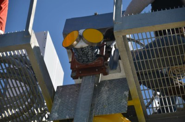
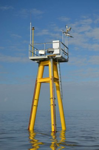
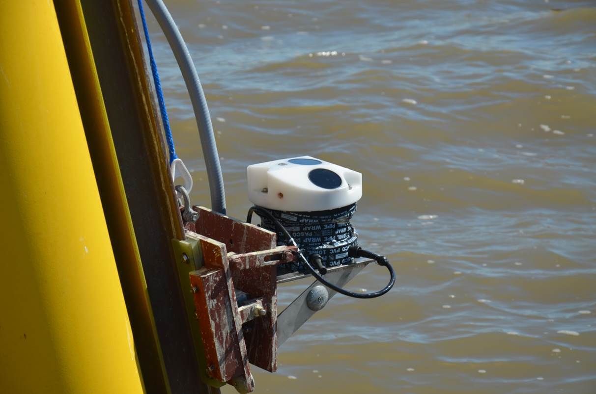
The ENCOS/RPS Evans-Hamilton team designed the platforms to withstand the high wave and wind conditions that periodically occur in this area during large storm events. The northern station, referred to as Eugene Island, is equipped with a primary water level sensor, a meteorological station, a salinity sensor and a backup water level sensor. The southern station is identified as the Atchafalaya Bar Channel and it includes a Nortek 2D Horizontal Current Profiler, a salinity sensor and an upward-looking Nortek AWAC providing wave data as well as vertical current profiles. It should be noted that this is the first active site using a Nortek 2D Horizontal Current Profiler to provide currents into the NOAA PORTS® program.
Monitoring data easily available on the web
All of the data from Eugene Island and the horizontal current data from the Atchafalaya bar channel are transmitted back to NOAA via a satellite transmitter where it undergoes data quality review and is then posted to the NOAA's PORTS® webpage. The salinity data and the wave/current data from the AWAC on the Atchafalaya Bar channel station are transmitted back via IP modem and accessible on a separate website.