Navigation for long-range AUVs used in environmental monitoring
- User stories
Synopsis
Challenge
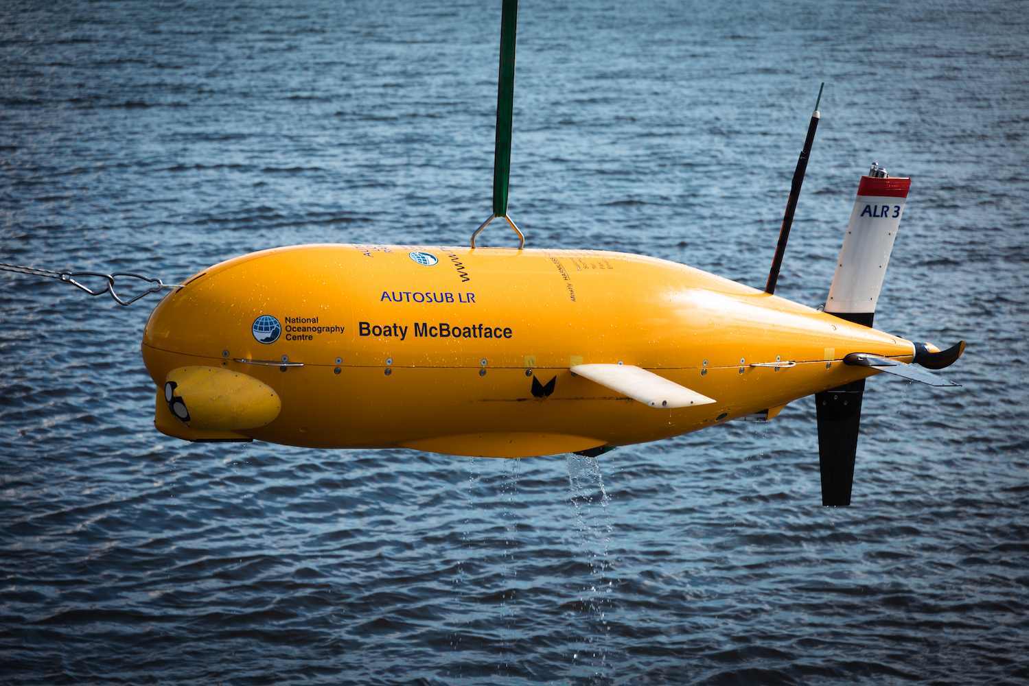
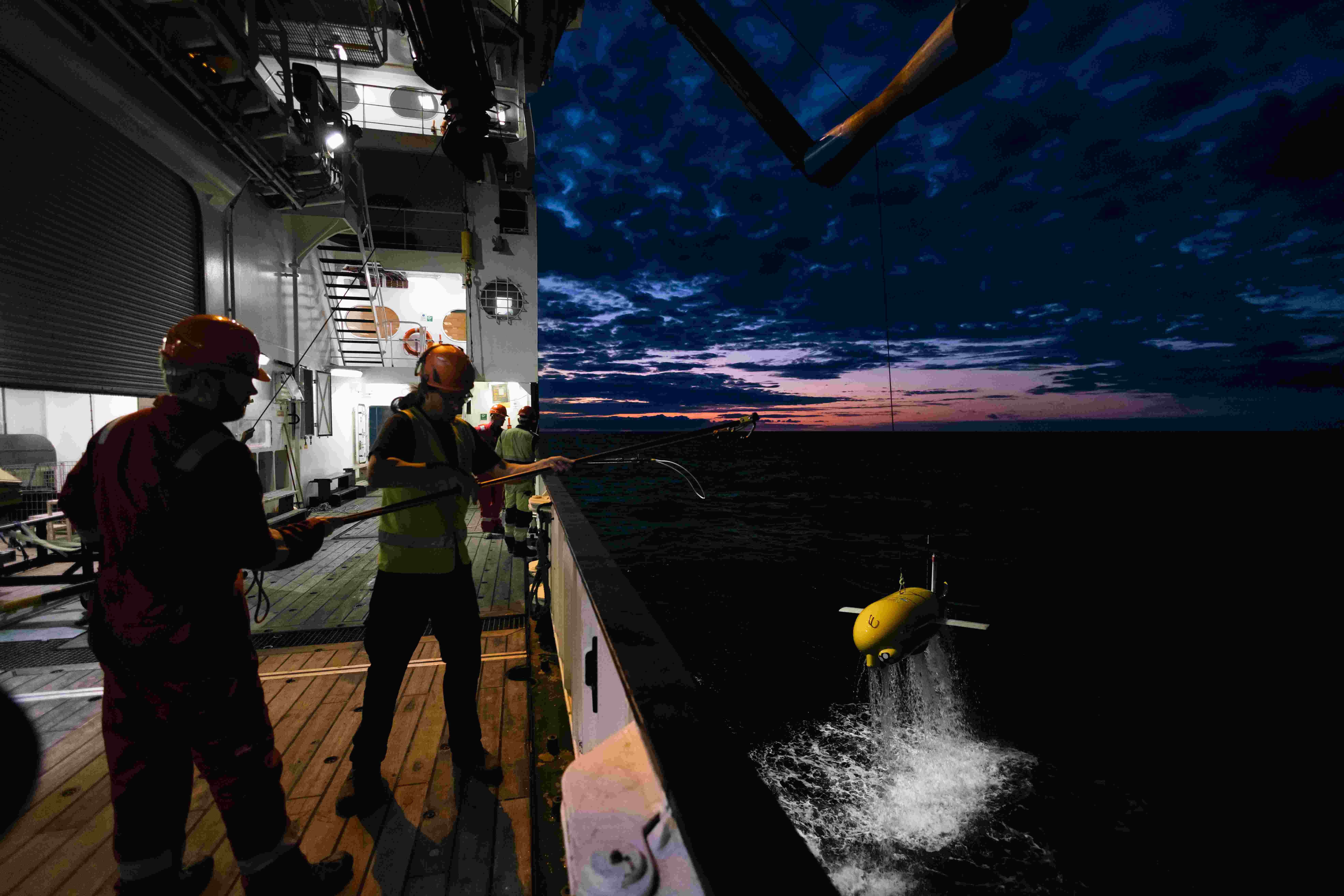
The National Oceanography Centre’s long-range AUVs, one of which is affectionately known as Boaty McBoatface, require precise, low-power and reliable navigation to perform the longest autonomous deployments known.
Solution
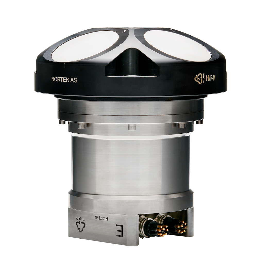
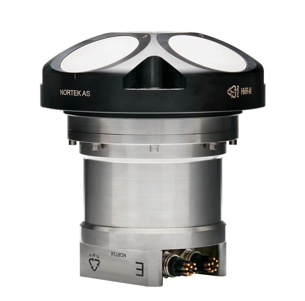
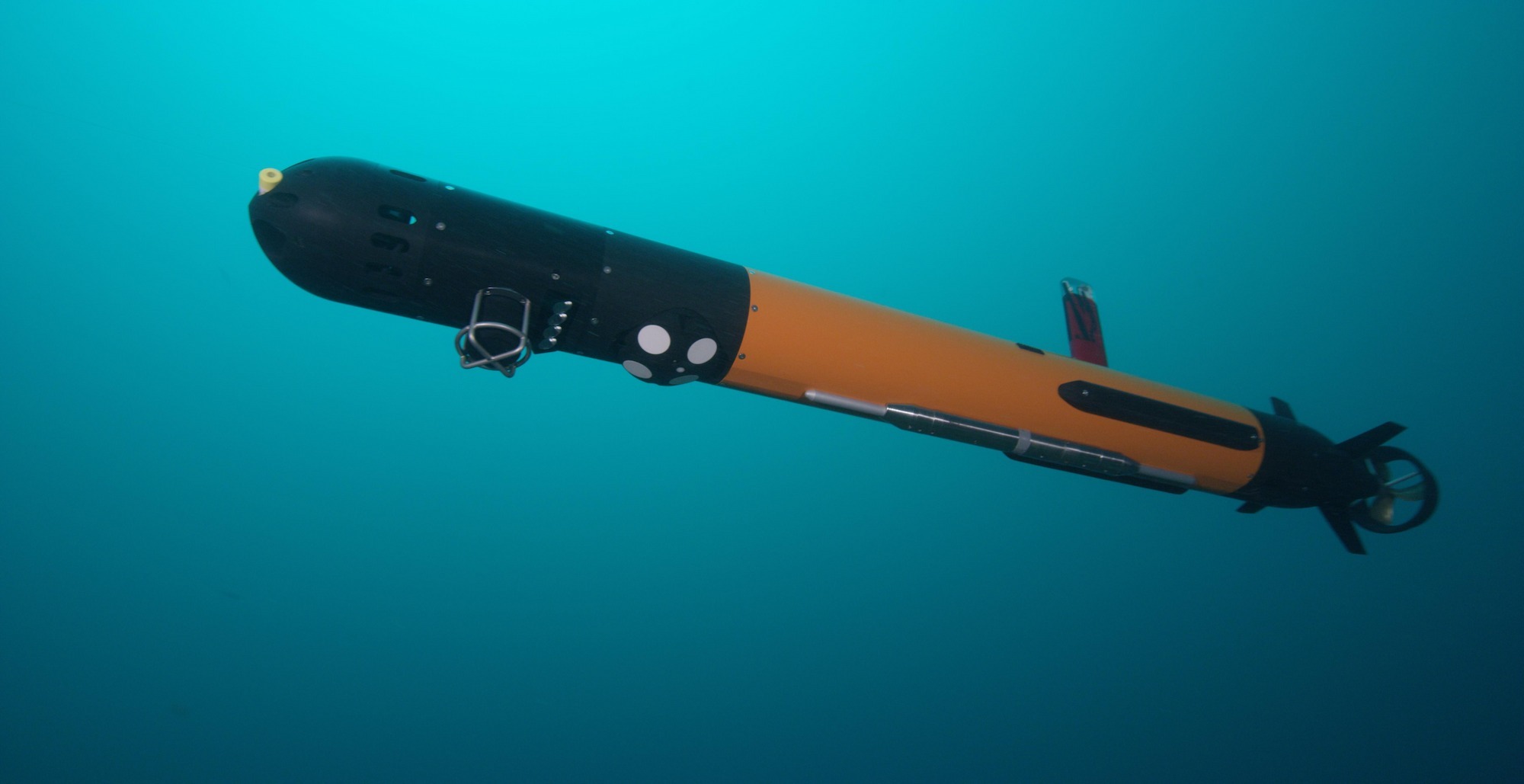
The vehicles are equipped with two DVL 500s for navigation and current monitoring – one for bottom-tracking, and one for tracking the ice when the AUV goes under ice and is out of range of the bottom.
Benefit
The Autosub Long Range vehicle was able to perform the longest-known scientific data collection mission done by an AUV, providing a large spatial and temporal environmental dataset over 2000 km traveled, all while requiring very little power, keeping carbon emissions low.
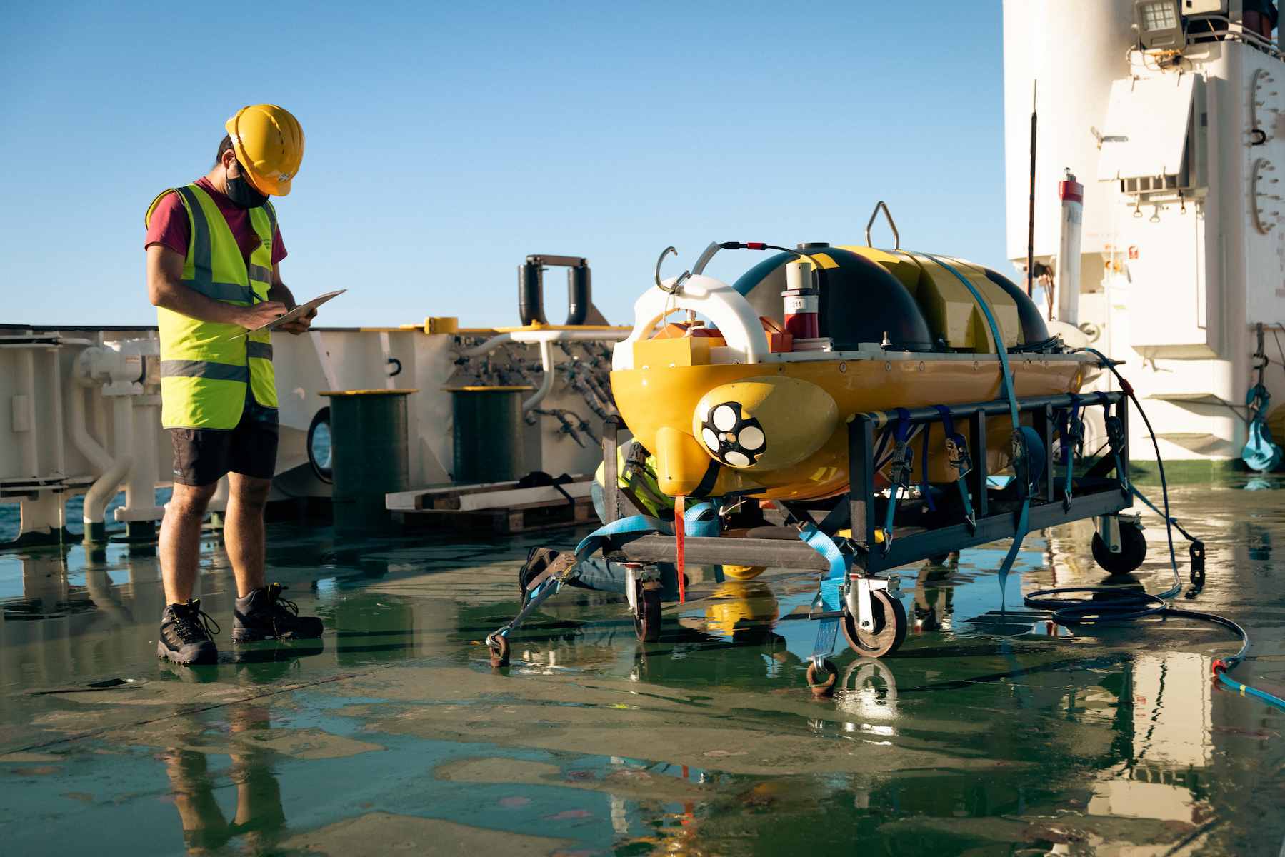
The NOC currently has six ALR vehicles in its fleet. Their goal is to collect environmental data, such as water chemistry information, current speeds and more, over a large spatial and temporal scale – much larger than that possible from a traditional, crewed vessel. The vehicles require very little power and therefore have significantly reduced carbon emissions compared to their crewed counterparts.
A suite of long-range AUVs for expanded data collection
“They are designed to do long-range science – so, shore launch, drive to site, do the science, drive back, recover back at shore,” says Matthew Kingsland, Senior Robotics System Engineer at NOC.
“It’s a very low-carbon way to do science because you don’t need a big gas-guzzling ship.”
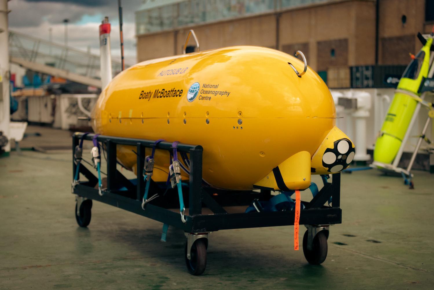
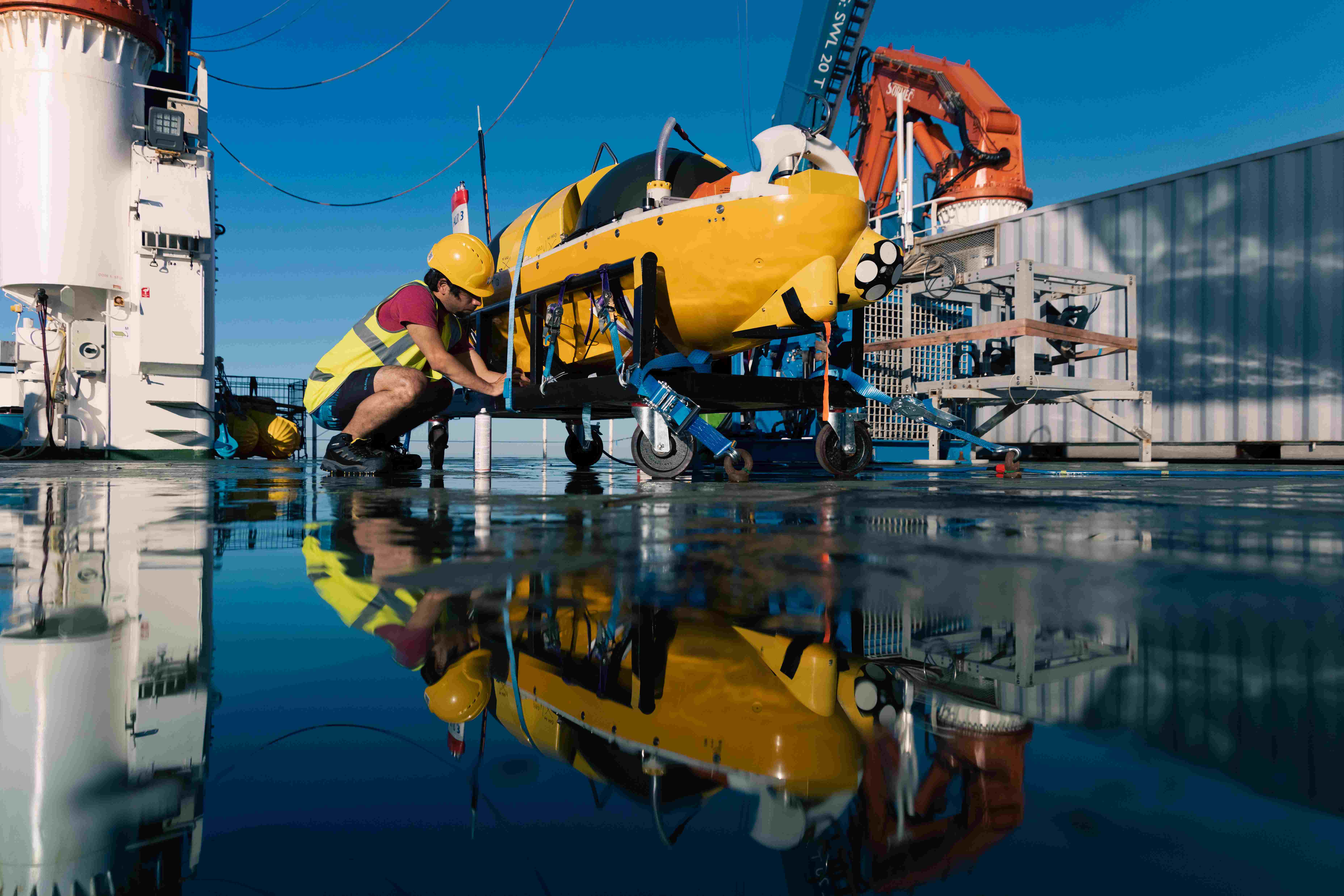
The ALR Boaty McBoatface is equipped with a suite of sensors – conductivity, temperature and depth (CTD) sensors, wet chemical sensors to measure nitrates and pH – and multifunctional Nortek DVL 500s to collect current profiles as well as help the vehicles navigate. The sensors are tailored to the mission – for example, on some missions, the AUV takes high-quality images using an on-board low-power visual mapping system.
“The aim is to get more temporal and spatial data points,” explains Kingsland. “With a ship, you have a single temporal and spatial data point. If you launch a whole load of AUVs off it, you get more data points, and can hopefully do better science.
“Long-distance AUV missions require even higher long-term accuracy to ensure the vehicle both reaches its destination successfully and returns to its launch site”
Low-power navigation for long-range AUV missions
A major requirement of a successful autonomous vehicle deployment is a reliable navigation system. In the case of the ALR, this is even more crucial: long-distance AUV missions require even higher long-term accuracy to ensure the vehicle both reaches its destination successfully and returns to its launch site.
The NOC team devised a robust navigation system for the vehicles, complete with not just one, but two (and sometimes three – more on that later) Nortek DVL 500s used for calculating the vehicle’s velocity. This velocity information is combined with heading information from a compass to provide accurate and reliable navigation for the ALR vehicles.
But why two DVLs for navigation? Most vehicles use a downward-facing DVL to track the vehicle’s velocity using the seabed as a reference. In this case, building a navigation system with a secondary, upward-facing DVL provides the vehicle with a backup in a unique situation: traveling under ice.
“Primarily, the [DVL] pointing down is used for our main navigation system,” says Kingsland. “However, when we go under ice, we have [a DVL] pointing up to detect the ice, which means we can do navigation based on that upwards-facing DVL. We basically get bottom lock – I don’t know if anyone has coined the term ‘top lock’, but that’s what we can do!”
Kingsland notes that using ice as a reference requires the assumption that the ice itself isn’t moving too much, a safe assumption when it comes to navigating under large, thick sheets of shelf ice.
Multi-functional DVL saves power and improves outcomes
Like everything on the ALR vehicles, low power consumption is a primary focus to enable long-term missions. The DVL 500s on the vehicles provide not only a low-power navigation aid, but double as current profilers, gathering valuable data for environmental researchers.
“It’s a very low-power navigation system. We only ping the DVL once per second, and we alternate pings between DVL [for navigation] and current profiling,” says Kingsland.
The multi-DVL setup has benefits for current profile collections as well.
“If you’re mid-water column, you can collect currents above you and currents beneath you with the two DVLs,” says Kingsland. “Again, it comes down to that temporal and spatial resolution and collecting more data to feed into models and other research efforts.”
Unique application of a DVL on the long-range AUV Boaty McBoatface
The upward-looking DVL isn’t the only way the ALR vehicles use Nortek DVLs in an unusual way. During a recent deployment as part of the TARSAN project, one of the vehicles was sent under the Thwaites Glacier. A forward-looking DVL 500 was attached to the nose of the vehicle to perform obstacle avoidance and detection.
Instead of the pings from the DVL recording information from the seafloor or the water column, the information can be used to determine if an obstacle exists in each beam’s “path”.
“We were getting the data back from each individual beam,” says Kingsland. “We were using that as a range detection for what we had in front of us.”
A forward-looking sonar is often used in this capacity instead. However, pinging a forwards-looking DVL once per second is a much less power-hungry process than continuously running sonar, explains Kingsland.
The information from all of the DVLs is fed into an on-board control system in order to determine the vehicle’s position relative to obstacles and the “grounding line” – the area where the ice and seafloor meet, crucial knowledge for the vehicle to avoid getting stuck. The information dictates when the sub should turn around or change course.
Pushing the boundaries of autonomous vehicle deployments subsea
According to Kingsland, the team recently performed the longest AUV deployment they’re aware of using one of the ALR vehicles. The team launched the vehicle from Plymouth in the southwest of the UK. From there, it drove about 1000 km out to Whittard Canyon, a drop-off marking the continental shelf on the UK side of the Atlantic where the depth changes from about 200 m to 4000 m rapidly. The AUV traveled along the “ramp” of the shelf collecting data until 1000 m depth, then returned to where it was deployed from.
“This was what we called the ‘long-distance proving trial’,” says Kingsland. “We traveled over 2000 km and used just 45 percent of the battery. We should, in the long run, be able to do 4000 km, collecting CTD and ADCP data along the way for environmental monitoring.”
Credit: National Oceanography Centre.
The obstacle avoidance and under-ice navigation system also opens new possibilities for missions. During the TARSAN project deployment, the AUV successfully traveled 40 km under ice and 40 km back using the system.
AUVs are also a valuable tool for exploring areas that may be unsafe for crewed vessels or divers, such as shipwrecks or old oil and gas fields.
“There are plenty of shipwrecks out there with arsenic and asbestos and other nasty things for the environment,” says Kingsland. “We can send these things out to do surveys of the shipwreck without having to send a ship out there.”
“The carbon output [for a typical survey] is like the equivalent of 2 L worth of diesel. It’s incredibly low.” – Matthew Kingsland, NOC
Long-term monitoring and informed decision-making using long-range AUVs
According to Kingsland, the major goal for the future of Boaty McBoatface and the other ALR vehicles is to perform regular shore-launch deployments for improved environmental monitoring in a sustainable way.
“The carbon output [for a typical survey] is like the equivalent of 2 L worth of diesel,” says Kingsland. “It’s incredibly low.”
Kingsland also hopes the NOC will be able to grow its fleet of ALR vehicles from six to 24 or more, so deployments can happen continuously and consistently around the UK and in other countries.
“Hopefully there will be fleets of these vehicles going from the shore of the UK or around the world, going to marine protected areas and monitoring those areas,” says Kingsland. “They will be providing useful data back to scientists, who will use that data to inform government policy and steps we should take to protect our environment.”