Understanding flow velocities to keep navigation channels open in sediment-rich Dutch waters
- User stories
Synopsis
Challenge
The ferry route to the island of Ameland in the Netherlands had become longer due to increased sedimentation. WaterProof Marine Consultancy aimed to find the hydromorphological impacts of potentially dredging a shortcut.
Solution
Using the VM Coastal system, the team gathered information about not only the currents, but also the sedimentation in the area using the combined echosounder on the Signature ADCP.
Benefit
Optimizing ferry routes saves money and reduces CO2 emissions, and Dutch authorities can now make informed decisions on how to do so using the data collected by WaterProof.
God created Earth, but the Dutch created the Netherlands, according to the old Dutch joke. It’s hard to disagree when you see the impact of measures through the centuries to reclaim and protect the country’s low-lying land from the sea, largely through the construction of dikes.
However, this activity is not without its side effects.
The construction of the Afsluitdijk, a 32 km dike through the IJsselmeer and Wadden Sea, has resulted in a major morphological shift in the Dutch section of the Wadden Sea, one of the world’s largest tidal flats systems, which stretches from the Netherlands to Denmark.
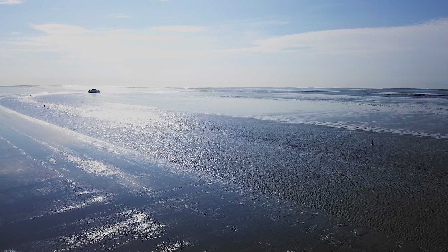
Off the northern Dutch coast, the sea bottom is rising and navigation channels for ferries are rapidly clogging up with sediments. The route for the ferry crossing between Holwerd and the island of Ameland needs to be dredged around the clock to keep it accessible. Near the village of Holwerd, sedimentation rates of up to 6 m a year are frequently reached. Total dredging volumes exceeded 1.5 million m³ in 2018.
WaterProof Marine Consultancy & Services was asked by the Dutch Ministry of Public Works to monitor and assess the possible impact of dredging a shortcut in the navigation channel.
Due to the constant erosion and sedimentation process, the channel to Ameland had meandered considerably from its original route, increasing the journey distance and time, and adding to fuel costs and CO2 emissions in the process.
However, dredging the shortcut for the ferry channel would change the hydromorphological conditions, so the operation needed to be carefully monitored to assess its efficiency and any wider long-term impact.
Vessel-mounted ADCP provides crucial data to measure sedimentation levels and water currents
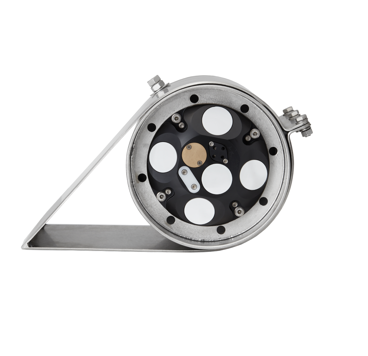
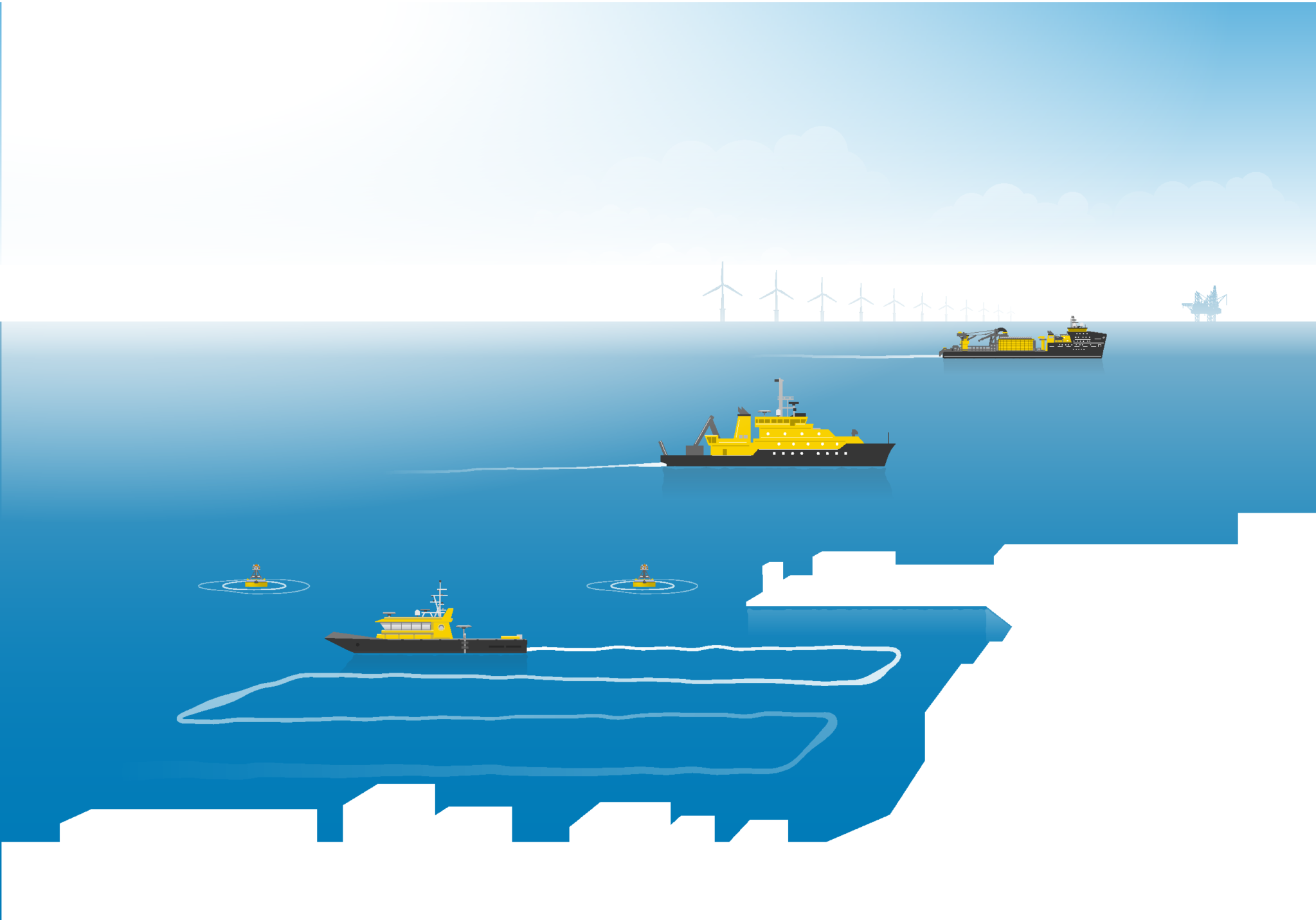
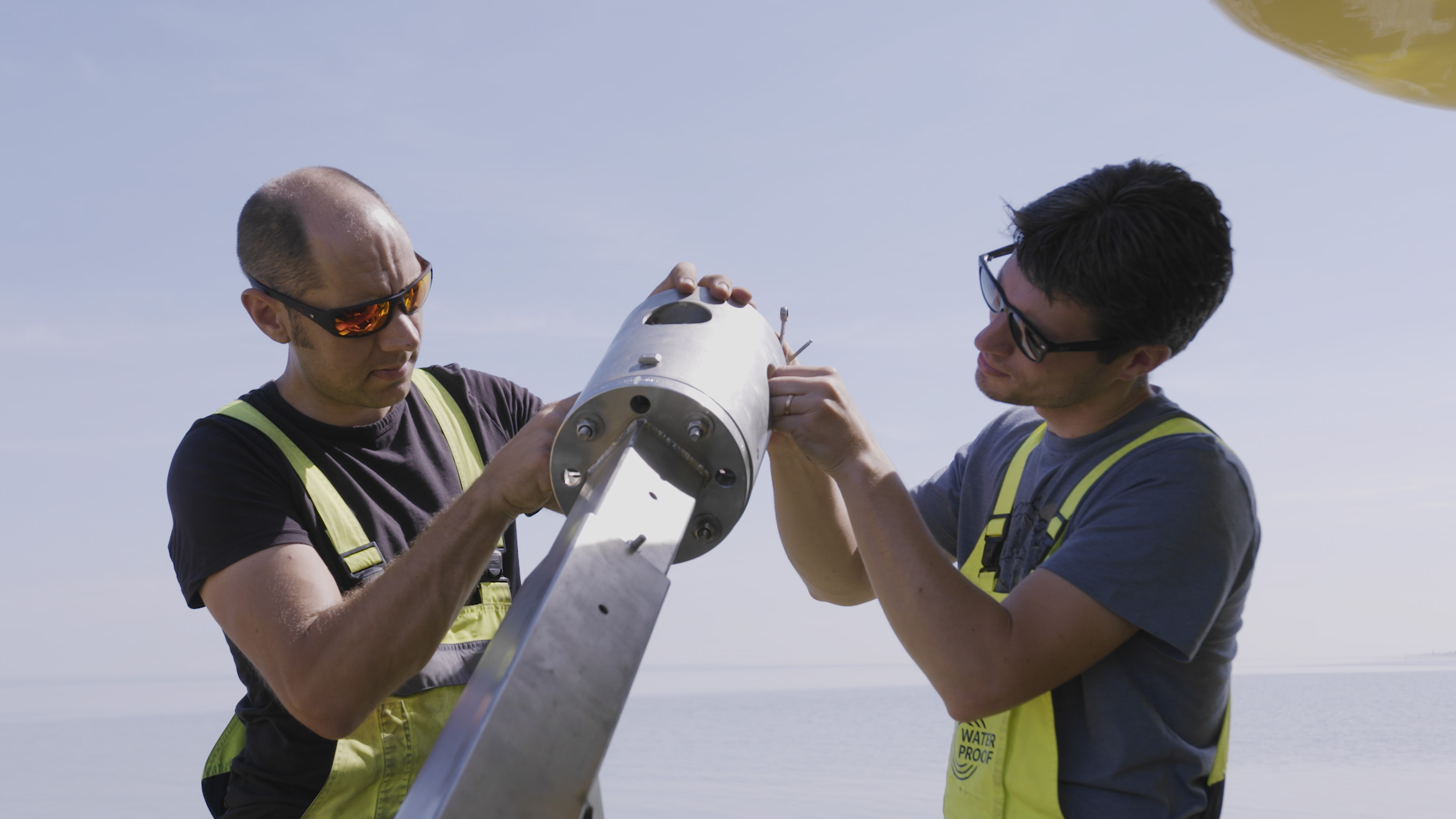
WaterProof needed to measure existing sedimentation levels and water currents in and around the channels as part of its analysis. The consultancy firm turned to Nortek, selecting the company’s Signature acoustic Doppler current profilers (ADCPs) to carry out the task, including the vessel-mounted VM Coastal.
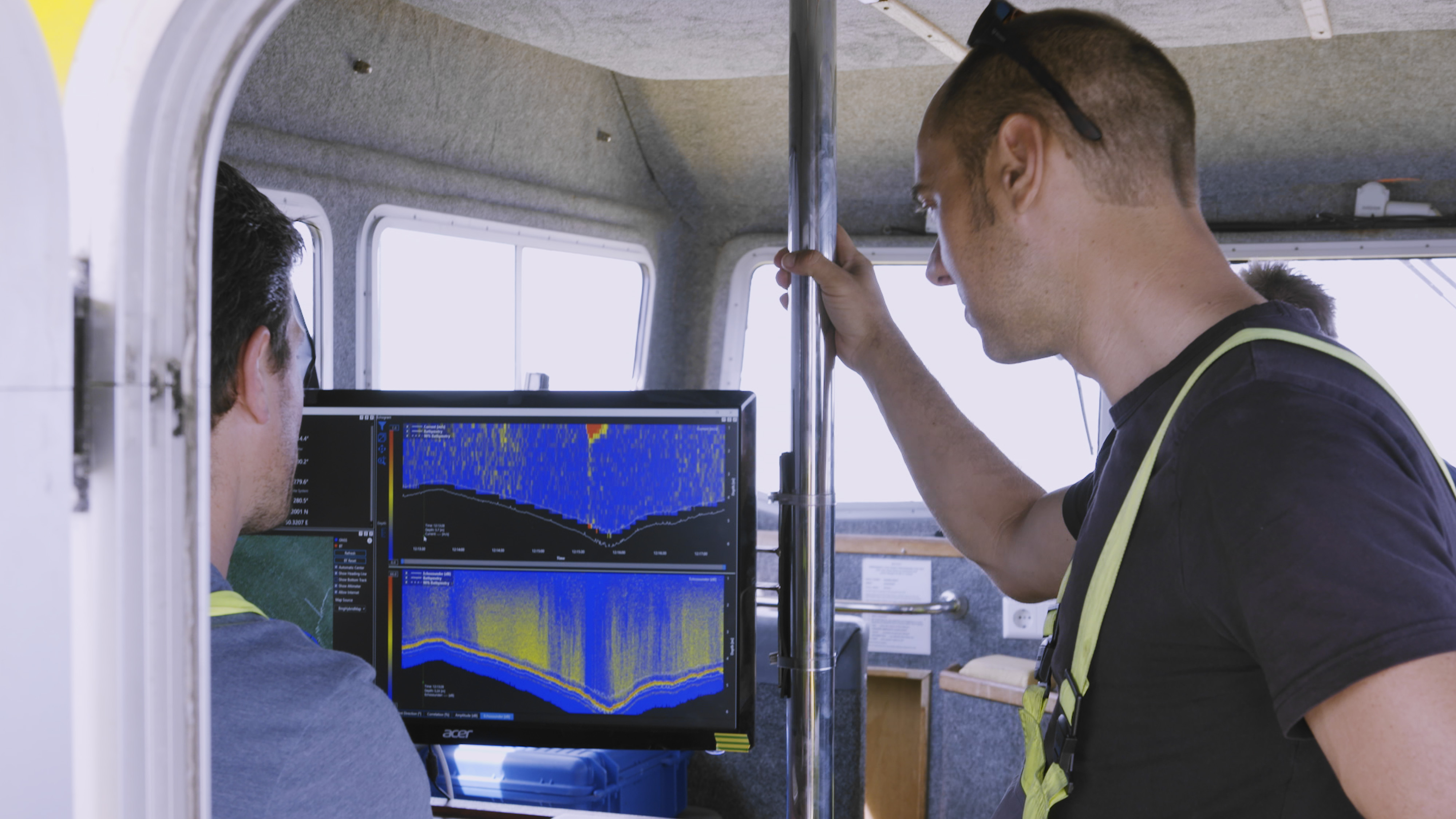
Data gathered by the VM Coastal provided accurate insight into flow velocities over the water column at the channel transects. It also showed sediment concentrations in the water over the tidal cycle. These continuously varied with depth.
This knowledge has helped provide better understanding of the morphological system and will improve the efficiency of future mitigation measures to keep the navigation channel open.
Accurately measuring currents and depth, while being easy to operate
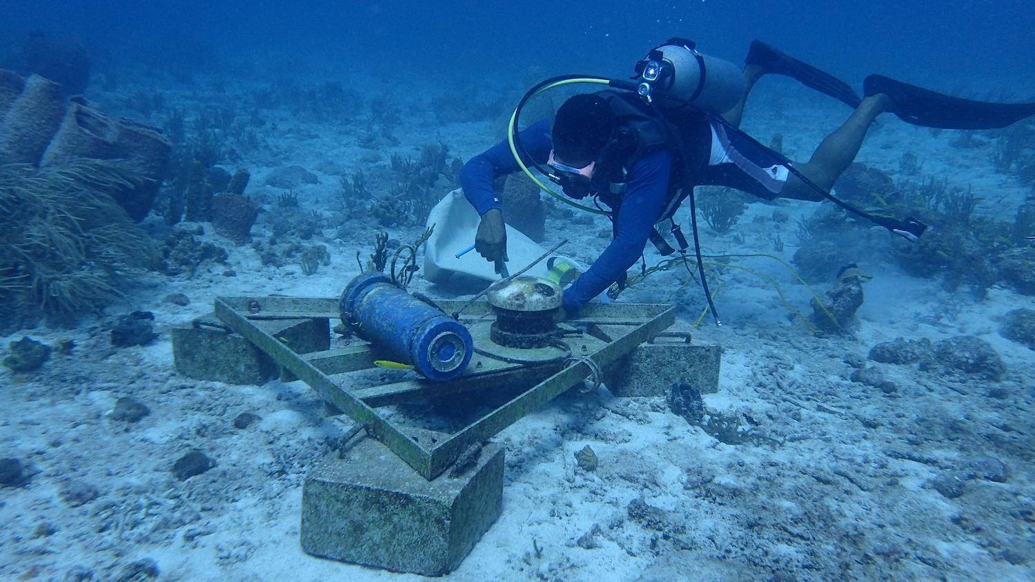
WaterProof’s Luitze Perk says: “Nortek advised us on suitable equipment for our extensive field campaign and delivered the right acoustic instrumentation for the job. Our bottom frames were equipped with Signature ADCP instrumentation to gain information about water flow, water level and (in combination with an optical sensor) suspended sediment concentrations over a two-month period.”
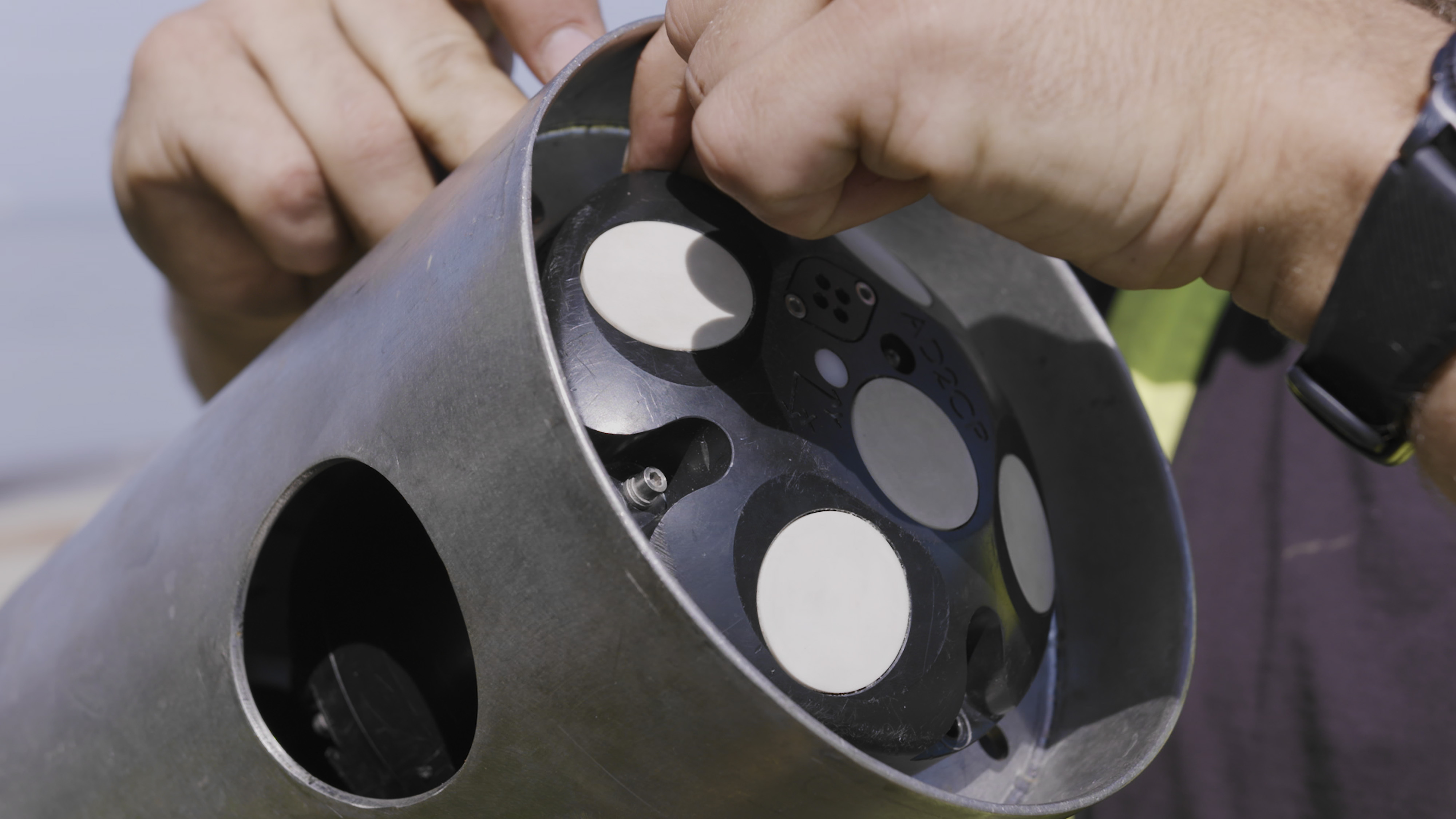
WaterProof took measurements using stationary Nortek Signature 1000 ADCPs, as well as the simple-to-use VM Coastal vessel-mounted solution. The VM Coastal has found favor with clients due to its ability to rapidly provide high data quality from its five-beam array, accurately measuring both currents and depth, while being designed for easy operation.
The vessel-mounted instrument played a key role in establishing the spatial distribution of velocities, sediment concentrations and tidal prisms (the volume of water moved between low and high tide) across the navigation channels.
“The vertical beam of this vessel-mounted system provides us with a high-resolution echograph, encompassing the entire water column from the water surface to the bottom of the sea, where the highest concentration of sediments can be expected,” Perk adds.
Additional flow measurements in laboratory flume
Sediment samples were taken back to WaterProof’s lab for additional flow flume measurements, where Nortek instrumentation was also used. A velocimeter from Nortek was employed to determine local, near-bed flow velocities.
“We’re pleased how Nortek supported us throughout the campaign, making it possible to gather extensive and useful data,” Perk says.
Thanks to these field and lab studies, the Dutch authorities now have WaterProof’s solidly based advice on measures likely to be needed to keep the ferry navigation channel to Ameland open.