Overview
The VM Coastal safeguards data quality, opens up new and unprecedented opportunities to the scientific community, and offers operational convenience and reduced complexity.
The VM Coastal package includes the Signature1000, 500 or 250, allowing for great versatility in both the vessel-mounted and bottom-mounted configurations. By using a state-of-the-art and user-friendly vessel-mounted package, measurement errors and initial installation time can be greatly reduced.
Download our guide to Vessel-Mounted ADCPs here.
- Currents
- Echosounder
- Bottom track
Highlights
-
Complete, coherent system built for high performance and quick deployment
-
Straightforward data acquisition and processing software
-
Intuitive discharge acquisition module and post-processing with Qrev data export
-
Simultaneous current, depth and suspended particulate matter (SPM) information in one place (1000 / 500)
-
Vertical echosounder beam for studying SPM down to the bottom (1000 / 500)
-
Multifrequency option enables vertical beam operation at 1000, 500 and 250 kHz (1000)
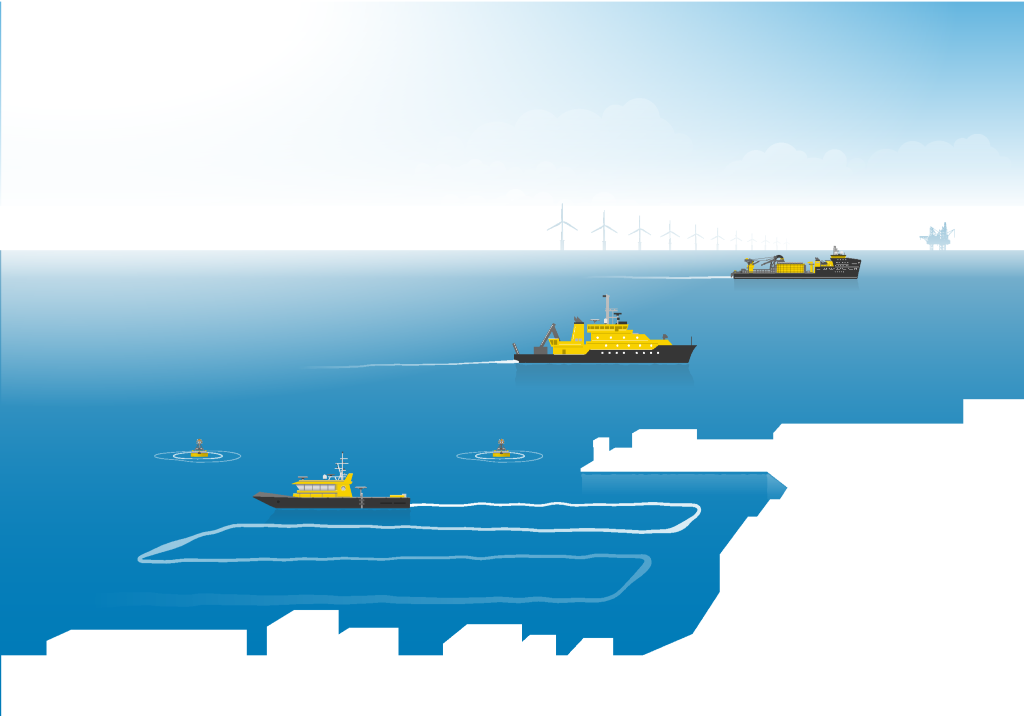
Usage
-
Coastal surveys, up to 200 m depth
-
Port and harbor modeling
-
River discharge measurements
-
Large-scale mixing studies
Setup
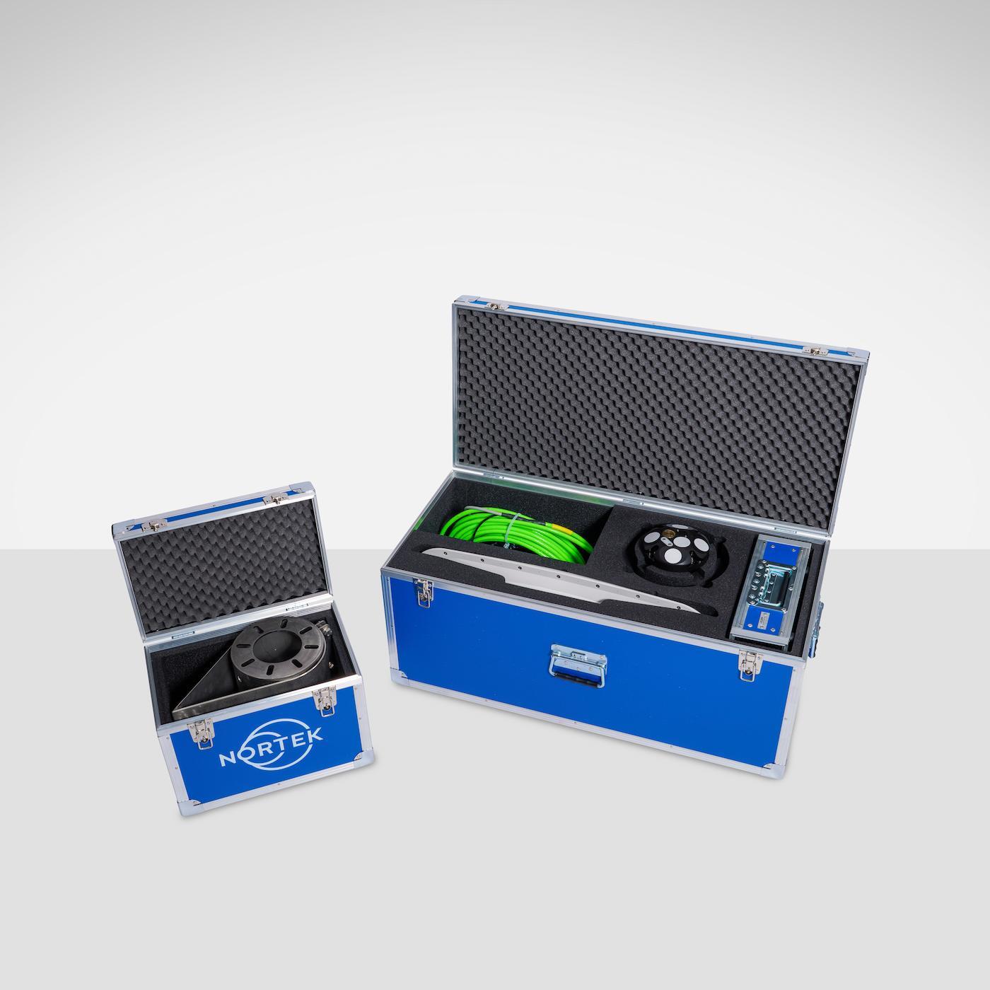
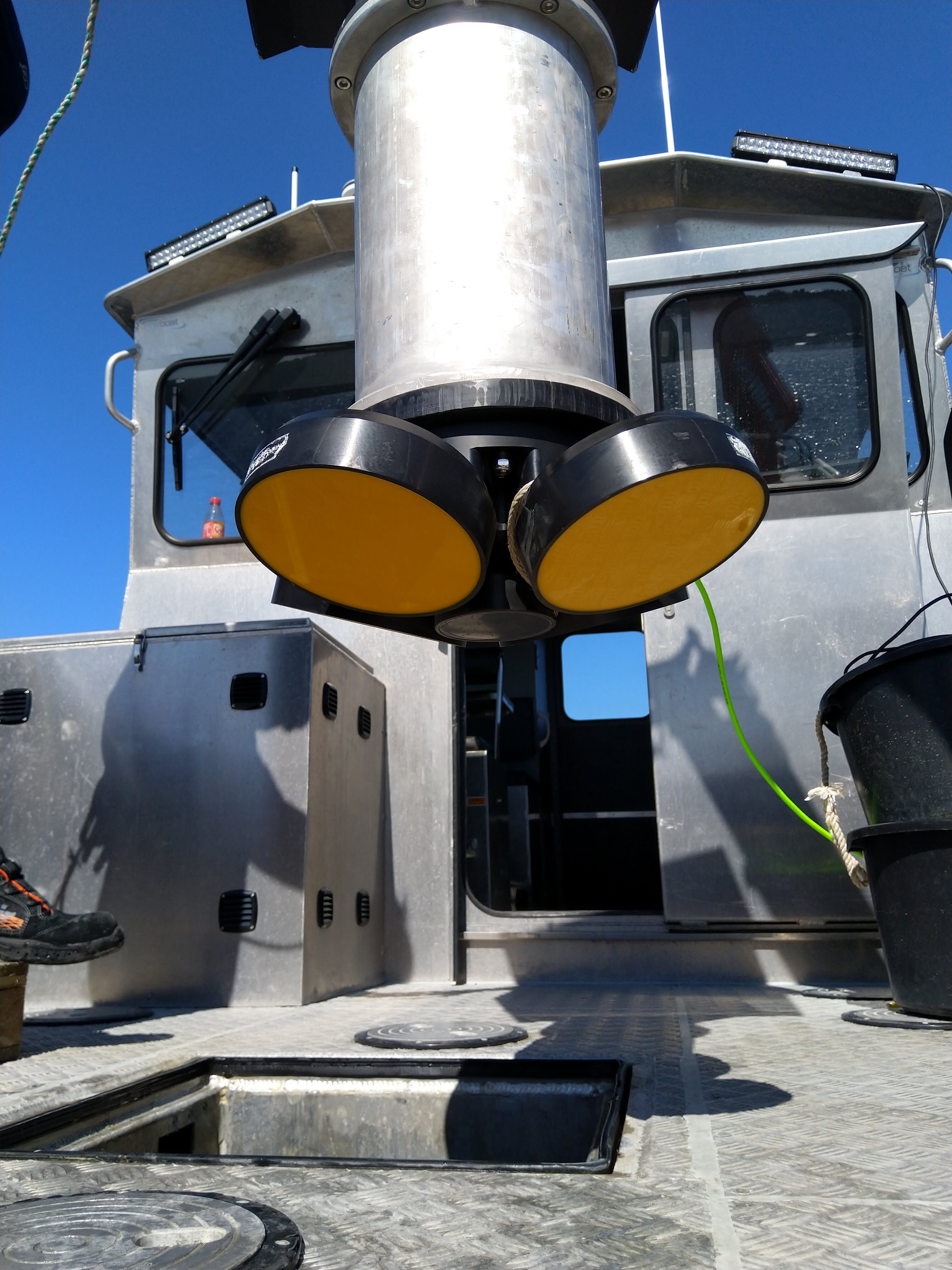
Any vessel of opportunity can accommodate the VM Coastal package. A mounted fairing bracket is included to house the Signature ADCP and reduce drag deploying the instrument on a pole on the front, moonpool or over the side of the vessel. Other components include an advanced GNSS satellite compass and a compact processing unit for pulling together system data.
Deployment
Configure, view, forward and store current velocity data in real time using VM Acquisition while onboard the vessel. Gather current speed and direction information as well as depth and SPM information with the vertical beam.
Data
Process and export subsets of interest using the VM Review software once your survey has ended. Make alignment and lever-arm corrections, process discharge results, display and export heatmaps, plots and cross sections as images, CSV, MATLAB or in Qrev format for independent discharge calculation.
Profiling range* |
30 m |
Cell size |
0.2–2 m |
Max no. cells |
256 |
Min. blanking |
0.1 m |
Minimum accuracy |
0.3% of the measured value ± 0.3 cm/s |
Velocity resolution |
0.1 cm/s |
Maximum sampling rate |
14 Hz |
No. of beams |
4 slanted at 25 degrees |
* Maximum range depends on acoustic scattering conditions and transmit power. |
Profiling range* |
70 m |
Cell size |
0.5–4 m |
Max no. cells |
256 |
Min. blanking |
0.5 m |
Minimum accuracy |
0.3% of the measured value ± 0.3 cm/s |
Velocity resolution |
0.1 cm/s |
Maximum sampling rate |
6 Hz |
No. of beams |
4 slanted at 25 degrees |
* Maximum range depends on acoustic scattering conditions and transmit power. |
Profiling range* |
150-200 m |
Cell size |
1–8 m |
Max no. cells |
256 |
Min. blanking |
0.5 m |
Minimum accuracy |
1% of the measured value ± 0.5 cm/s |
Velocity resolution |
0.1 cm/s |
Maximum sampling rate |
2 Hz |
No. of beams |
4 slanted at 20 degrees |
* Maximum range depends on acoustic scattering conditions and transmit power. |
Single ping std @ 3 m/s |
0.5 cm/s |
Long-term accuracy |
± 0.1% / ± 0.1 cm/s |
Minimum altitude |
0.2 m |
Maximum altitude |
30 m |
Velocity resolution |
0.01 mm/s |
Maximum sampling rate |
4 Hz |
Single ping std @ 3 m/s |
0.5 cm/s |
Long-term accuracy |
± 0.1% / ± 0.1 cm/s |
Minimum altitude |
0.3 m |
Maximum altitude |
70 m |
Velocity resolution |
0.01 mm/s |
Maximum sampling rate |
2 Hz |
Single ping std @ 3 m/s |
TBA |
Long-term accuracy |
TBA |
Minimum altitude |
5 m |
Maximum altitude |
205 m |
Velocity resolution |
0.01 mm/s |
Maximum sampling rate |
1 Hz |
No. of beams |
1 vertical |
Maximum sampling rate |
2 Hz |
Max. range |
30 m |
Vertical resolution / accuracy |
0.001 m / 1% of the measured value** |
** Assuming a constant speed of sound |
No. of beams |
1 vertical |
Maximum sampling rate |
2 Hz |
Max. range |
70 m |
Vertical resolution / accuracy |
0.001 m / 1% of the measured value** |
** Assuming a constant speed of sound |
No. of beams |
N/A* |
Maximum sampling rate |
N/A |
Max. range |
N/A |
Vertical resolution / accuracy |
N/A |
* Depth measurement via the 4 slanted beams. |
|
Sampling |
Same as velocity for slanted beams |
Resolution |
0.5 dB |
Dynamic range |
70 dB slanted beams |
No. of beams |
4 slanted at 25 degrees |
Beam width |
2.9° |
Sampling |
Same as velocity for slanted beams |
Resolution |
0.5 dB |
Dynamic range |
70 dB slanted beams |
No. of beams |
4 slanted at 20 degrees |
Beam width |
2.3° |
No. of beams |
1 vertical |
Frequency |
1000 kHz; 1000, 500 and 250 kHz selectable channel(s) with MF license |
Maximum sampling rate |
2 Hz |
Max. range |
30 m |
Resolution |
3 mm - 0.25 m; 5 mm - 0.25 m with MF license |
Number of bins |
10,000 |
Transmit pulse length |
16 μs - 0.5 ms, 64 μs - 0.5 ms |
Transmit pulse |
Monochromatic or pulse compressed (1000 kHz, 25% BW); 500 and 250 kHz monochromatic with Multifrequency option |
Resolution / dynamic range |
0.01 dB / 70 dB |
No. of beams |
1 vertical |
Maximum sampling rate |
1 Hz |
Max. range |
70 m |
Resolution |
6 mm - 0.5 m |
Number of bins |
11,000 |
Transmit pulse length |
32 μs - 1 ms |
Transmit pulse |
Monochromatic or pulse compressed (25% BW) |
Resolution / dynamic range |
0.01 dB / 70 dB |
No. of beams |
N/A |
Maximum sampling rate |
N/A |
Max. range |
N/A |
Resolution |
N/A |
Number of bins |
N/A |
Transmit pulse length |
N/A |
Transmit pulse |
N/A |
Resolution / dynamic range |
N/A |
Temperature sensor range /accuracy |
-4 °C to 40 °C / 0.1 °C |
Pressure |
Piezoresistive |
Standard range |
0-300 m (inquire for options) |
Accuracy/precision |
0.1% FS / better than 0.002% of full scale |
Compass and tilt |
Solid-state magnetometer |
Data recording |
16 GB (inquire for options) |
Data cable |
10 m Ethernet cable (inquire for options) |
IO |
Ethernet |
DC Input |
15–48 V DC |
Operating temperature |
-4 °C to 40 °C |
Storage temperature |
-20 °C to 60 °C |
Vibration |
IEC 60068-1/IEC60068-2-64 |
EMC approval |
IEC 61000 |
Depth rating |
300 m – Bottom track is limited to surface vessels |
Connectors |
Straight fitted MCBH6F (Ethernet) |
Housing |
Small instrument housing |
Material |
POM with titanium fasteners and additional, reinforced transducer cups for VM 250 |
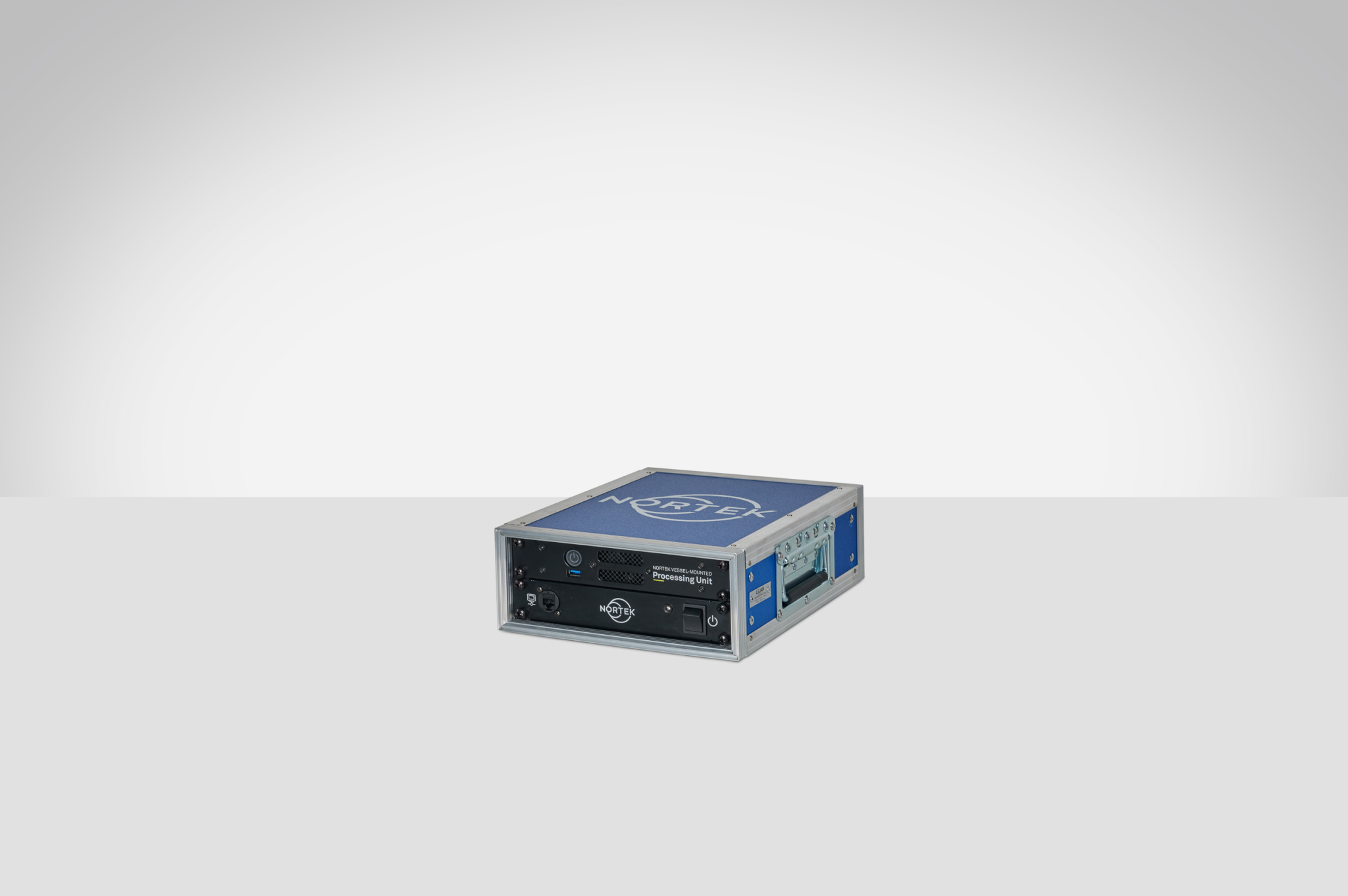
Processor/memory |
Intel i3/2x 8GB |
Hard disk |
SSD, 500 GB |
Operating system |
Windows® 11 IoT Ent LTSC |
Housing |
Half 19" 2 HE case |
Dimensions |
265x110x340 mm |
Input |
24 V DC, 20 W typical. (230|120 V AC adaptor supplied) |
Total weight |
5.75 kg |
Connections |
Power, Signature ADCP, AN_GNSS, 2x HDMI, 2xLAN, 3x USB |
Acquisition |
Signature VM - binary, AN GNSS compass - binary |
Timing |
< 0.6 s ZDA, IEEE1588/PTP and NTP for absolute timestamping (GNSS compass/Signature VM) |
Configuration |
Signature VM (partly)Advanced Navigation GNSS compass |
Display |
Vessel track in map, Bottom-track velocity, Depth, Speed through water, Velocity magnitude and direction, Echo amplitude, Echo correlation, Vertical depth*, Vertical echogram; corrected relative volume backscatter (1000/500)*, Discharge, Frequency spectrum analyzer |
Status |
Signature VM + AN_GNSS compass |
Output |
Online: NMEA and binary data formats (Hypack, Qinsy, Displays). Offline: CSV, ASCII VMT, MATLAB, MATLAB VMT, MATLAB QRev, KML |
* Signature1000 and 500 |
Brand and model |
Advanced navigation GNSS compass v2 |
Position accuracy (with RTK) |
Horizontal: 0.01 m, Vertical: 0.015 m |
Heading accuracy |
0.2° |
Supported navigation systems |
GPS L1_L2, GLONASS G1_G2, GALILEO E1_E5b, BeiDou B1_B2 |
Heave accuracy |
0.05 m |
Communication |
Ethernet 10/100 |
Timing |
PTP, NTP timeserver functionality |
Protocol |
NMEA 0183, AN Packet Protocol, TSS1 Simrad, RTCM |
Accelerometer dynamic range |
± 2 g |
Gyro dynamic range |
± 250°/sec |
Magnetometer dynamic range |
± 1.3 Gauss |
Pitch and roll range / resolution |
± 90° (pitch), ± 180° (roll)/0.01° |
Pitch and roll accuracy |
± 2° (dynamic)3), ± 0.5° (static, ± 30°) |
Heading range / resolution |
360°, all axes /0.01° |
Heading accuracy |
± 3° (dynamic)3), ± 2° (static, tilt < 20°) |
Sampling rate |
Same as measurement rate |
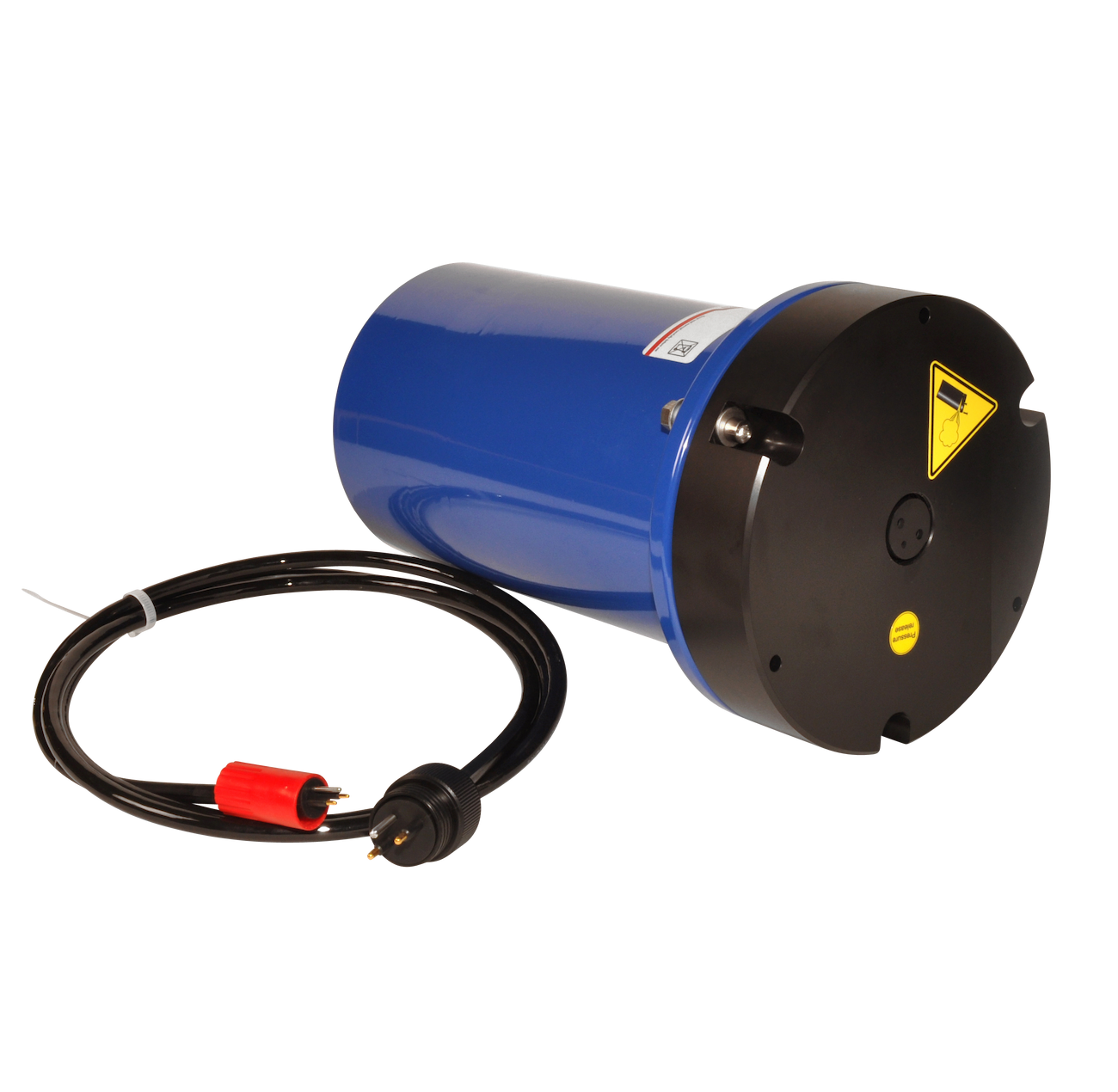
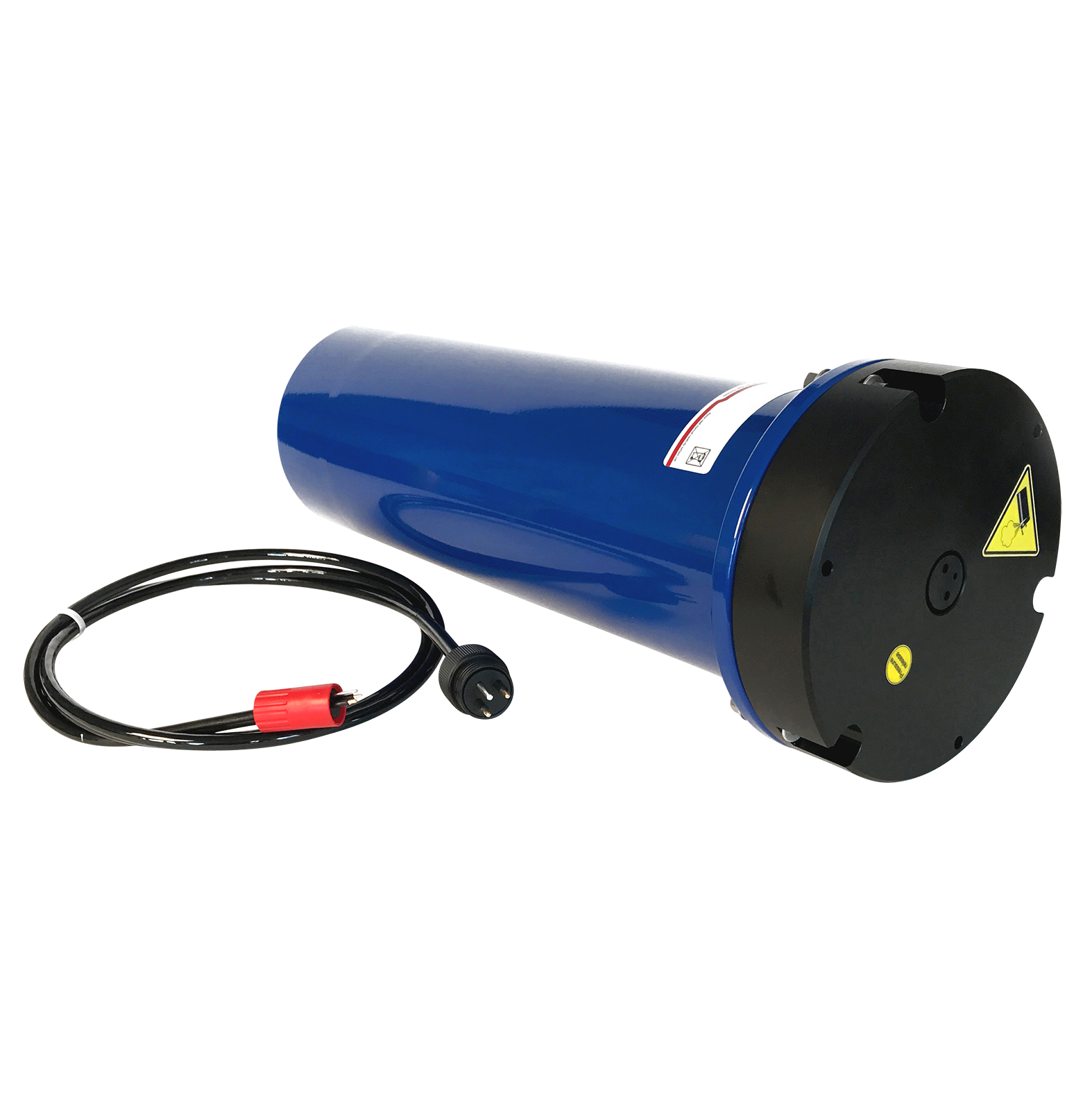
Signature1000 VM
Signature500 VM
Signature250 VM
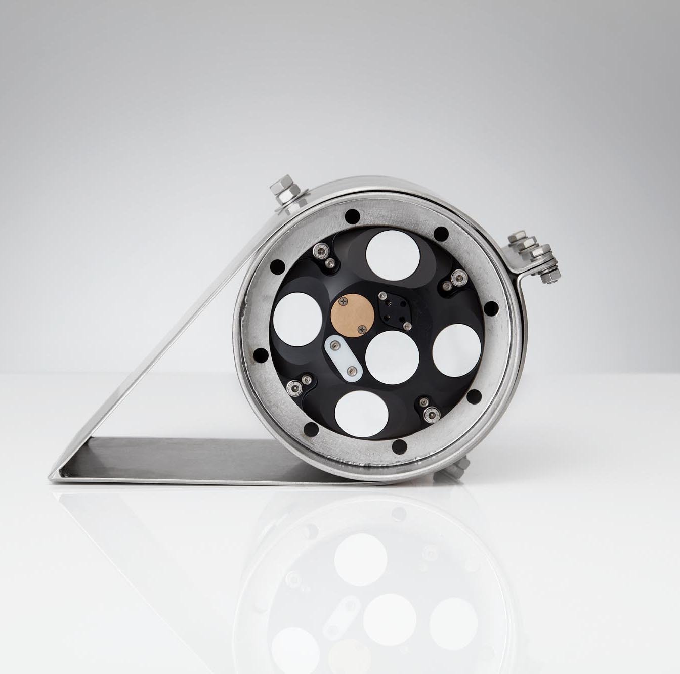
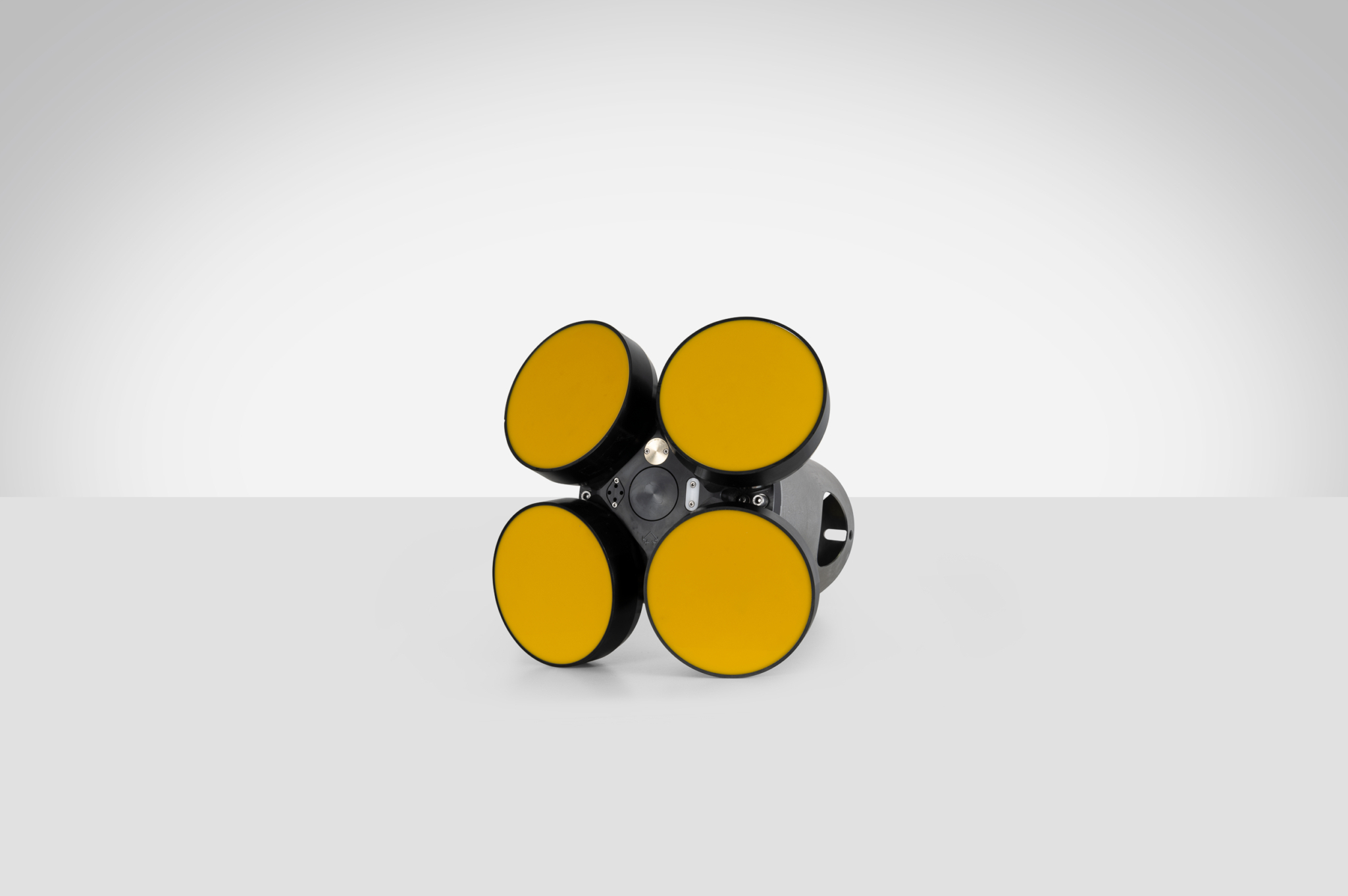
5-beam head (1000, 500)
4-beam head (250)
5-beam head (adds 500 kHz center transducer for wave measurements) (250)
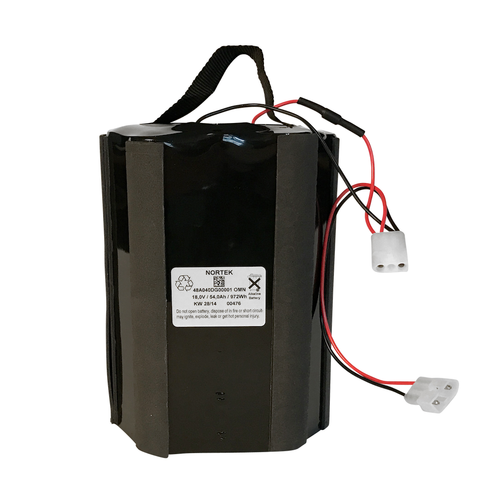
Short, no room for battery (external battery canister for bottom mount use)
16 GB SD card data logger
64 GB SD card data logger
128 GB SD card data logger
256 GB SD card data logger
Pressure sensor 0-300 m, 0.1% (standard)
Pressure sensor 0-50 or 0-100 m, 0.1% (option)
AD2CP: 10 m Ethernet cable with MCIL6MP, Power/RJ45 at dry end (standard)
AD2CP: 10-100 m Ethernet cable (specify length) with MCIL6MP-PWR/RJ45
GNSS: GC-POE-CABLE-20M Ethernet cable for GNSS Compass 20 m (please inquire for other length)
Vessel Mounted over the side
Vessel Hull mounted
Unmanned Surface Vehicle (USV) mounted (please inquire)
Compass and Tilt sensor
AHRS