Using a versatile vessel-mounted ADCP to obtain high-resolution current data in estuarine and near-shore environments
- User stories
Synopsis
Challenge
Water depths can vary enormously across short distances. Nortek’s Vessel Mounted Signature was put to the test during two site transect surveys in China and the Netherlands.
Solution
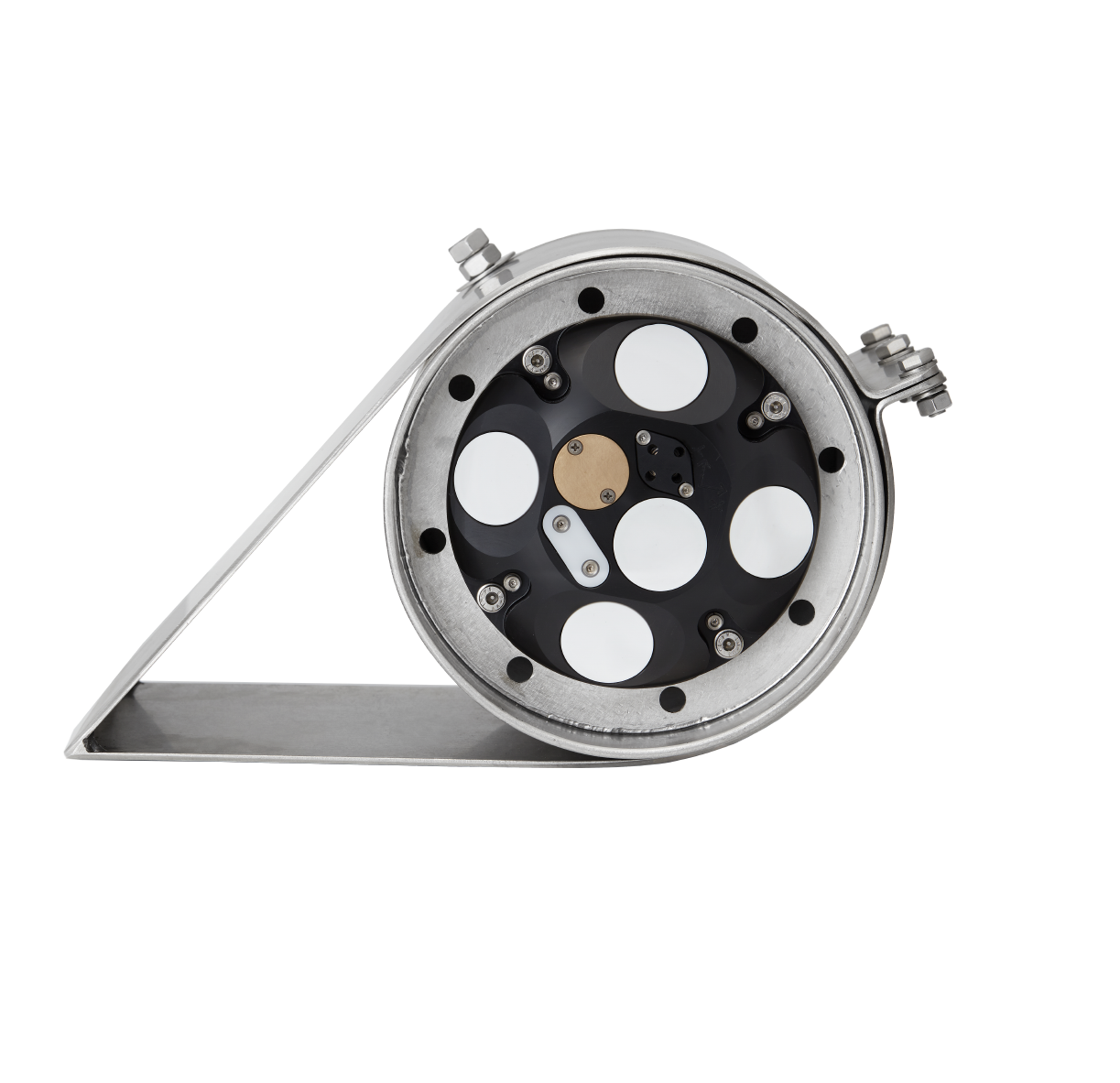
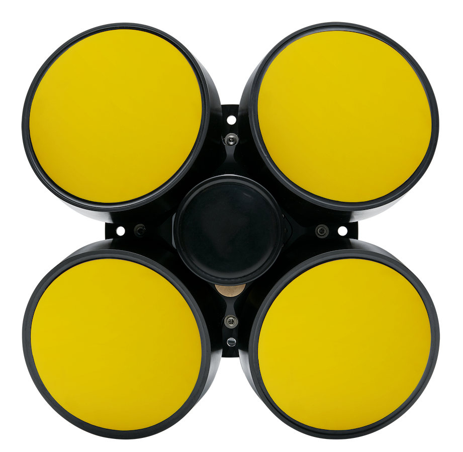
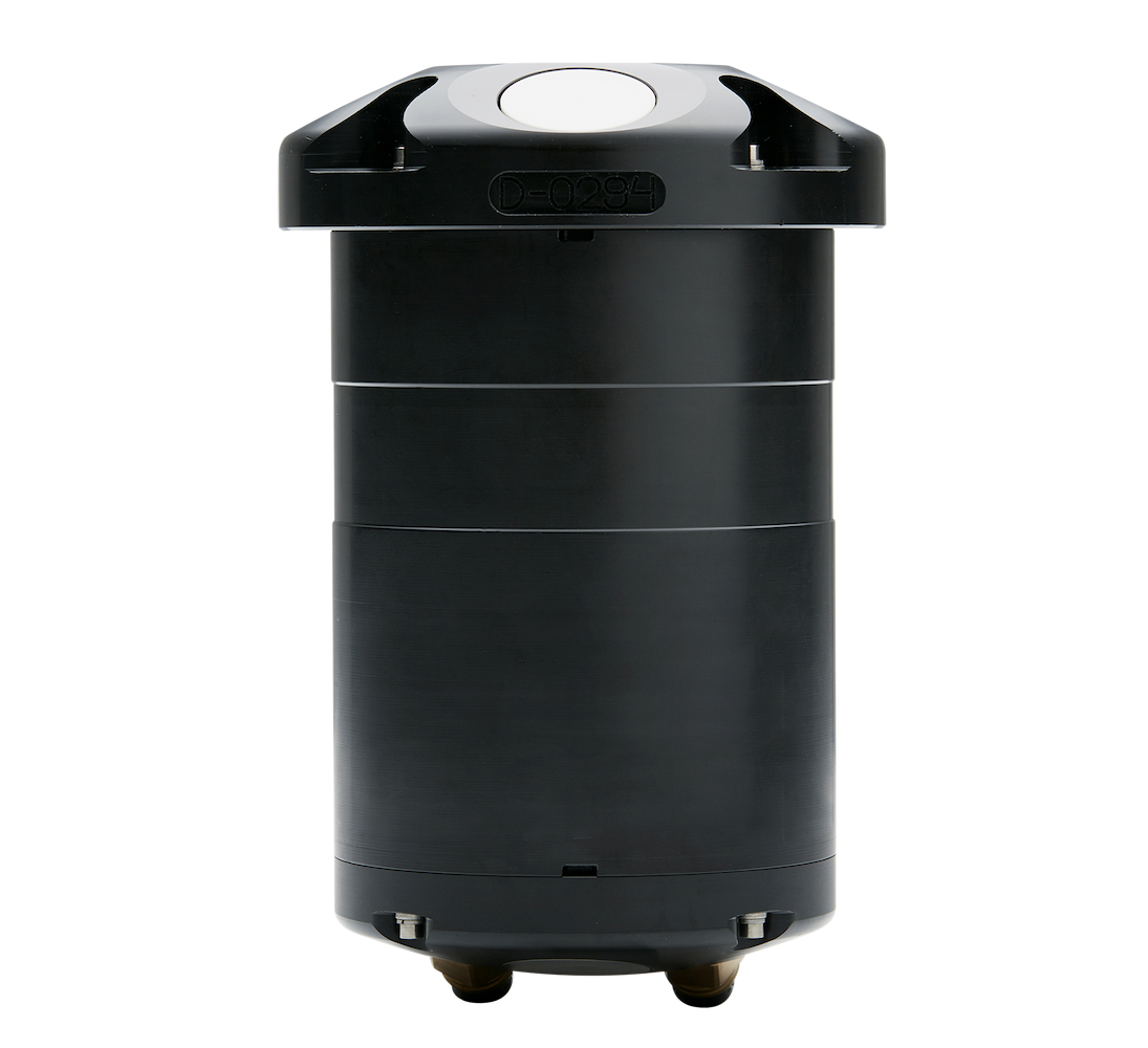
The low frequency of Nortek’s Signature 250 ADCP makes it suitable for obtaining current measurements in water depths up to 200m, but it can also perform in shallower water due to a high sampling rate. Tests showed successful bottom track and current measurement across multiple depths and condition combinations.
Benefit
The versatility of the SignatureVM system permits high-quality current measurements from moving vessels, even with complex bathymetry.
As shown from two deployments in China and the Netherlands, the Signature 250 can be used to obtain high-resolution data with a single instrument in estuarine and near-shore environments.
Deploying the vessel-mounted Signature 250 ADCP in the Bohai Strait, China
In September 2020, Nortek China deployed the Signature 250, providing an opportunity to assess instrument performance in depths from 60 to 70 m and current speeds upwards of 0.2 m/s.
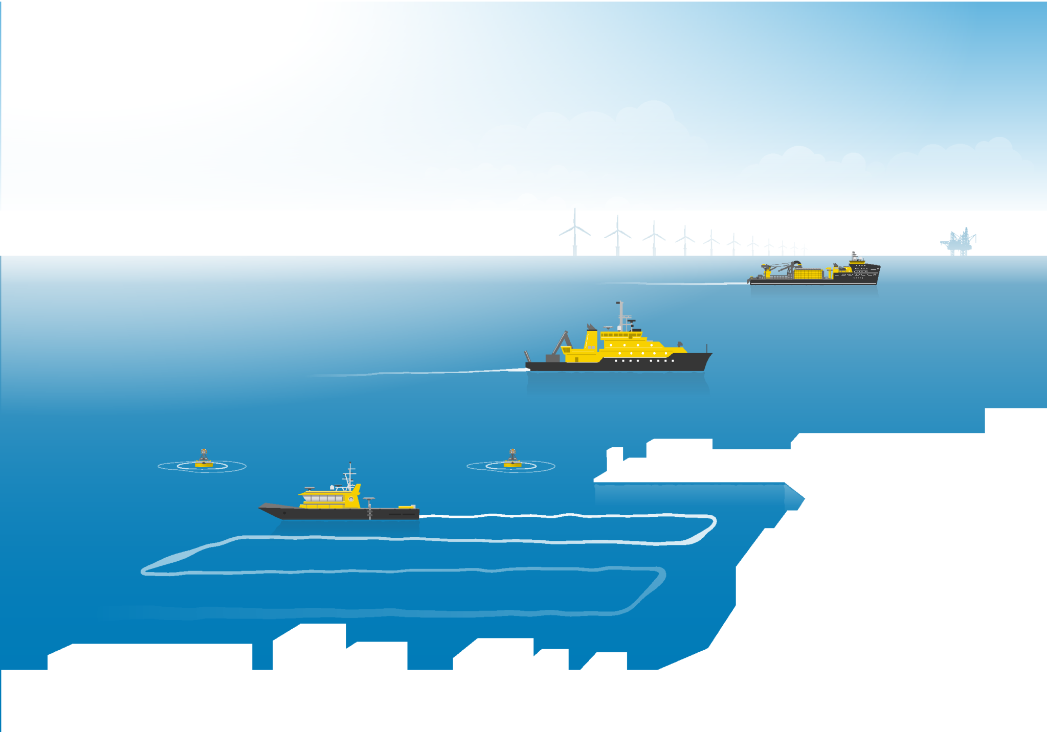
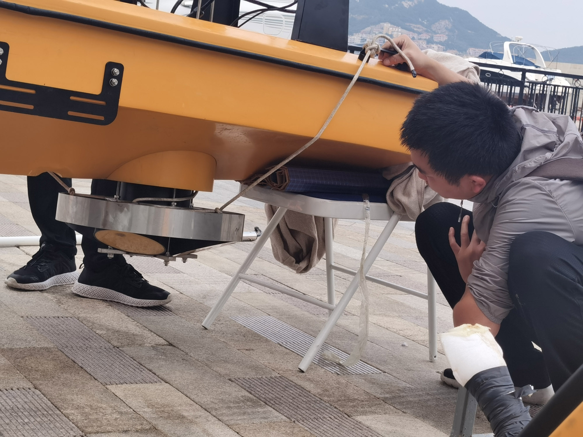
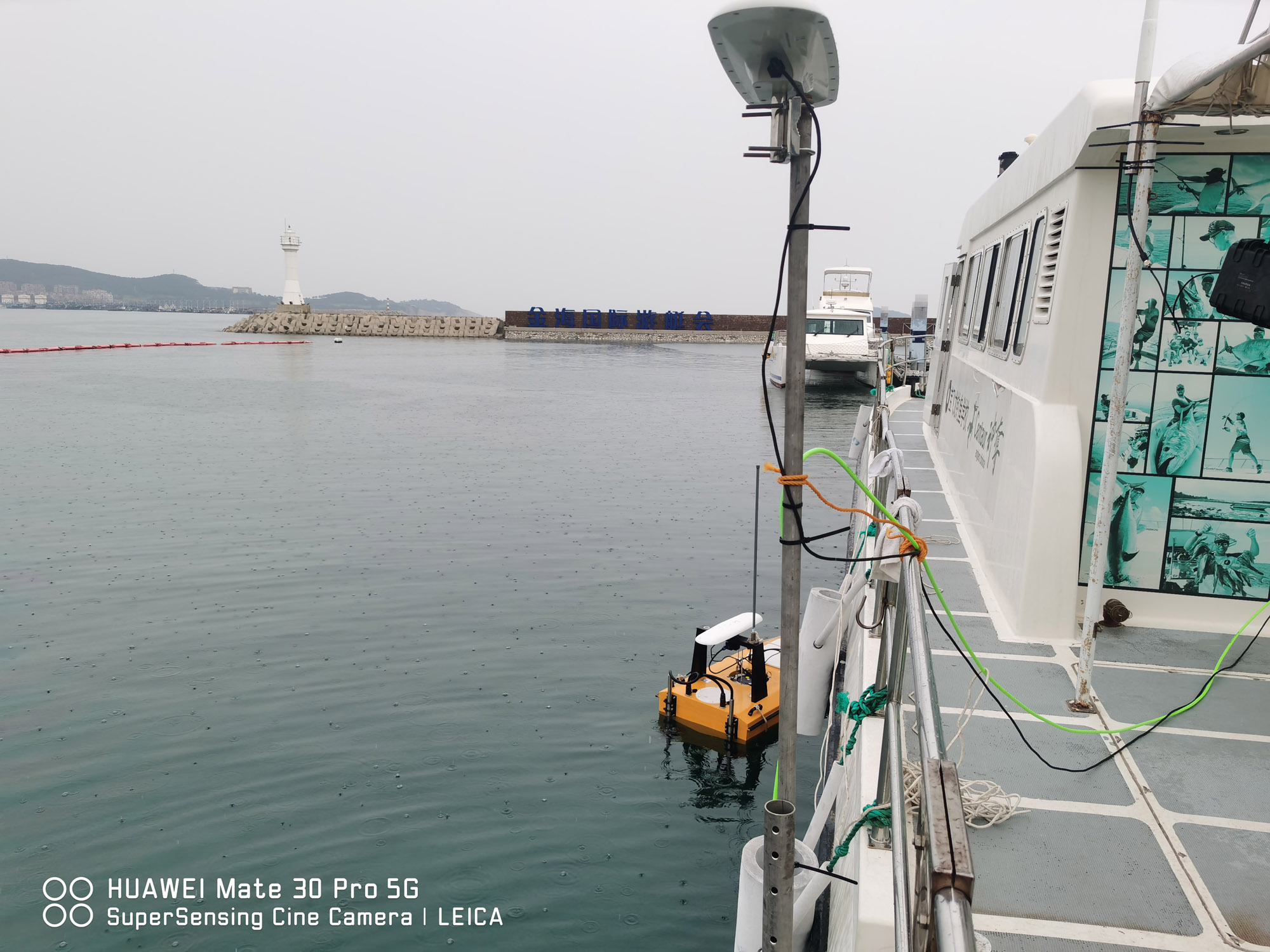
Deploying the vessel-mounted ADCP on an unmanned surface vehicle in a dynamic environment
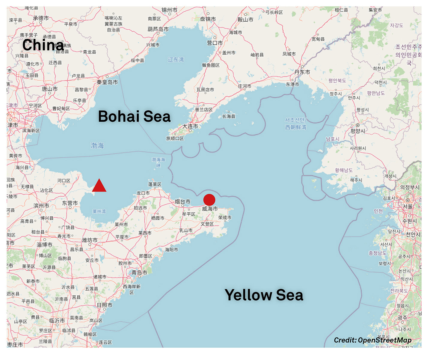
The test took place in the Bohai Strait (Figure 1), which connects the Bohai Sea and the Yellow Sea and transports sediment-rich waters from the Yellow River. The seabed in the region sailed is comprised of silt, clay and sand.
(To learn more about the conditions in this area, please see “The Impact of Winter Storms on Sediment Transport Through a Narrow Strait, Bohai, China”.)
Bottom track and four cell sizes were tested over 8.5 km. Waters were sampled using a vessel-towed, unmanned surface vehicle (Figures 2 and 3). Sail speed ranged from 0.8 to 1.3 m/s. For the six tracks sailed, cell sizes of 1, 2, 6 and 8 m were tested with a sample rate of 1 Hz.
Motion and bottom track when deploying the vessel-mounted Signature 250 in China
For most of the distance sailed, the pitch and roll varied from a few degrees to five degrees, with a maximum pitch of seven degrees. Bottom lock was 100 per cent under these conditions. A few incidents of bottom-track dropout occurred, with rolls up to 17 degrees and pitch up to 23 degrees. This indicates reliable bottom lock onto a relatively soft bed in waters up to 70 m deep.
Learn more about vessel-mounted current surveys along China’s Maritime Silk Road
A vessel-mounted ADCP with optimal velocity resolution in moderate depths
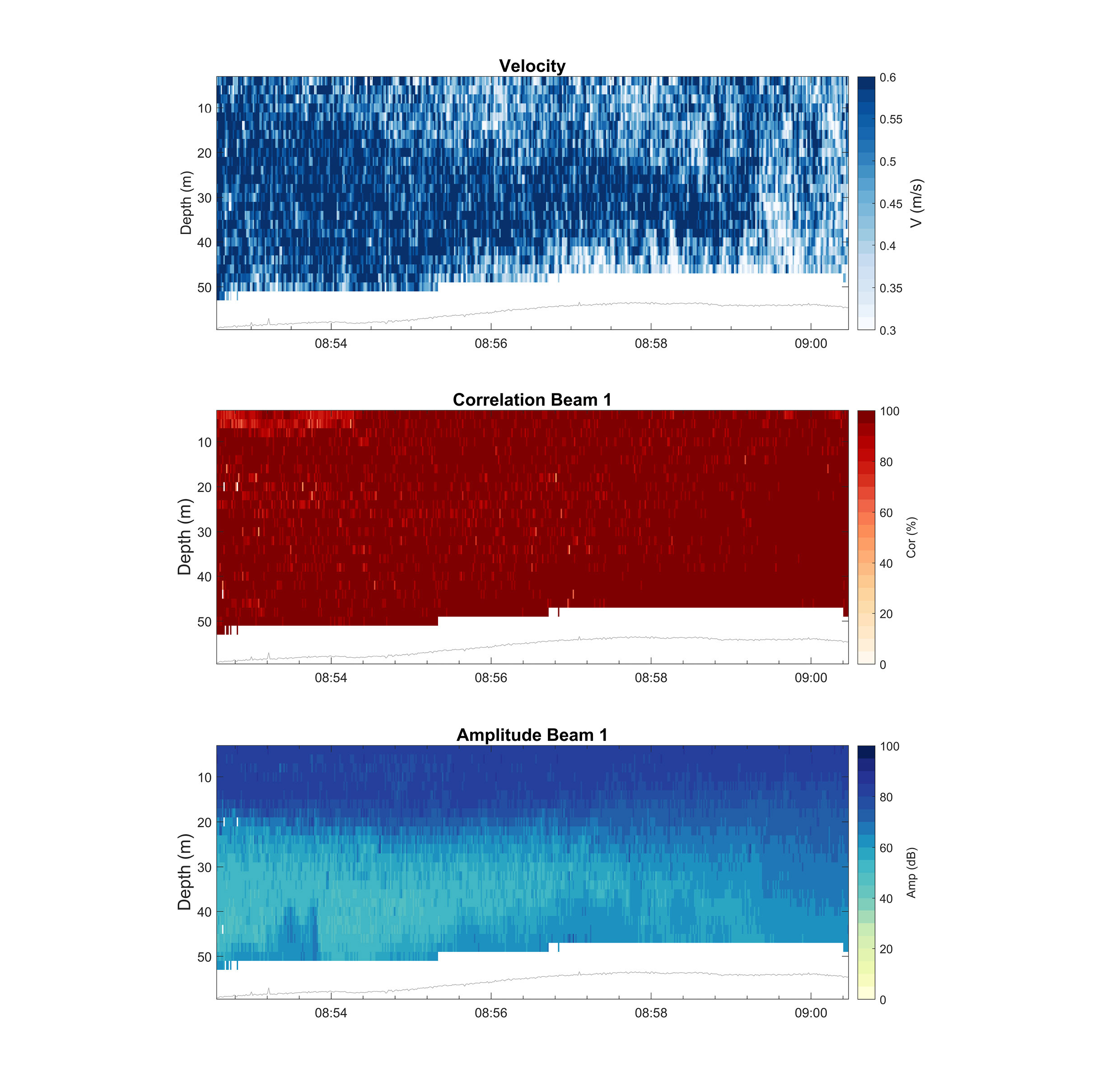
The 1 m cells had a noisy appearance, while the larger cells had a coarse, over-averaged appearance. A cell size of 2 m provided an optimal balance of resolution and quality in this deployment. Figure 4 shows a high-resolution view of the water column with a bottom-track-derived seabed at approximately 60 m depth and correlation and amplitude well above thresholds (50 per cent and 30 dB, respectively).
Deploying two vessel-mounted ADCPs in the North Sea Canal, the Netherlands
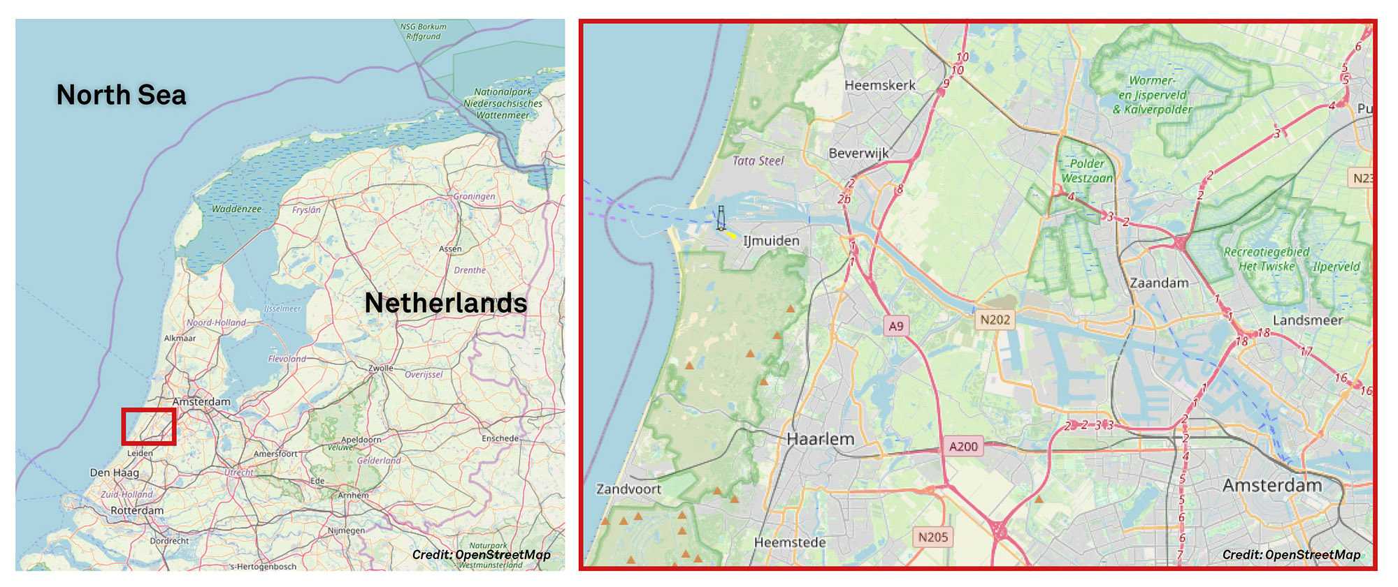
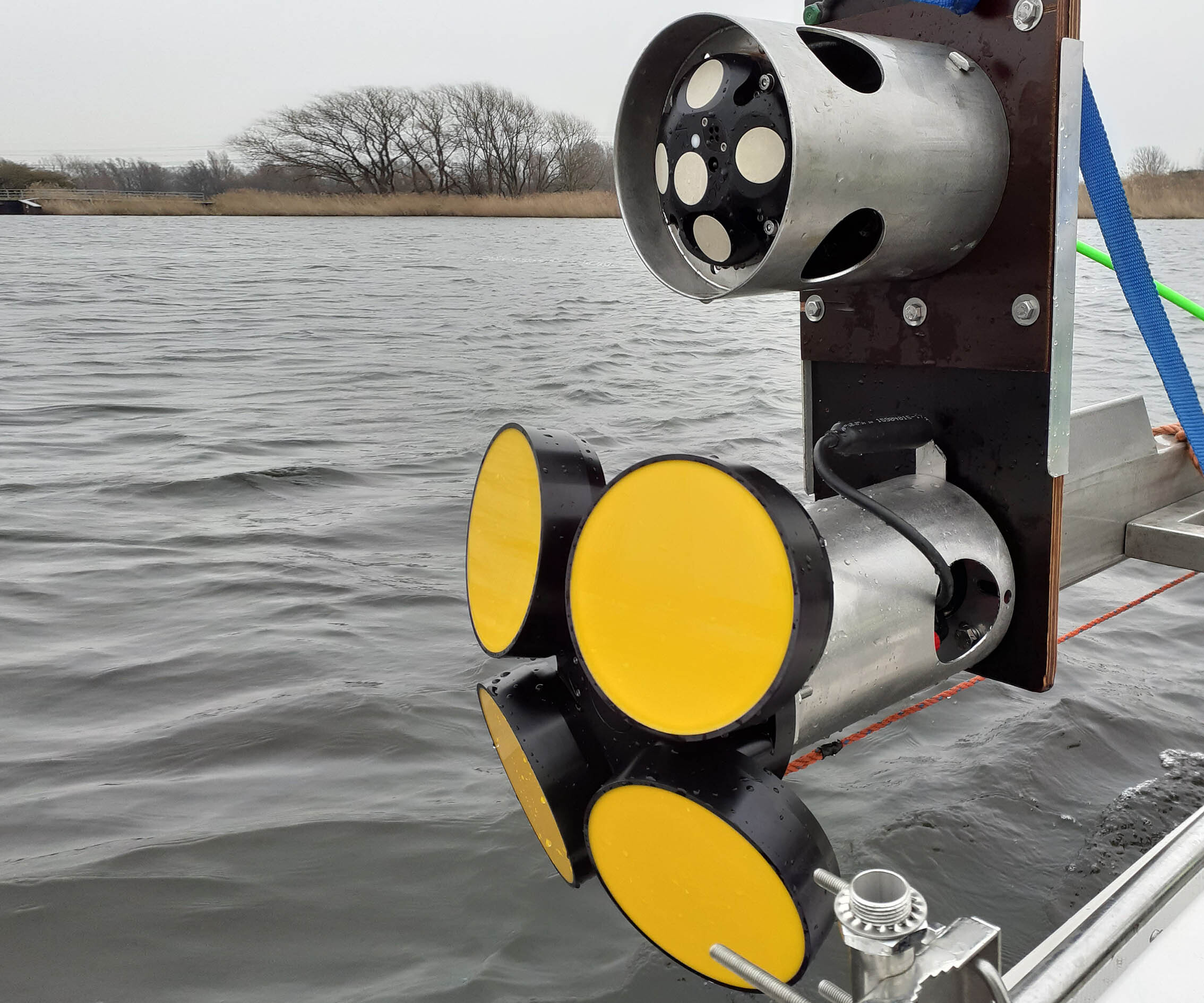
In March 2021, Nortek in the Netherlands paired a Signature 1000 and a Signature 250 with no resulting interference. This deployment was initiated to test software updates and bottom-track performance in the North Sea Canal (Figure 5).
Video: Learn how a vessel-mounted ADCP helps keep a Dutch navigation channel open
The North Sea Canal is a navigation channel connecting the North Sea and Amsterdam. Discharge enters the sea through the IJmuiden Lock Complex, which houses the largest pump station in Europe. Currents are relatively low in the canal, which is below mean sea elevation.
Bottom track from vessel-mounted ADCPs was tested over 18.5 km with high-resolution settings
Four tracks totaling 18.5 km in length were sailed using a double deployment (Figure 6) in choppy conditions (Figure 7), with the Waterwolf, a 5.5 m vessel. Cell sizes of 1, 2 and 2.5 m were tested at 1 Hz.

Motion and bottom track when deploying vessel-mounted Signature ADCPs in the Netherlands
The steel mounting frame and instruments withstood pitch as high as eight degrees and roll as high as six degrees, yielding 100 per cent bottom lock in depths of 2 to 20 m.
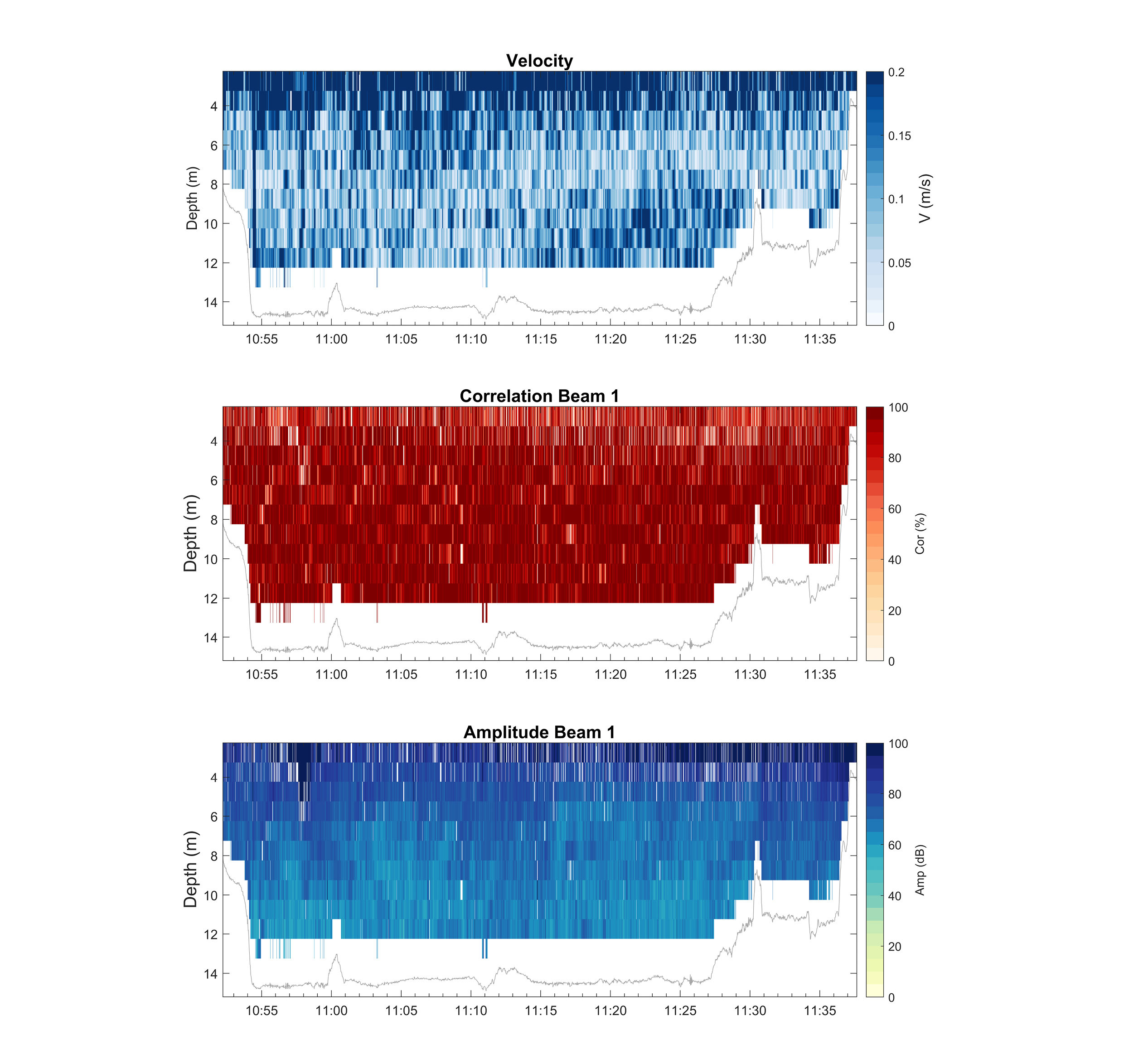
Optimal velocity resolution in shallow water
The velocity profile displays a 1 m resolution view of transport in this relatively shallow, gravity-driven channel. A bottom-track-derived seabed at approximately 14 m depth is shown along with correlation and amplitude, which are generally above thresholds (Figure 8).
Conclusion – the Signature 250 ADCP is a versatile instrument capable of bridging the gap between coastal and deep waters
These deployments represent success in two very different environments. High-quality, high-resolution current data were captured in the sediment-rich, estuarine regime of the Bohai Strait via a towed, unmanned surface vehicle. Data obtained from a Signature 250 mounted to a relatively small vessel was sufficiently detailed to capture variability in the sluggish currents of a shallow navigation channel. Both deployments yielded high-performing bottom track in the presence of motion. The Signature 250 can be optimized with 1 m cell sizes in shallower water and 2 m in moderate depths. This makes it a versatile instrument capable of bridging the gap between coastal and deep waters.
Reference: Wang C, Liu Z, Harris C, Wu X, Wang H, Brian C, Bi N, Duan H, Xu J. The impact of winter storms on sediment transport through a narrow strait, Bohai, China. Journal of Geophysical Research: Oceans. May 2020.