 Roos van Dorp
Making discharge measurements simpler and smarter
- Company & product news
The critical role of reliable discharge measurements
Accurately quantifying discharge is essential for applications ranging from hydrology and climate research, civil and hydraulic engineering to flood risk management. Yet, campaigns aiming to measure discharge from a moving vessel are often constrained by short field windows, complex equipment setups, and high data workloads. The VM Coastal system simplifies this process, empowering users to capture, review, and report reliable discharge data faster than ever.
A powerful innovation for reliable discharge data
Nortek's VM Coastal new discharge feature can deliver real-time flow computation, intuitive visualization, and connect to USGS’ QrevInt. software. This latest innovation transforms how scientists, engineers, and environmental professionals measure, review, and validate water discharge in coastal and riverine environments. Beyond discharge measurements, the VM Coastal system now enables users to explore turbulence dynamics and suspended particle transport, making it the go-to solution for integrated coastal and river research.
Key improvements in the VM discharge mode
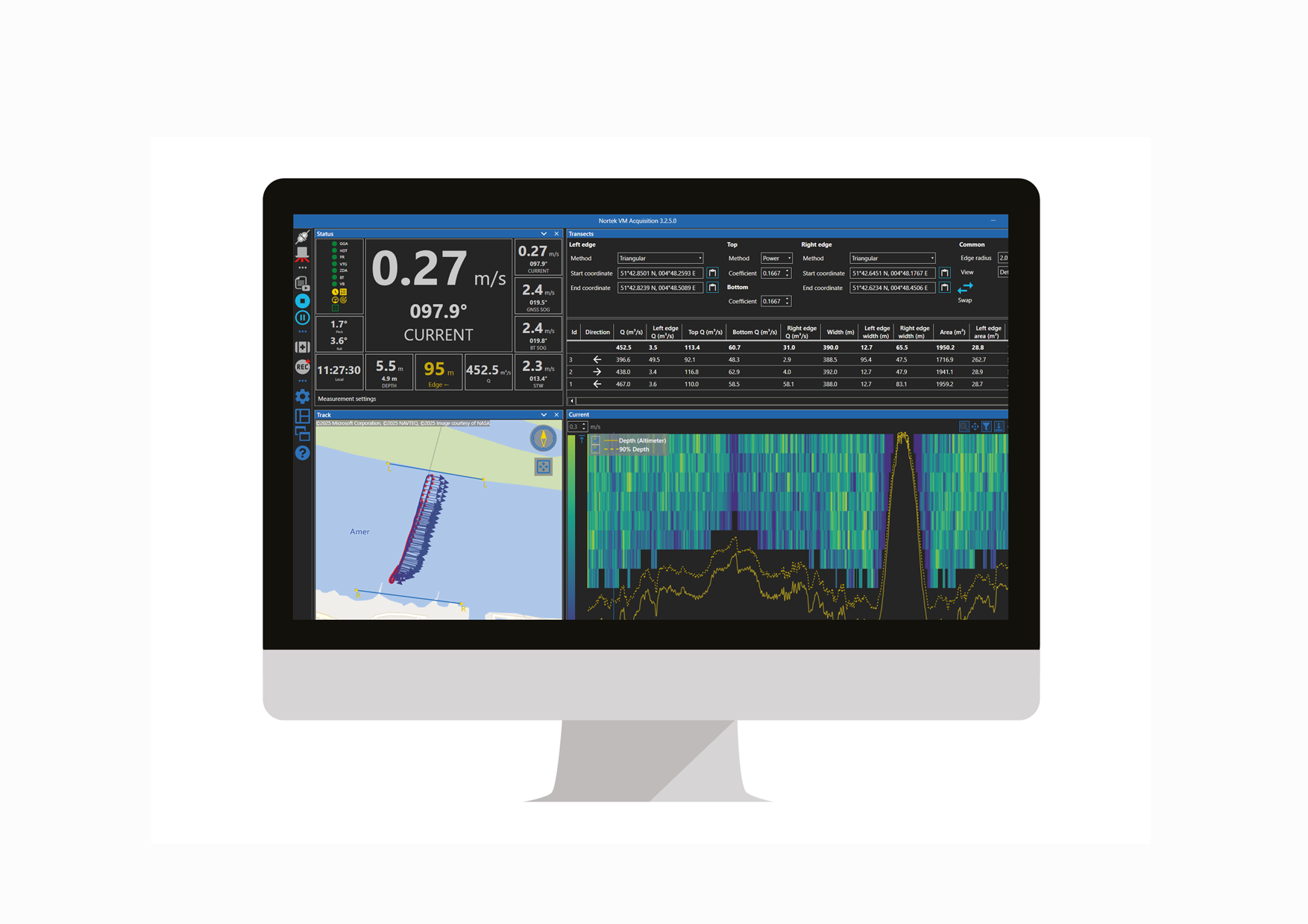
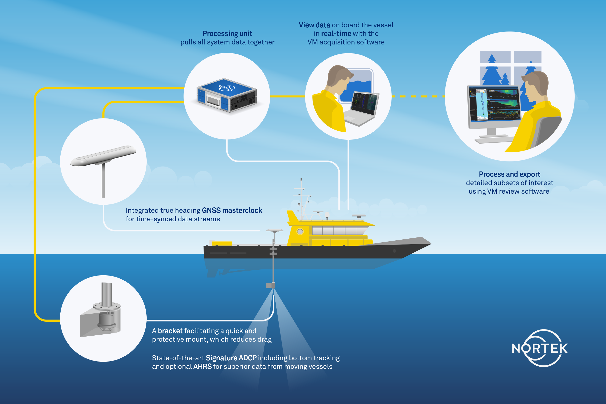
Integrated discharge computation in Nortek’s VM Acquisition Software
Users can now compute and visualize discharge directly within the VM Coastal Acquisition Software using the new discharge mode that requires no external tools.
- It provides a straightforward interface for discharge measurement, while still allowing users to display optional parameters such as the 5th beam backscatter echogram for suspended particulate matter (SPM) monitoring
- The software now supports automatic recognition of transects — no need to manually start or stop each one
- Edge extrapolations are automatically calculated based on real GNSS coordinates
- Built-in warnings alert users if sailing speed, duration, or edge ensemble counts fall outside recommended limits, helping ensure data quality in real-time
VM Review Software provides a streamlined environment for data review and post-processing, working hand-in-hand with the acquisition software.
- It automatically detects and extracts transects, bottom track loops, or SMBA measurements from each dataset, eliminating the need for extra BT loops
- It supports batch processing for long-duration measurements, such as 13-hour tidal surveys
- The software enables easy export of visualizations and data to picture files, CSV, or MATLAB formats
- Compatibility is ensured with USGS’ QrevInt., the globally trusted post-processing standard, guaranteeing accuracy, consistency, and regulatory traceability
Built for challenging field conditions
With true RTK GNSS heading replacing traditional magnetic compass calibration, the VM Coastal ensures stable and accurate measurements even near metallic structures or in areas with magnetic interference.
The GNSS master clock and embedded AHRS enhance data reliability when bottom track is unavailable. This is a significant advantage for small, fast-accelerating, and turning vessels operating in choppy or dynamic conditions.
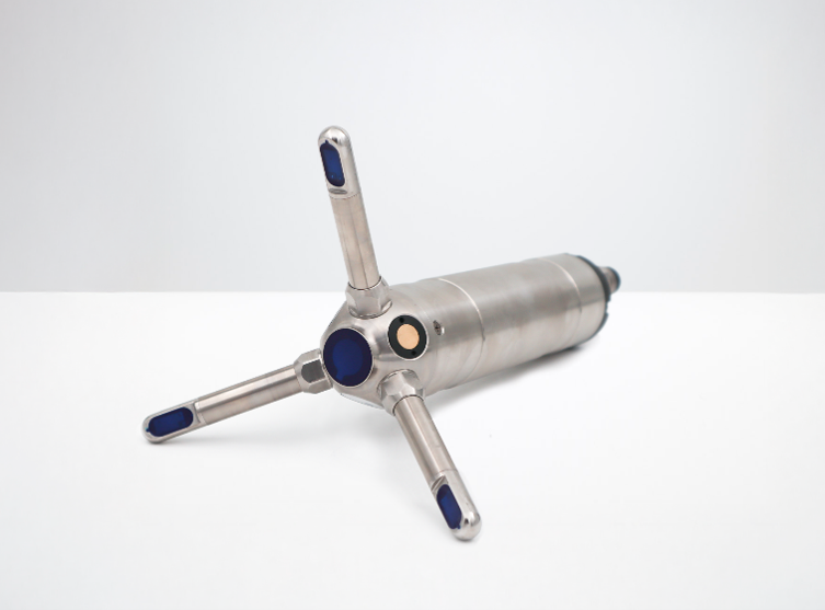
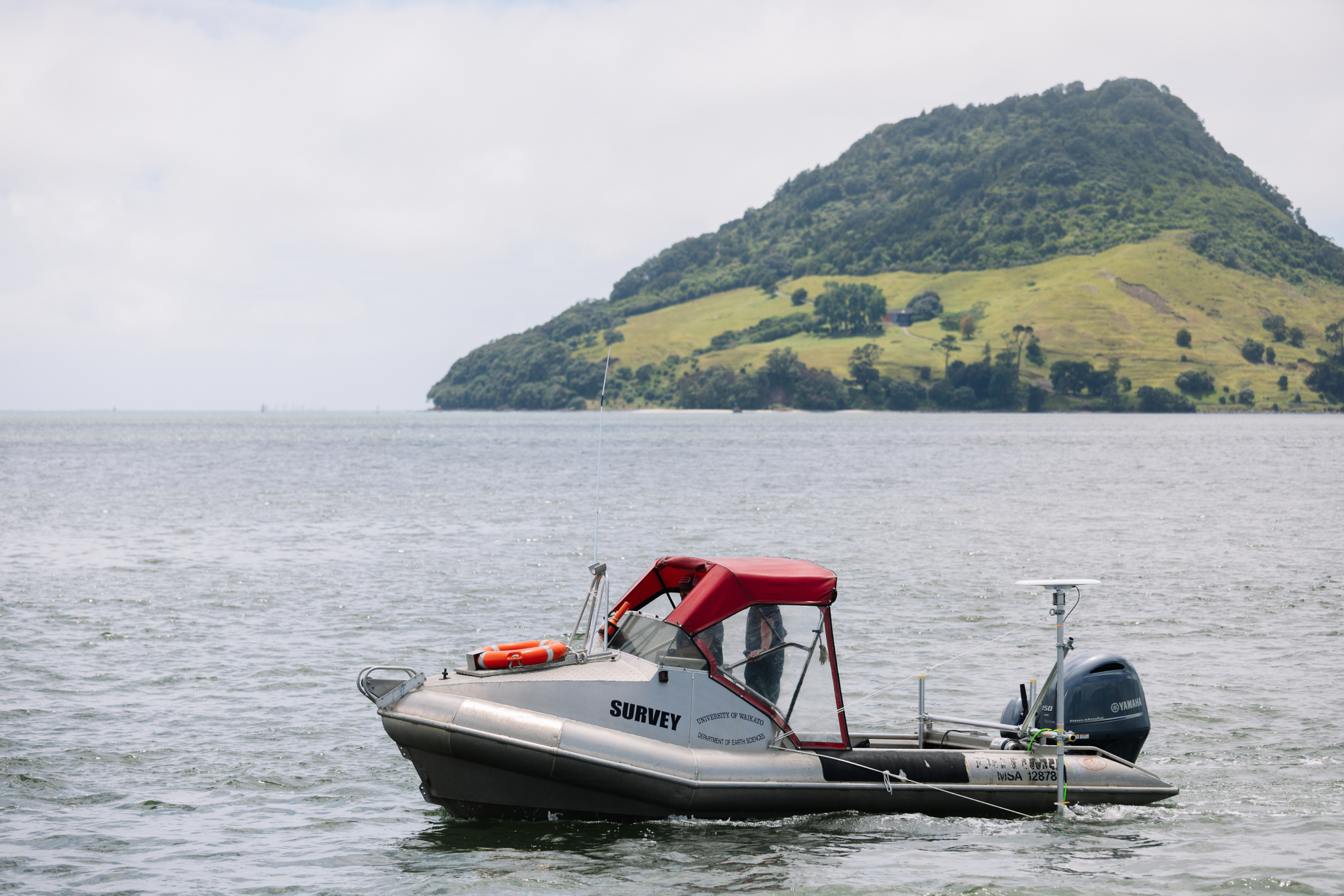
The VM Coastal is designed for use on a wide range of vessels, from 3 m rigid inflatable boats to 20 m crewed survey vessels and large USVs, and performs optimally in waters wider than 30 m and deeper than 2 m.
Advantages for practitioners
For practitioners, the solution provides a clear and straightforward experience. Its simplified setup and intuitive operation mean there’s no steep learning curve, making it a quick deployment and provides immediate usability. Once in action, it consistently delivers high-quality data, even under the most demanding real-world conditions. Beyond performance, it’s also cost-effective and designed for efficiency, helping professionals save time and resources while maintaining the highest standards of accuracy.
The benefits of this solution can be used in a wide range of fields, ranging from geomorphology and sedimentology to ecology and environmental science, climate and earth system studies, civil and hydraulic engineering, as well as flood and water resource management.
Explore the VM Coastal series here, or reach out to your local Nortek representative to request a sample data set or arrange a live demonstration.
Stay Connected
By subscribing, you'll be the first to know about new vessel-mounted developments.
When signing up, don't forgot to select the vessel-mounted box option to receive tailored content and updates specifically for your area of interest.