
Overview
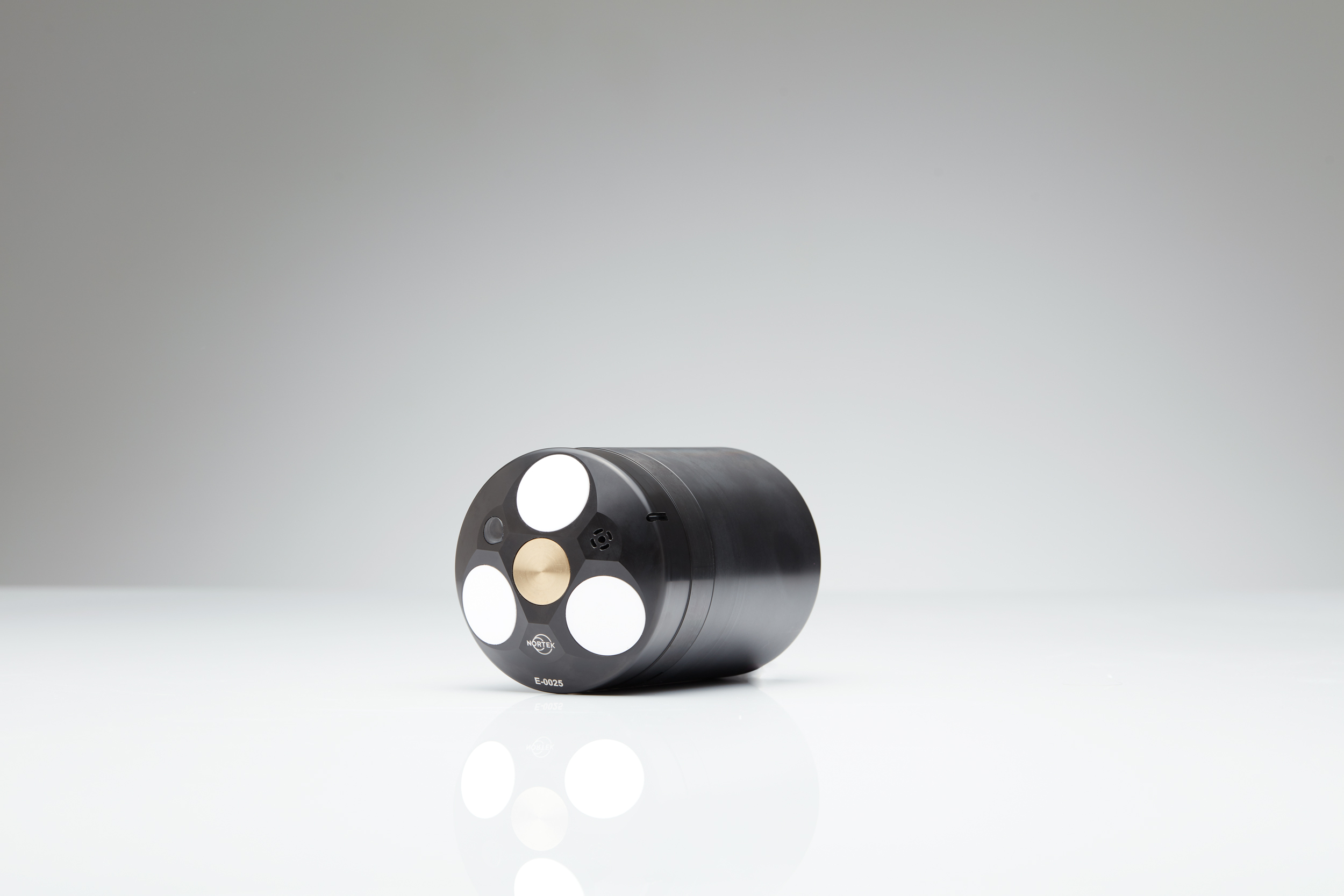
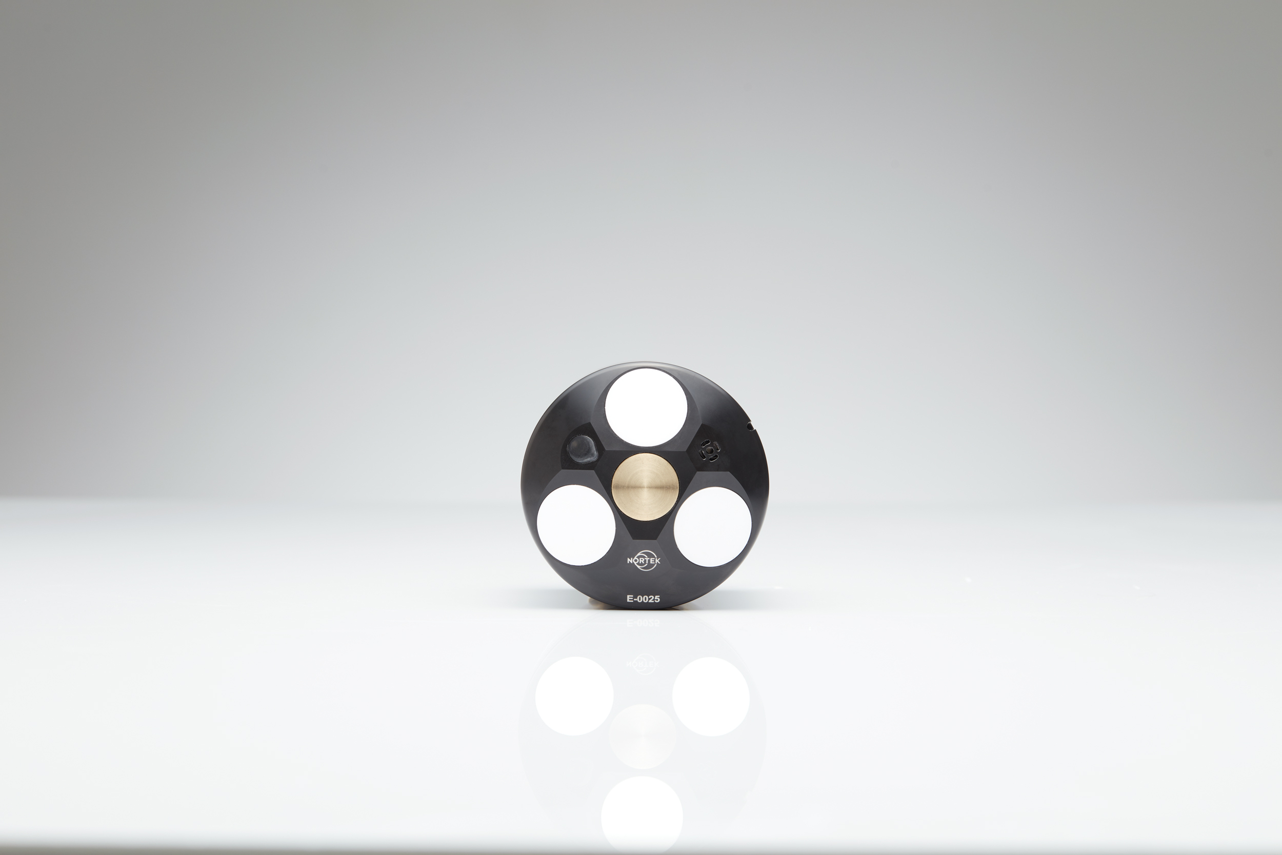
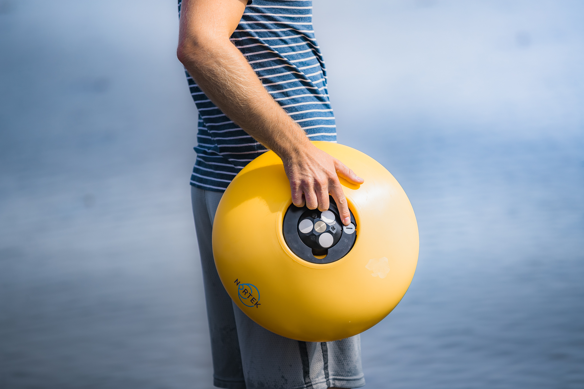
The Eco current profiler is the first ADCP right-sized and designed specifically for shallow-water measurements. It allows you to measure water velocities in situ, through the water column using the same acoustic Doppler technology as other Nortek instruments, but in a more affordable and easy-to-use package. Simple buoy and bottom-mount solutions are available and designed to fit Eco off-the-shelf. Eco is portable enough to be put in the water from a paddle board or kayak by one person. While the Eco does not feature many of the more complex capabilities of other Nortek instruments, such as wave measurements, turbulence estimation, or echosounder data, Eco does present a host of new, unique capabilities.
Read more about Eco's capabilities here.
- Currents
Highlights
-
Self-configuring data collection in various depths and water types
-
Seamless current profiles from 30cm to 20m from the instrument
-
Built-in battery and inductive battery charger. No cables or connectors!
-
Integrated deployment and recovery system available
-
Built-in GNSS, temperature, pressure and tilt sensors
-
Automated data processing to ensure quality data reports with no prior ADCP experience
-
Weighs only 1 kg in air and is only 13 cm tall
Usage
-
Shallow-water estuarine studies
-
Short- and longer-term coral reef studies
-
Coastal engineering projects
-
Educational use with graduate students, undergraduates or young students
Setup
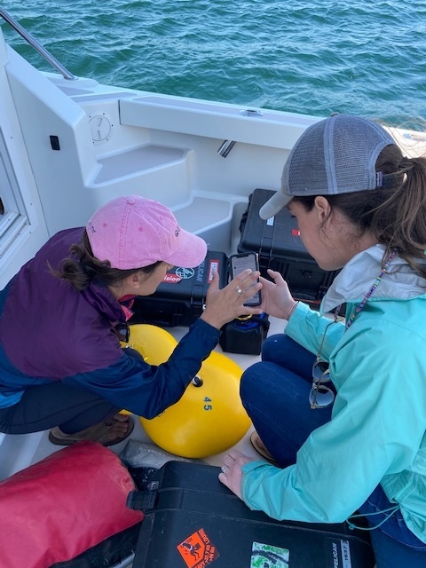
The Eco is configured online via the Eco WebApp through Bluetooth communication. Users need only to input their desired measurement interval (as little as 2min or as much as 1hr) and expected water salinity (fresh, salt, or a mix). Designed specifically for first-time users and students, the WebApp is also used to configure the Eco’s accompanying timed release.
Deployment
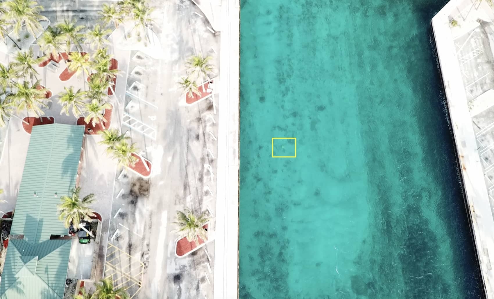
Two off-the-shelf deployment solutions are available for the Eco: a tripod for bottom-mounted deployments in shallow water, and a buoy system with a timed release for deployments in slightly deeper water. An LED on the Eco displays the Eco’s status and assures users of function.
Data
After recovery of the Eco, data is loaded back onto the WebApp via Bluetooth. Data processing is done automatically, including data quality controls accounting for sidelobe and fish interference, bin mapping and other common issues. Users are presented with current velocity in three depth layers. Raw data cannot be accessed.
Maximum profiling range* |
20 m |
Cell size |
Self-configured (profiling range 0.3-20 m) |
Minimum blanking |
0.1 m |
Maximum number of cells |
3 |
Accuracy |
±1% of measured value ±0.5 cm/s |
Velocity resolution |
0.1 cm/s |
Maximum sampling rate (output) |
2, 4, 5, 6, 8 10, 20, 30 or 60 minutes |
Velocity range (horizontal) |
±5 m/s |
*Dependent on measurement conditions |
Sampling |
N/A |
Transducer acoustic frequency |
1 MHz |
Number of beams |
3 |
Beam width |
3.4° |
Type |
N/A |
Temperature |
Thermistor in head |
Temp. range |
-4 to +40 °C |
Temp. accuracy/resolution |
0.1 °C/0.01 °C |
Temp. time response |
2 min |
Compass |
Solid-state magnetometer |
Accuracy/resolution |
3° for tilt < 30°/0.01° |
Tilt |
Solid-state accelerometer |
Accuracy/resolution |
0.2° for tilt< 30°/0.01° |
Maximum tilt |
30° |
Up or Down |
Up-looking only |
Pressure |
Piezoresistive |
Range |
50 m |
Accuracy/precision |
0.5% FS / 0.005% of full scale |
Position |
embedded GNSS receiver |
Accuracy |
3 m |
No. of channels |
N/A |
Capacity |
16 GB (>5 yrs back-to-back monthly deployments without formatting) |
Accuracy |
±2 min/year |
I/O |
Bluetooth Low Energy (BLE) |
User control |
Smart device and PC App with secure cloud storage Eco account |
Bluetooth and NFC tag module |
NINA-B112-02B |
Bulkhead |
None |
Cable |
None |
Functions |
Deployment planning, instrument configuration, data retrieval, secure cloud storage, automatic data processing, automatic report generation, deployment position mapping with embedded GNSS. |
DC input |
N/A |
Battery capacity |
70 Wh rechargeable smart Li-ion charged by induction |
Operating temperature |
-5 to +40 °C |
Storage temperature |
-20 to +60 °C |
Shock and vibration |
IEC 60068 |
EMC approval |
EN301489, EN 61326, EN61000 |
Depth rating (Eco) |
50 m |
Depth rating (Release) |
60 m |
Standard model |
POM |
Maximum diameter |
85 mm |
Maximum length |
130 mm |
Weight in air |
1.02 kg |
Weight in water |
0.28 kg |
Deployment planning, instrument configuration, data retrieval, secure cloud storage, automatic data processing, automatic report generation, deployment position mapping with embedded GNSS.