Why accurate data on speed through water is essential for sub-seabed survey vessels
- User stories
Synopsis
Challenge
Offshore wind farms represent a significant investment, requiring meticulous planning to mitigate risks. One risk during construction and installation is the presence of hazards beneath the seabed, the most significant of which is potential unexploded ordnance (pUXO) – bombs and other explosive devices that have not detonated as intended. Finding such devices quickly and accurately is a challenge that must be overcome before construction commences.
Solution
A fast and accurate survey of the sub-seabed can locate hazards that might be met during offshore construction, before detailed planning even begins. Nortek’s vessel-mounted ADCP solution – VM Operations – supports these high-resolution, accurate subsea surveys with real-time oceanographic data for current and tidal flow.
Benefit
Risk mitigation that could save millions of dollars and thousands of lost work-hours by avoiding the need for crisis management of issues that might arise due to undetonated buried explosives.
Commercial maritime activity is moving further offshore into more challenging environments. Secure and accurate operational current data is essential to safely optimizing vessel operations.
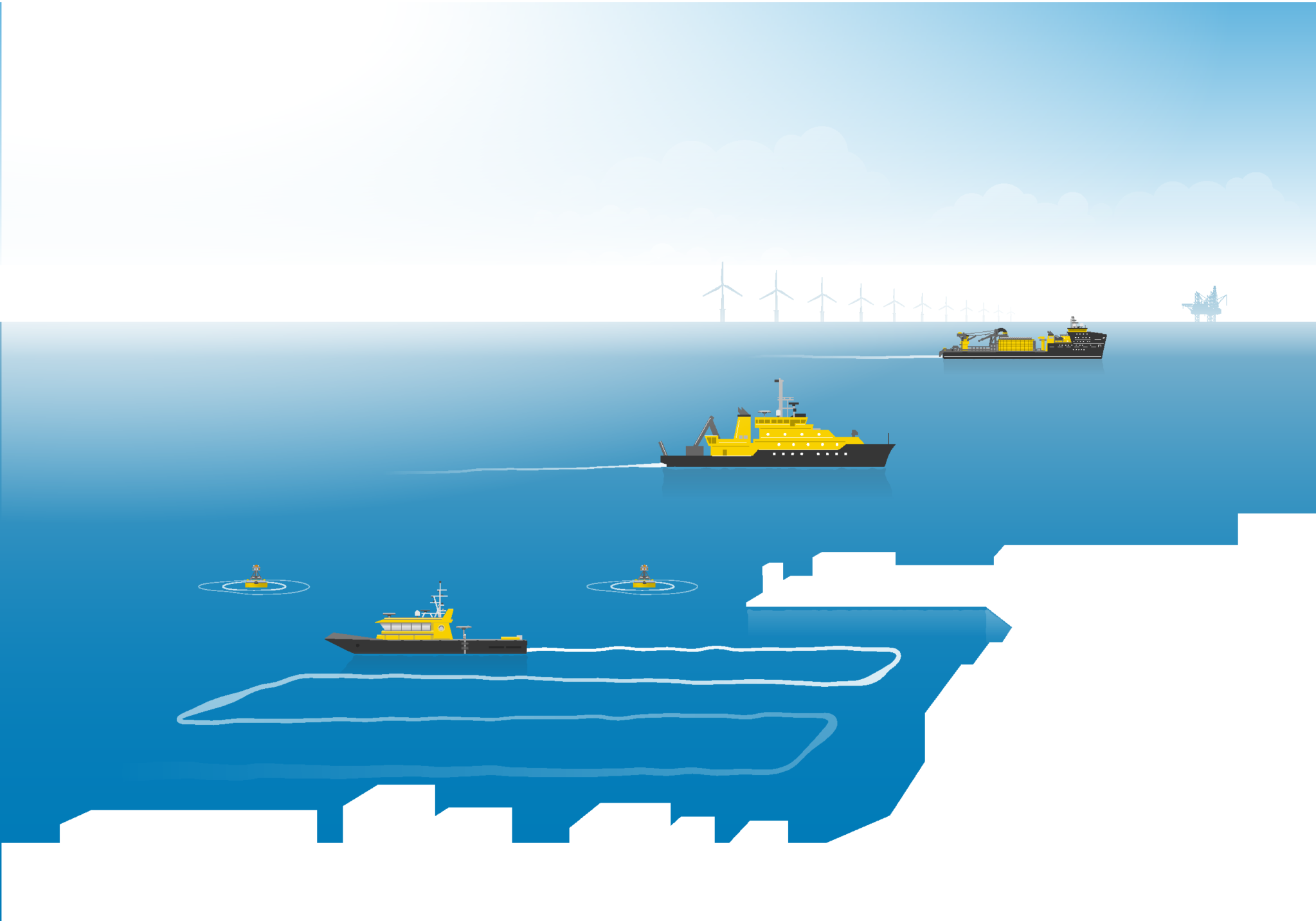
The need for accurate current data during surveys has been demonstrated while ScottishPower Renewables has been developing its East Anglia Hub, an offshore wind complex with the ultimate goal of delivering a capacity of over 3 GW of electricity from more than 250 wind turbine generators, installed across hundreds of square kilometers of the southern North Sea.
Fugro was contracted to provide the geophysical surveys for this wind field, a multidisciplinary investigation that included sub-seabed mapping to support foundation design, cable routing and engineering.
Fugro in turn chose to collaborate with offshore operator Kraken Robotics to perform a Remotely Operated Towed Vehicle (ROTV) survey.
“Kraken Robotics Services provides a range of acoustic tools and vehicles for imaging and surveying objects and structures below the sea floor,” explains Ian Rouse, an offshore manager for the company and who was in charge of the survey.
“This includes pipe and cable depth of burial surveys, UXO [Unexploded Ordnance] and debris identification as well as boulder identification and seafloor structure analysis. This survey was completed to identify potential unexploded ordnance and other buried objects on the East Anglia Hub corridor.”
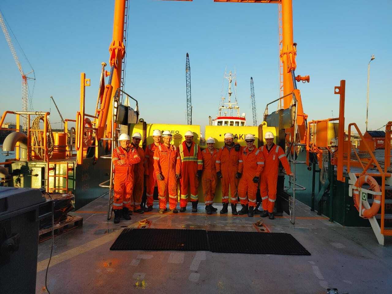
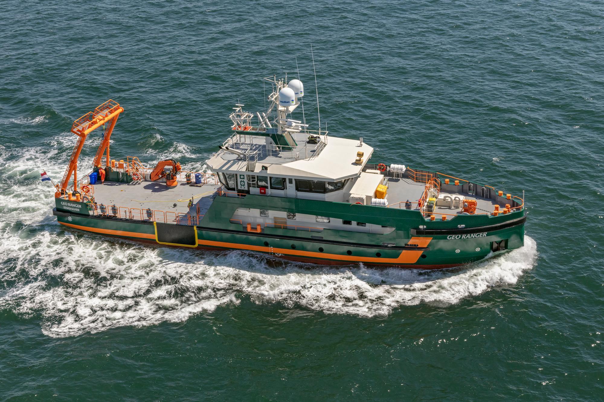
The Geo Ranger, a 41 m vessel owned by the company Geo Plus, was selected for the survey. This is a new shallow-water survey and ROV support vessel, launched in mid 2020. It carries multiple sensors, with plug-and-play facilities for survey-specific equipment.
Knowing the speed through water is essential for sub-bottom surveys
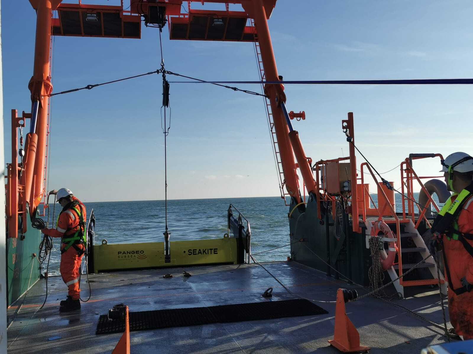
For this survey, Kraken Robotics installed their SeaKite, a Sub-Bottom Imager (SBI), aboard the Geo Ranger.
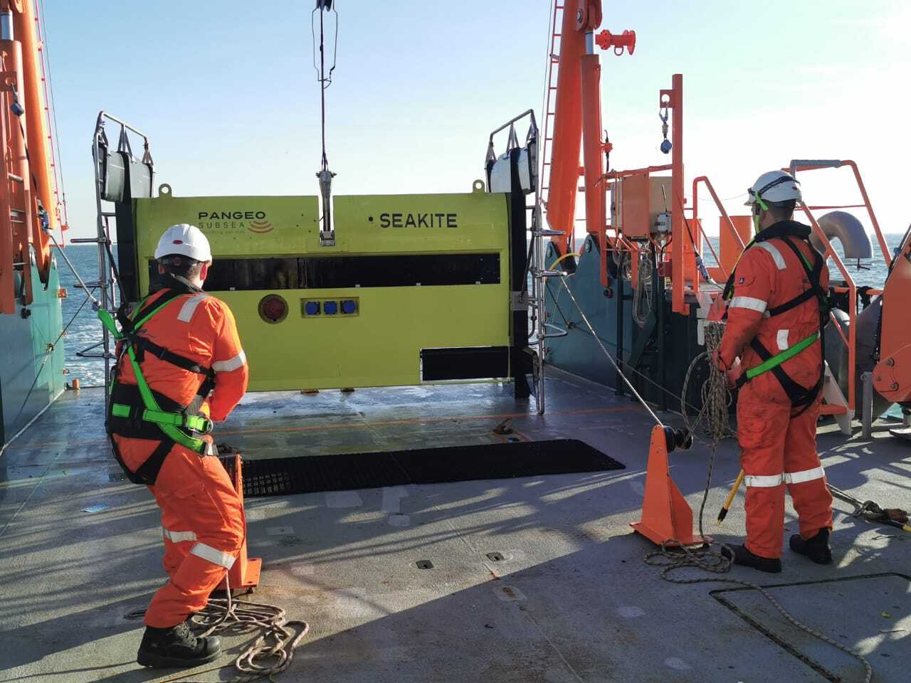
The SeaKite has been developed for wide-area site investigation and anomaly mapping using advanced acoustic technology to provide a real-time 3D image of the sub-seabed to identify anything from magnetic pUXO to other non-ferrous geohazards at a 10 cm resolution.
The SeaKite needs to be towed at some distance from the vessel to stop engine and motion noise influencing the data.
“The SeaKite vehicle is towed with between three and four times the water depth of cable deployed, and about 3 to 4 m above the seafloor. And it’s deployed behind the Geo Ranger at a speed of four to five knots,” explains Rouse.
“So knowing the vessel’s speed through water plus the tidal current is absolutely key to being able to accurately tow the vehicle. The Nortek vessel-mounted ADCP and software provided this on board the Geo Ranger.”
How vessel-mounted ADCPs measure water flow and speed through water
The ADCP uses sound signals to measure the rate and direction of water flow. It does this by transmitting a series of high-frequency sound signals that bounce off particles in the water and reflect back to the sensor.
The shift in frequency between the pulses sent out and those returning allows the sensor to calculate the speed and direction of motion of the particles, and hence the velocity of the water flow that is carrying them. By monitoring the time between the sending of the pulse and the receipt of the reflection, the sensor can calculate the depth of water of the current speed and direction data measurement.
The vessel-mounted ADCP can also measure speed through water and speed over ground by using an extra pulse transmitted specifically to detect the vessel speed relative to the seabed.
Accessible oceanographic data for commercial vessels offshore
While ADCPs are a well-established technology, until recently their development has focused on helping oceanographers and biologists conduct scientific research. The devices were rarely and only temporarily installed to acquire real-time, operational current data by commercial vessels offshore.
The sensors were not catering to the needs of the commercial operational industry offshore, which requires real-time oceanographic data delivered in a straightforward format to the bridge or the survey or operations room. The VM Operations system is the first ADCP developed for this specific industrial use.
“What we did is to make it as simple as possible for people working on commercial survey vessels offshore,” says Herman Huitema, Business Development Manager for Nortek’s vessel-mounted series.
“The VM Operations system helps offshore engineers and project managers on vessels make informed decisions during subsea operations in areas affected by underwater currents. It is designed to give offshore operators clear and detailed information on current speed and direction from the vessel to the seafloor,” he adds.
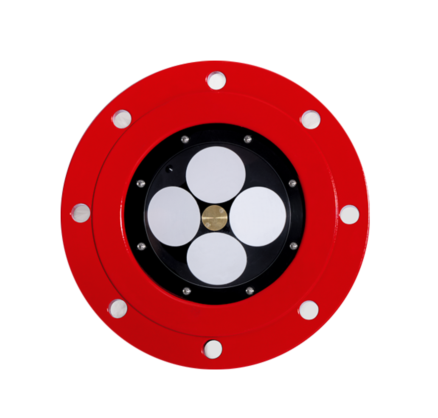
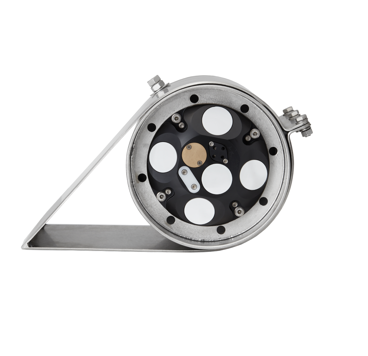
Nortek’s VM Operations is a 333 kHz ADCP with a brand-new concave design. This specially developed ADCP can be deployed in combination with a sea valve to create an in-water serviceable and flush hull-mounted solution.
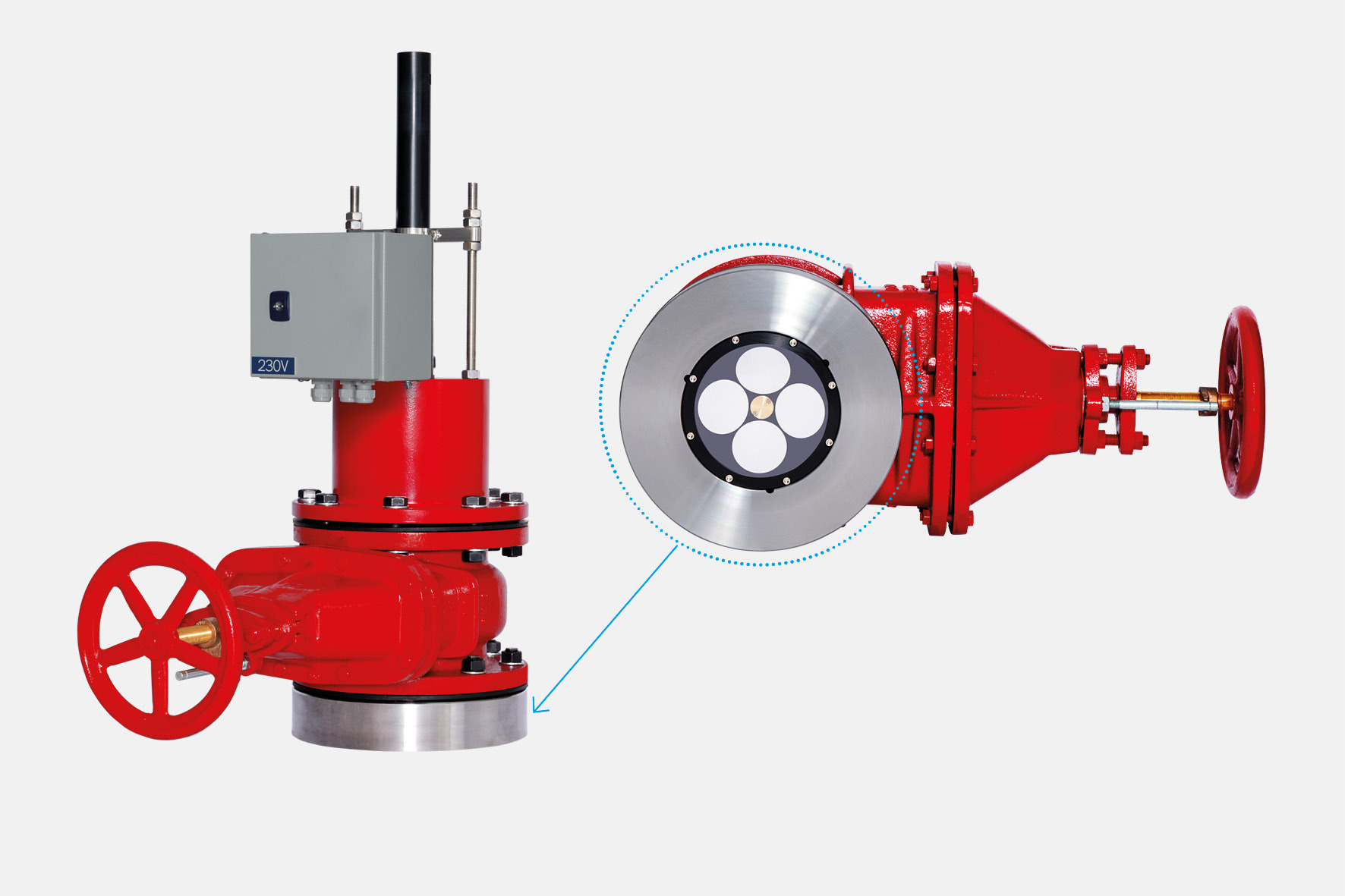
“During subsea operations, teams rely on ADCP data to make informed decisions. We developed software to fit this application, allowing the data to be shared with other systems,” continues Huitema.
Accurate data on current profile helps survey vehicle maintain its position
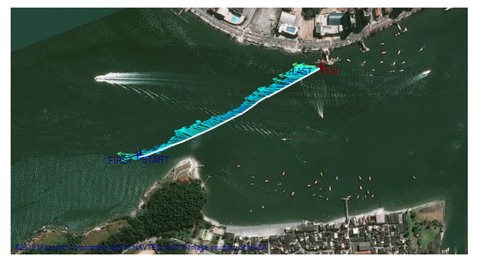
Precise sailing of a grid was needed in the case of the survey for the East Anglia Hub offshore wind site. The Nortek VM Operations provided this information for the survey team aboard the Geo Ranger.
“The Nortek data is used to maintain a set survey speed through the water and also to provide speed and direction of surface and subsurface currents,” Ian Rouse explains.
The survey team define the gridlines and then they must sail along them continuously. The whole idea is not that the vessel is on the gridline, but that the SeaKite sub-bottom imaging vehicle is being towed along the survey line. So if there is any current, then there has to be an offset for the SeaKite, to maintain its position accurately. To calculate the offset, it is essential to have very accurate data on the current profile down to the depth of the SeaKite.
“This allows the correct offset from the vessel to the SeaKite to be applied and reduces the corrections to the survey track that the SeaKite has to do. So both the direct reading of the vessel speed through water and the bins of current versus depth data are important for the towed SeaKite survey operation,” Rouse adds.
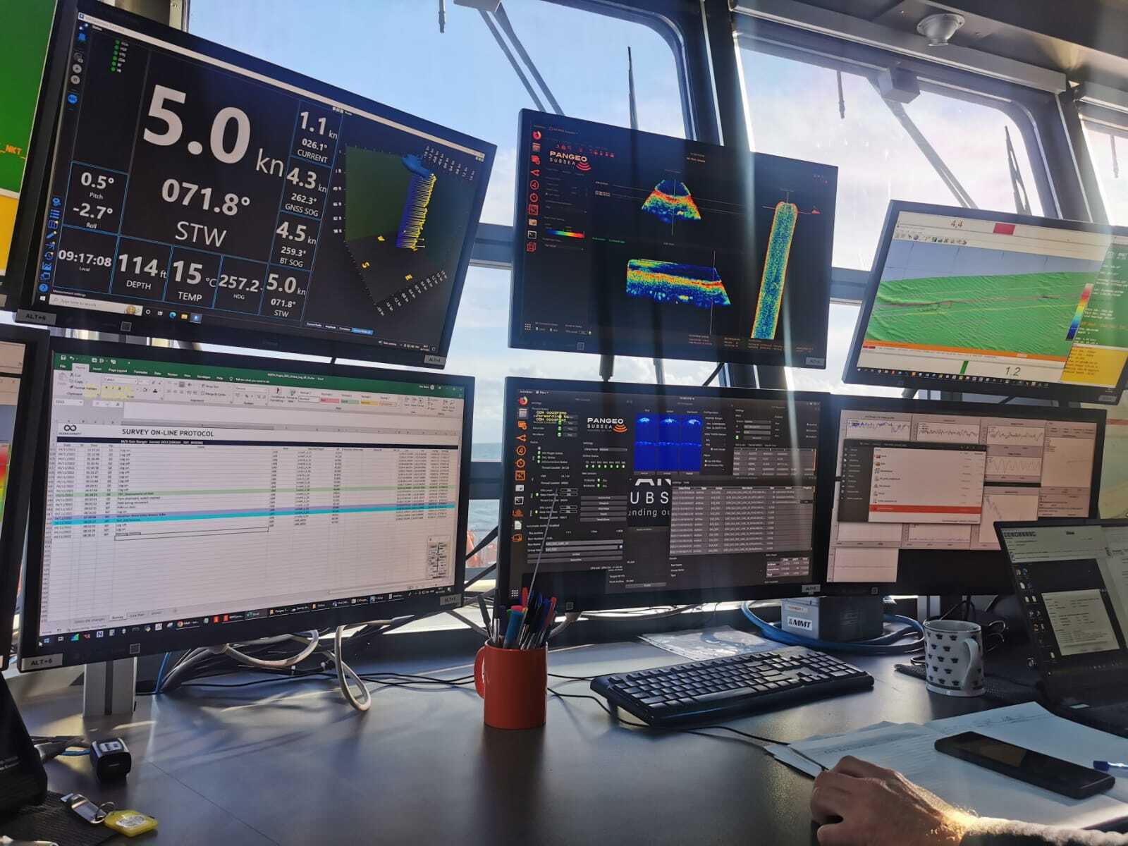
“The VM Operations sensor was very easy to use. The Nortek display was visible both on the bridge and also in the survey room. It was an essential part of the survey to enable the correct line to be run and also to maintain the correct survey speed,” he concludes.
Industries that will benefit from real-time current speed and direction data
There are many industries that will benefit from knowing real-time current speed and direction data, including the offshore wind and oil and gas industries, ROV operators, pipe and cable layers, rock dumpers, towed instrument surveys and the evolving offshore USV sector. For all these industries and more, the innovative VM Operations ADCP system is a timely solution for offshore engineers and project managers.