Accurate subsea navigation systems on ROV enables deep ocean research
- User stories
Synopsis
Challenge
Pelagic Research Services needs to operate their Odysseus ROV in the deep ocean. Accuracy in navigation is crucial during time-sensitive missions in challenging environments.
Solution
Nortek's DVL 1000 paired with a high-quality INS enables the Odysseus ROV to operate at great depths and very close to the seabed. Its high accuracy and easy integration make missions simpler and more efficient.
Benefit
Pelagic Research Services is able to work with organizations to successfully investigate deep-sea phenomena, such as hydrothermal vents, using their ROV.
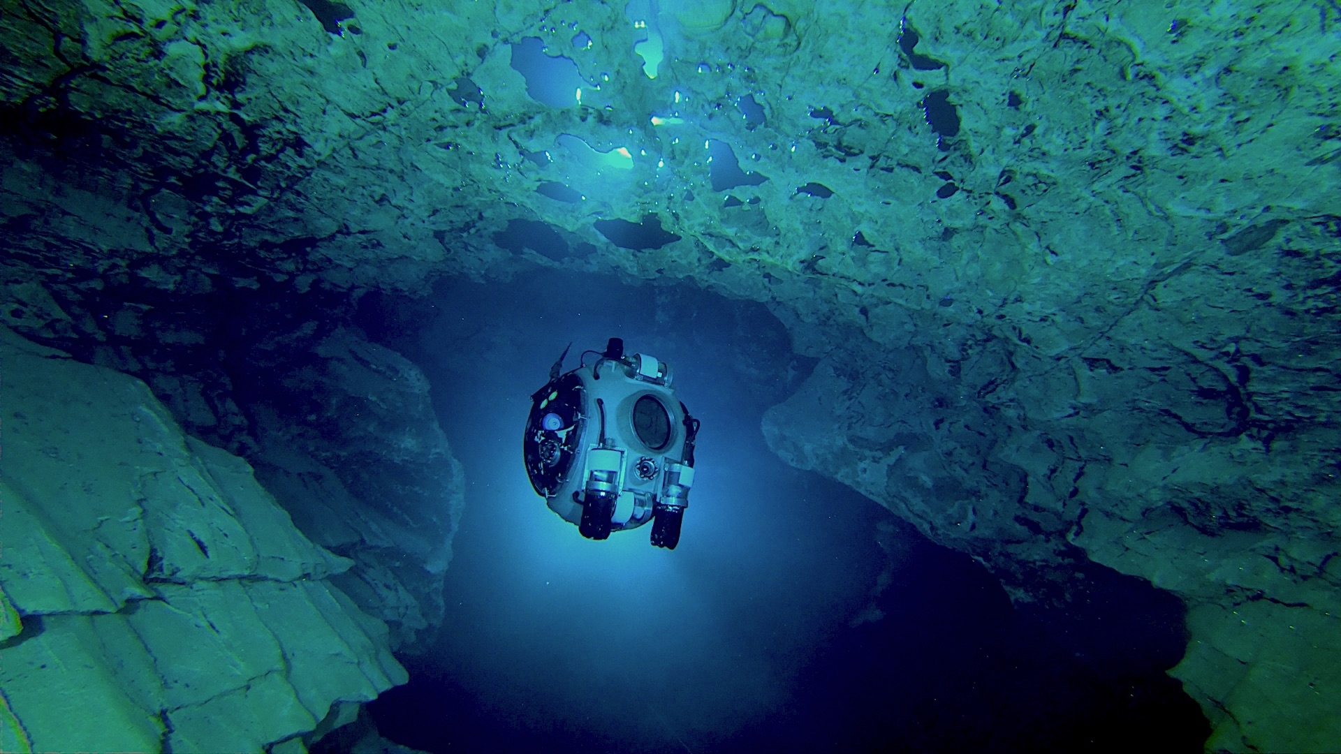
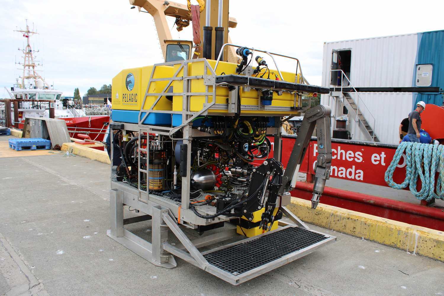
Pelagic Research Services, based in Cape Cod, Massachusetts, USA, has been carving out a niche in the remotely operated vehicle (ROV) market with its versatile Odysseus vehicle, which can carry out a wide variety of duties despite its small footprint.
The ROV is capable of providing real-time HD imagery, lifting loads of up to 4000 lb (1814 kg – in-air weight) and using seven-function manipulators to carry out precise work in water depths down to 6000 m.
The ROV has proved to be a flexible tool for University of Victoria’s Ocean Networks Canada (ONC), which installs infrastructure in the waters around Canada’s coasts to deliver data in real time for scientific research to help government and industry decision-making on future projects.
As part of ONC’s “Wiring the Abyss” program, Odysseus has carried out several assignments. Operating in one of the most hostile underwater environments on the planet, the ROV has enabled ONS to monitor and install infrastructure in an area of hydrothermal vents some 200–300 km offshore Vancouver Island at depths of greater than 2200 m.
Accurate navigation vital in a complex subsea environment
Hydrothermal vents are fissures in the seafloor, often at great depth, close to the edge of tectonic plates, from where geothermally heated, mineral-rich water is forced up into the otherwise cold water of the ocean bottom.
They provide an environment where complex chemical reactions can take place and provide a breeding ground for micro-organisms. These, in turn, attract a wealth of larger underwater life, some of it found only in this habitat, to feed on these organisms – and each other.
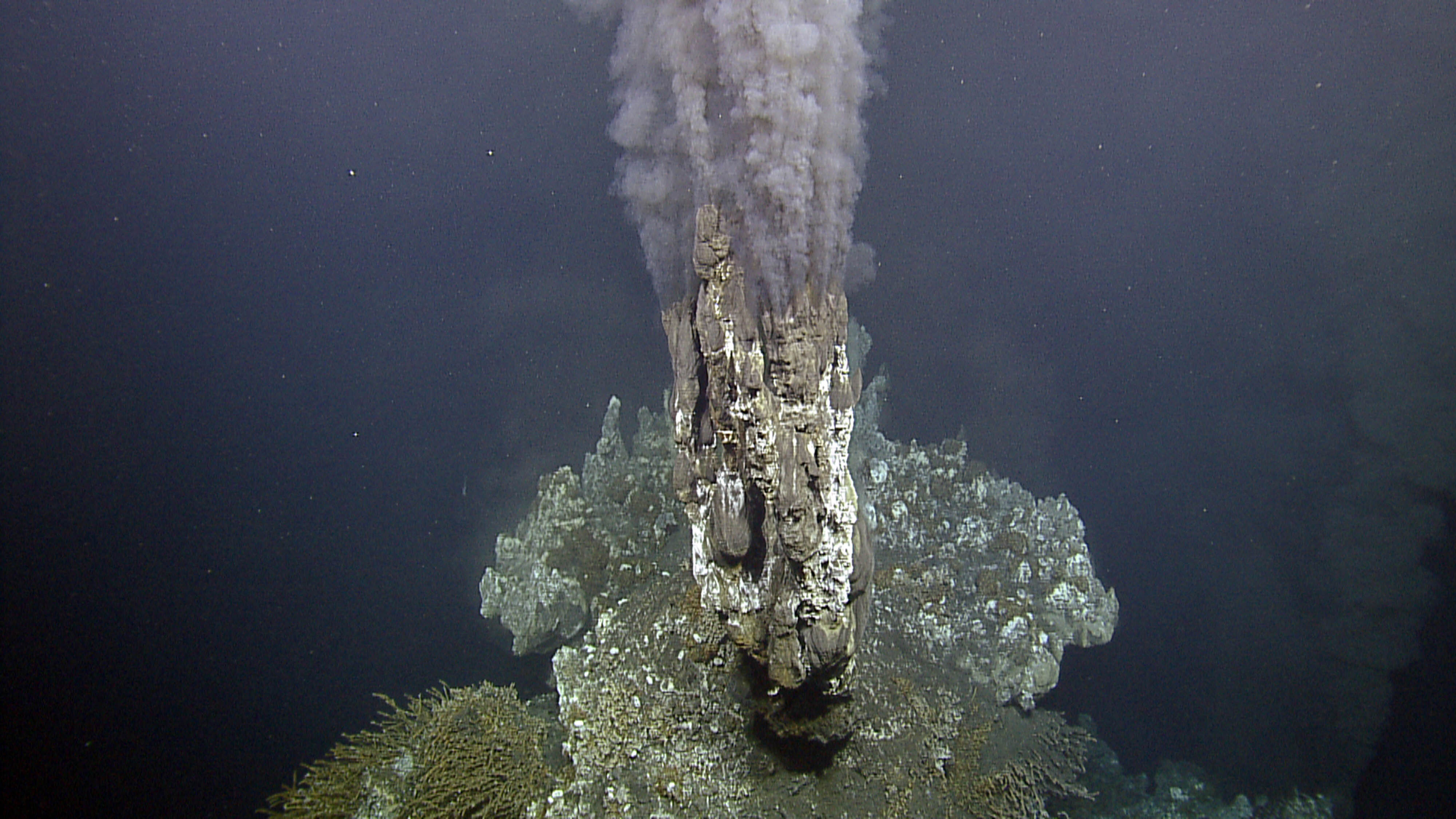
The vents provide a unique habitat, so they have long been the target of serious investigation. But this is not an environment that is easy to work in or get around.
“It can take one or one-and-a-half hours to get to the sea floor at 2200 m, and you might be limited by a weather window, so once you get down there, you need to be able to work quickly and effectively. To do that, accurate navigation is vital,” says Ed Cassano, Pelagic’s Chief Executive.
Typically, chimneys formed from minerals carried by the geothermal water are created around the vents, some tens of meters high. Cassano likens looking for equipment down there as being akin to walking in the pitch black around city streets surrounded by skyscrapers trying to find where you left your car.
“The bottom may have been mapped, but you need to know exactly where equipment is placed on the seafloor, and know exactly where you are too,” he says.
A high-accuracy DVL and inertial navigation system to pinpoint subsea location
An ROV’s INS routinely uses ultra-short baseline (USBL) acoustic positioning, which sends pings from the ROV to a transceiver on the surface vessel that can then be interpreted to provide positional data. But that becomes less accurate the deeper the ROV goes and the greater the number of water layers of differing density the sound must pass through, as changing density alters the acoustic properties of water.
Even the highly accurate USBL system Pelagic was using routinely resulted in positioning errors of around 25 m down on the seabed. That might be fine for navigation in some deployment scenarios, but not for the precision work required around the hydrothermal vents.
The iXblue Phins is the industry-leading inertial navigation system (INS), and it was used on board the Odysseus. This provided a means to navigate with considerable accuracy across the tricky contours around the hydrothermal vents. However, even the best INS used in this application requires external input that limits its drift; this is one of the primary functions of a DVL for a survey-grade navigation system.
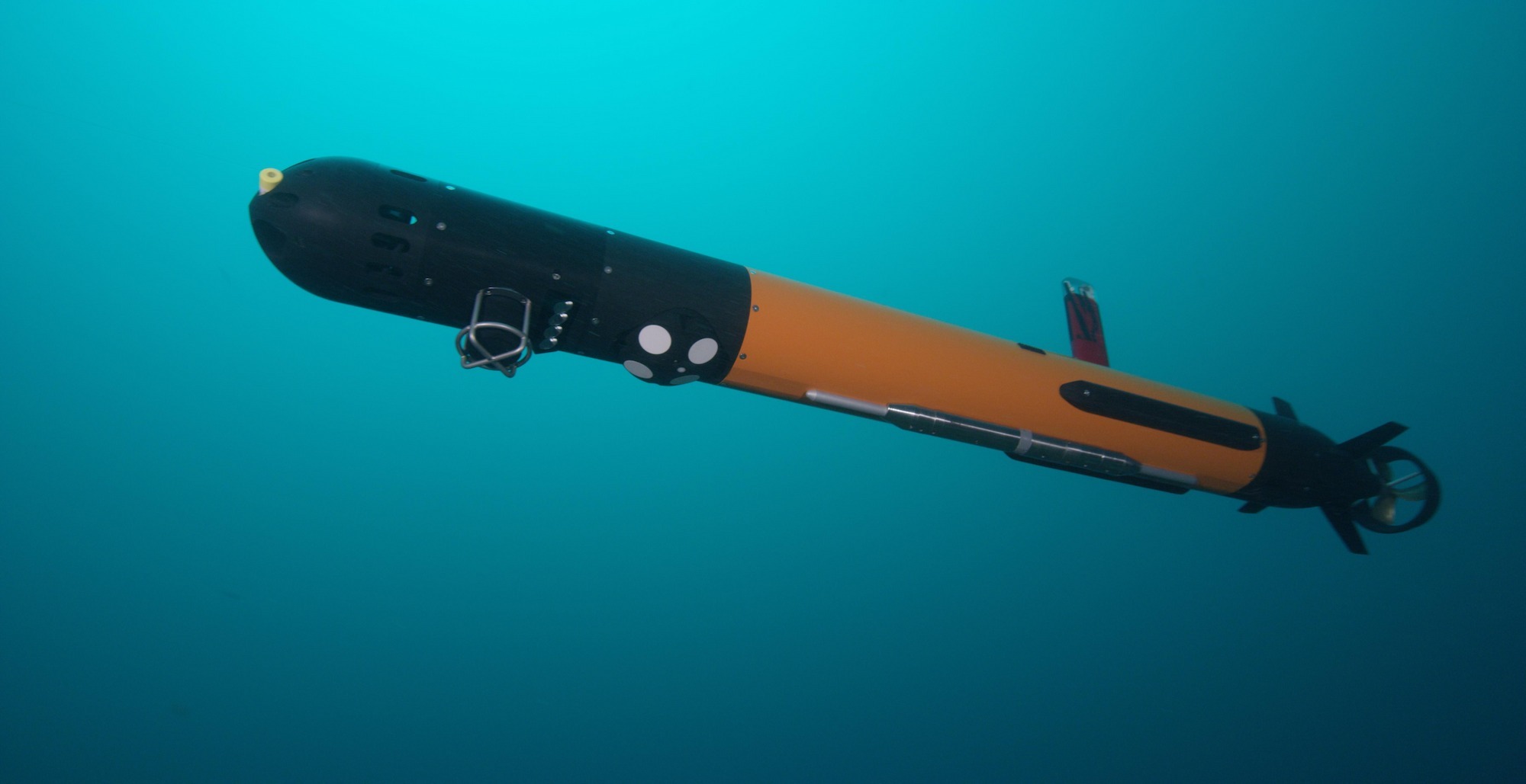
So, Pelagic needed a more accurate input into the INS to achieve accurate ROV navigation. This is where Nortek’s Doppler Velocity Log came in.
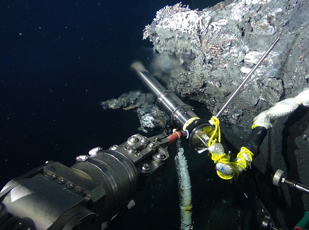
A DVL fires acoustic pulses from its transducers on board the ROV into the water at various distances from the vehicle to the sea bottom and detects the reflected pulses. These received pulses are in turn processed according to the Doppler effect, as well as using proprietary algorithms, in order to accurately estimate the ROV’s speed relative to the sea bottom.
Moving around in subsea areas where USBL positioning is not viable
The Odysseus is operating within the confines of towering smokers, where USBL positioning is not viable. It is incredibly valuable to be able to employ a paired DVL and INS solution of the highest grade to permit remote navigation independent of the surface.
Nortek’s DVL 1000 “integrated seamlessly”
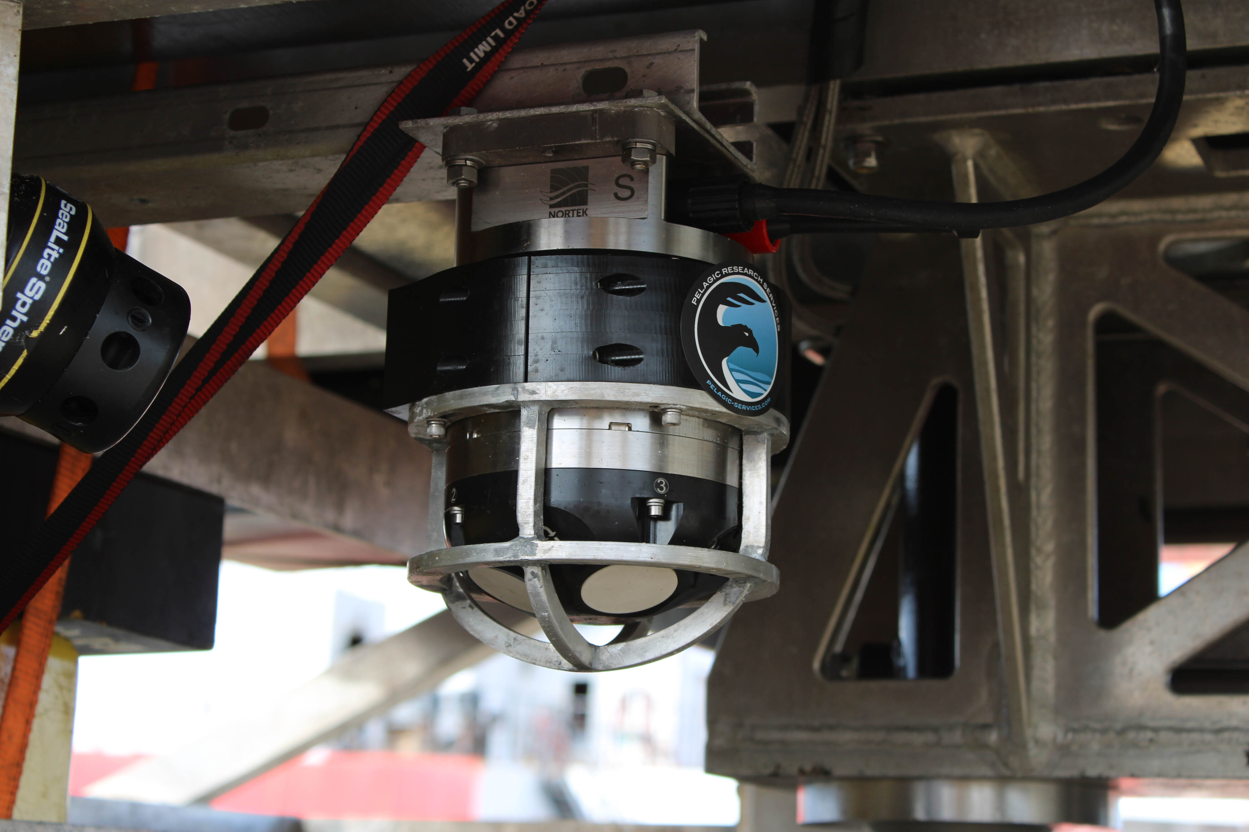
Pelagic clearly needed a DVL to complement its INS, but its requirements were quite specific: the DVL needed not only to be accurate, but also light – and it had to fit into the compact form of the Odysseus, which was already densely packed with equipment.
Given Pelagic’s requirements, iXblue, the manufacturer of the ROV’s INS, pointed Cassano in the direction of Nortek, citing previous successes in combining instruments made by the two companies.
“They said the Nortek DVL works well and integrates very easily with their INS. So, we talked to Nortek. They were responsive, they were technically expert, and they were incredibly supportive in helping us come up with a solution to our very challenging navigational situation within the constraints of our vehicle,” Cassano says.
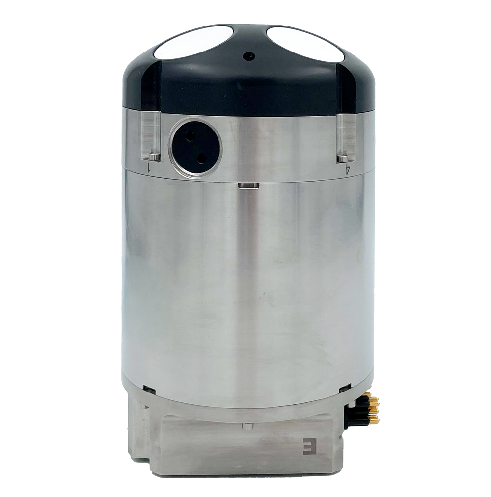
Pelagic integrated the Nortek DVL 1000, a Doppler Velocity Log combining accuracy with a small footprint, into their ROV. The 1 MHz DVL, which has a maximum operating depth of 4000 m, is widely used by subsea operators, not just because of its light weight and compact form, but also due to its high accuracy, state-of-the-art technology and ability to operate close to the seabed.
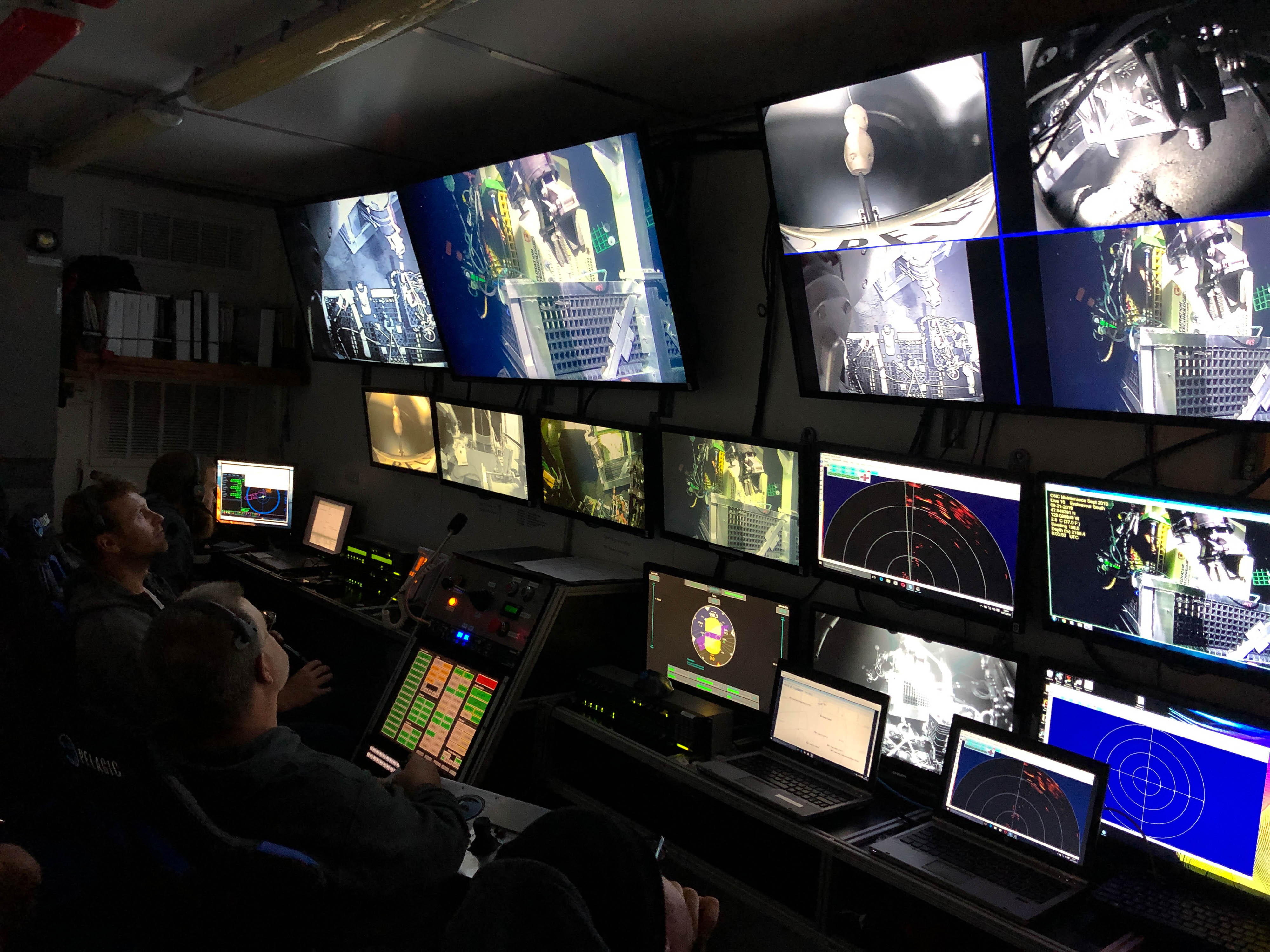
“The DVL 1000 integrated seamlessly with the INS system right off the bat. After the first time we took it into the field, the client basically said: ‘You’ve solved navigation for us” Cassano recalls.
Improved efficiency in subsea navigation means cost savings
“We were able to move around the subsea spires and vents with confidence and with great efficiency. It really allowed the world to come into focus for us down there. And that meant we had more time to do the work and get the job done faster, which can save thousands of dollars for the client just by speeding it up,” says Cassano.
The DVL 1000’s bottom-tracking capabilities have also proved a valuable asset for Pelagic. The instrument can track from 0.2 m above the seafloor right up to 75 m.
“If you run the DVL in bottom-tracking mode, you can move very precisely. We’ve used it to create a grid pattern to drive along multiple times and found things that we’ve missed within the hour,” Cassano recalls.
The accuracy and reliability of the Nortek DVL 1000 has helped ease stress levels among the crew too.
“There are other good DVLs on the market, but what I really liked about the Nortek unit was that its functionality was outstanding, its form factor was perfect for our vehicle and the price point was very good,” says Cassano.
Watch video of ROV operations for Ocean Network Canada – here featuring Nortek ADCPs